According to the Department of Construction, flooded locations do not ensure safe traffic for vehicles traveling on National Highway 3, Hanoi: in areas Km28+00 and Km19+00, they are deeply flooded.
District traffic from a distance for vehicles traveling from Hanoi to the Hanoi - Thai Nguyen Expressway following the Bac Phu intersection, then going to Xuan Cam Bridge to Hiep Hoa to continue to Thai Nguyen ( consideration for trucks, underground vehicles, limiting cars);
Or from Hanoi to the National Highway 18 intersection to Bac Ninh to the Cho overpass to Dong Xuyen bridge to Hiep Hoa.
On-site traffic flow:
The plan to divert traffic to Thai Nguyen: From National Highway 3 at Km24+670 (Soc Son Intersection), turn right to Nui Doi and then turn left onto Nui Doi - Bac Phu road to the intersection of Bac Phu with Hanoi - Thai Nguyen Expressway to Thai Nguyen; From National Highway 3 to Km19+750 (Mai Noi - National Highway 18 intersection), then go to the intersection of Hanoi - Thai Nguyen Expressway to enter the expressway to Thai Nguyen.
Traffic diversion plan to Bac Ninh: From National Highway 3 to Km3+630, turn right into Duc Tu to move to Van Ha, Co Chau to move to Bac Ninh; From National Highway 3 Km24+670 (Soc Son Intersection), turn right to Nui Doi, turn left onto Nui Doi - Bac Phu road, turn to Bac Phu intersection, move Xuan Cam bridge to Bac Ninh; From National Highway 3 to Km19+750 (Mai Noi - National Highway 18) move to National Highway 18 to Yen Phong, Bac Ninh.
The implementation period is from October 10, 2025 until the flood is gone.
The Hanoi Department of Construction requested the People's Committees of Bac Ninh and Thai Nguyen provinces to announce the content of traffic flow and safety at flooded locations on the route on mass media to guide and warn vehicles traveling through flooded areas.
Along with that, the People's Committees of the communes in Dong Anh, Phuc Thinh, Soc Son, Trung Gia arranged functional forces under their management to be on duty, coordinate with relevant units to regulate and guide traffic flow at flooded locations according to the traffic organization plan of the Department of Construction, to prevent traffic insecurity and traffic congestion from occurring.
Organize propaganda for people in the area to grasp the plan to adjust traffic flow.
The Traffic Infrastructure Maintenance Board will develop a plan and direct road management units to arrange human resources, materials, and equipment in coordination to regulate traffic flow and ensure traffic safety at flooded locations according to the plan of the Department of Construction...
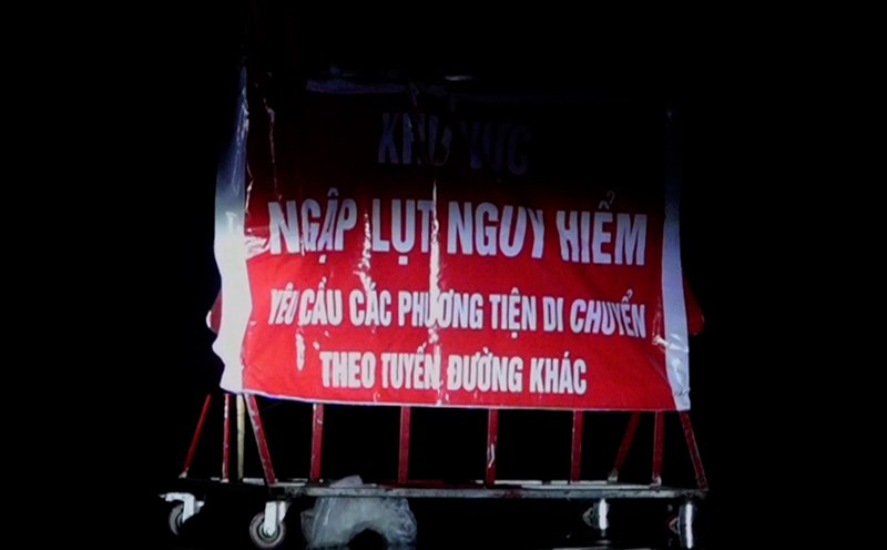
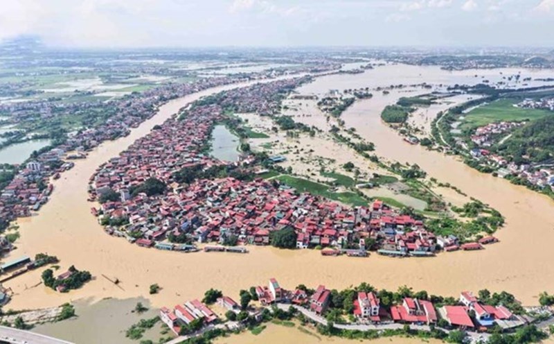
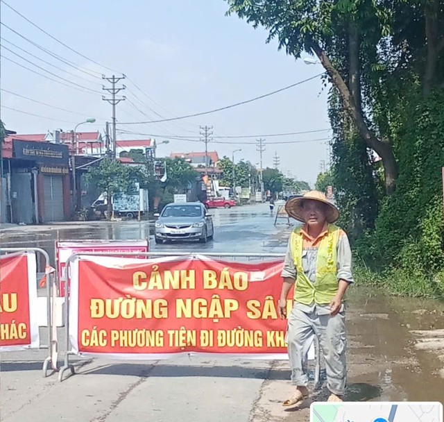
According to the Hanoi Department of Construction, as of the morning of October 10, the flooding situation in Trung Gia commune (Hanoi) was still complicated, the water level on many roads remained high, showing no signs of abating. The road management unit is coordinating with local authorities to place warning signs and arrange guides to guide traffic at points where vehicles cannot travel.
Specifically, National Highway 3 is flooded from 0.5 to 1 meter at Km28 and Km29. Road 35 was flooded from 0.5 to 1.3m deep in the sections Km0+300 - Km0+700 (Tu Tao bridge area) and Km2 - Km2+500. Road 16 was flooded 0.5- 1m at Km2+100 - Km2+400. Hong Ky - Bac Son road through Chien bridge was flooded from 0.8 - 1.3m, while route 401 was overflowed about 0.5m due to rising river water.