
Damaged embankment, road subsidence
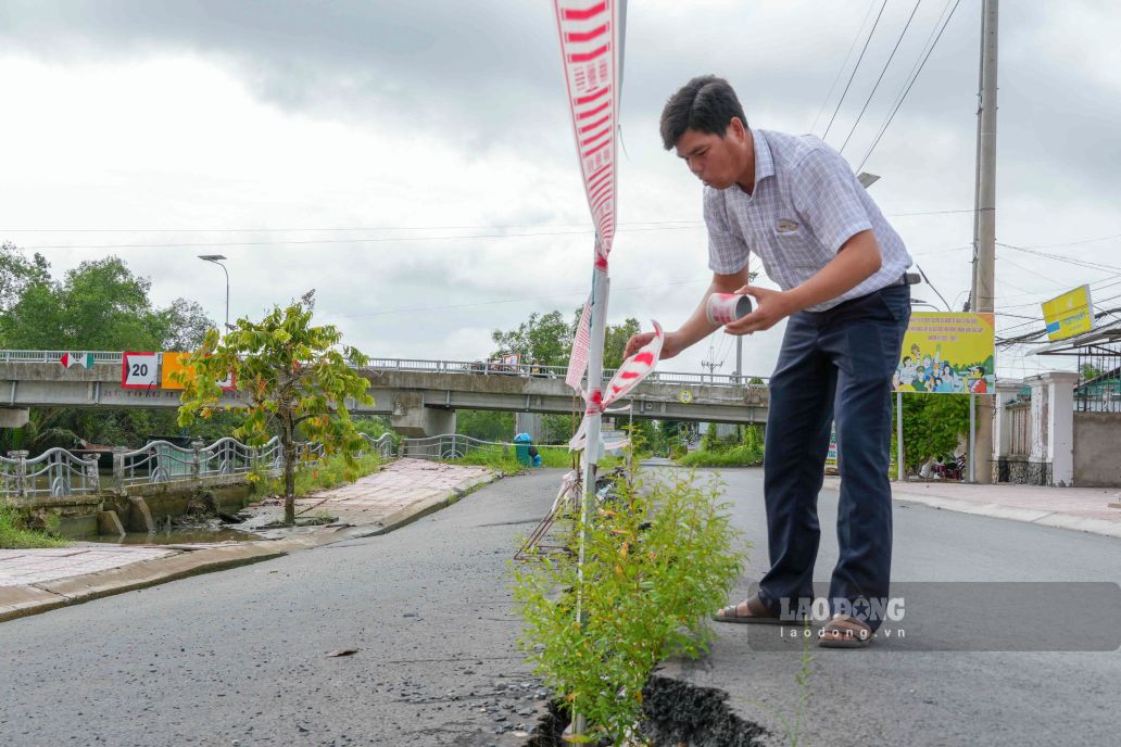
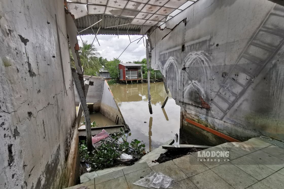
According to reporters' records, the bank of canal No. 1 along provincial road 932C has landslides stretching about 800m. Among them, the reinforced concrete embankment section about 225m long in front of the headquarters of Dai Hai Commune People's Committee was heavily damaged, the embankment peak is deviated from 0.1-0.9m. Sidewalks, drainage systems and more than half of the road surface width are subsided from 0.2-0.5m, many concrete components are cracked and broken, and the embankment anchor is damaged.
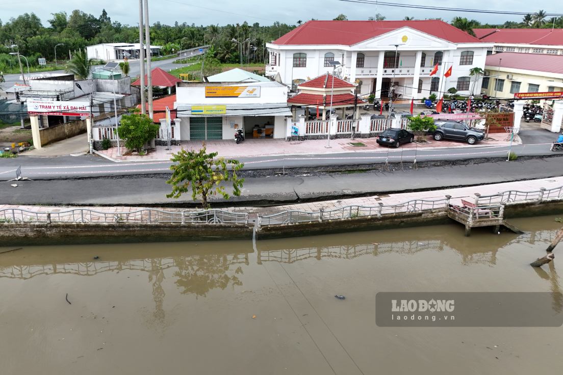
The landslide area is located right in the commune center, where the headquarters of the People's Committee, Dai Hai 2 Primary School, Dai Hai 2 Secondary School, Mang Ca market and many households are concentrated, so it poses a potential risk of unsafety for people and vehicles traveling.
Mr. Duong Chi Nguyen - Chairman of Dai Hai Commune People's Committee (Can Tho City) - said that from the beginning of the year to now, the locality has recorded 17 landslide points on riverbanks and canals, including 3 particularly serious points.
The most worrying thing is the safety of people and students. This is the central area of the commune, concentrating the People's Committee headquarters, health station, schools and markets, so there are many people passing by every day," Mr. Nguyen said.
According to Mr. Nguyen, the scale of damage has exceeded the local budget balance capacity. For 3 major landslide points, a very large source of funding is needed for handling, so the commune has reported and requested Can Tho City People's Committee for support. Initially, the locality organizes the relocation of households in dangerous areas, installs warning signs, barriers, traffic diversion and temporarily reinforces locations at risk of continued landslides.
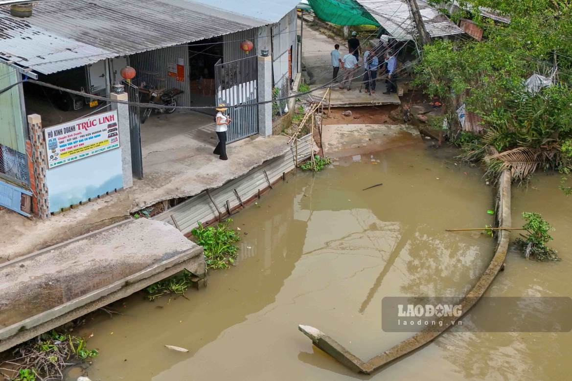
In addition to provincial road 932C, the old Mang Ca ferry terminal area also experienced landslides about 20m long and about 8m wide, completely damaging the embankment and concrete road surface, affecting traffic and people's lives.
According to the assessment of the survey team of the Department of Agriculture and Environment of Can Tho City after a direct working trip at the end of July 2026, landslides occur due to the combined impact of swirling currents in the river intersection area, waves from large tonnage watercraft, unusual tides and the fact that the embankment line built in 2013 has deteriorated after many years of exploitation.
Proactively prevent risks
Faced with the increasingly complex situation of subsidence, landslides, flooding, drought and saltwater intrusion, the Standing Committee of the Can Tho City Party Committee has issued a Program to implement Conclusion No. 26-KL/TW of the Politburo, with the goal of improving adaptive capacity, proactively preventing and ensuring population safety, and sustainable development of the city in the period 2026 - 2035.
According to assessments, in recent years, riverbank erosion in Can Tho has become unpredictable, no longer following seasonal rules as before, occurring both in the rainy and dry seasons, directly affecting people's lives, transportation infrastructure and production. Meanwhile, urban flooding has increased due to the impact of high tides, heavy rain, low terrain and drainage systems that do not meet requirements. Dry season saltwater intrusion is also complicated, causing difficulties for agricultural production and domestic water sources.
Implementing Conclusion No. 26-KL/TW, the city determined that it is necessary to innovate the approach, strengthen forecasting, early warning, risk management and synchronously deploy engineering and non-engineering solutions. In which, Can Tho will review planning, improve the mechanism for managing water resources, irrigation, and disaster prevention; promote the conversion of production structure suitable to climate conditions and protect natural ecosystems.
One of the key tasks is to mobilize and effectively use investment resources. The city will prioritize overall, inter-regional, and multi-purpose projects such as: climate resilience, flood and landslide prevention, urban embellishment and relocation of residents out of dangerous areas.
Along with infrastructure investment, Can Tho promotes the application of science and technology, digital transformation in disaster forecasting and warning; building an interconnected database, researching river sand replacement materials and climate change adaptation solutions.
The city also strengthens regional linkages, international cooperation in water resource management, attracts non-budget capital in the form of public-private partnerships (PPP), and at the same time exploits new resources such as carbon credits. The implementation is associated with inspection and supervision to ensure investment efficiency, contributing to building Can Tho into a central urban area of the Mekong Delta region with high adaptability to climate change.
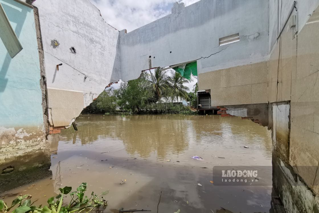
According to the Can Tho City Civil Defense Command, riverbank and coastal erosion is the type of natural disaster that caused the greatest damage to the locality from the beginning of 2026 to date. As of mid-July 2026, the whole city recorded 232 erosion points with a total length of about 13.87km. This incident directly affected 32 houses (of which 11 were completely damaged) and devastated many rural traffic routes.


