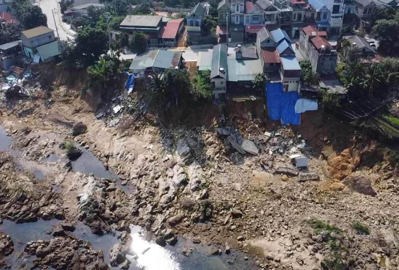
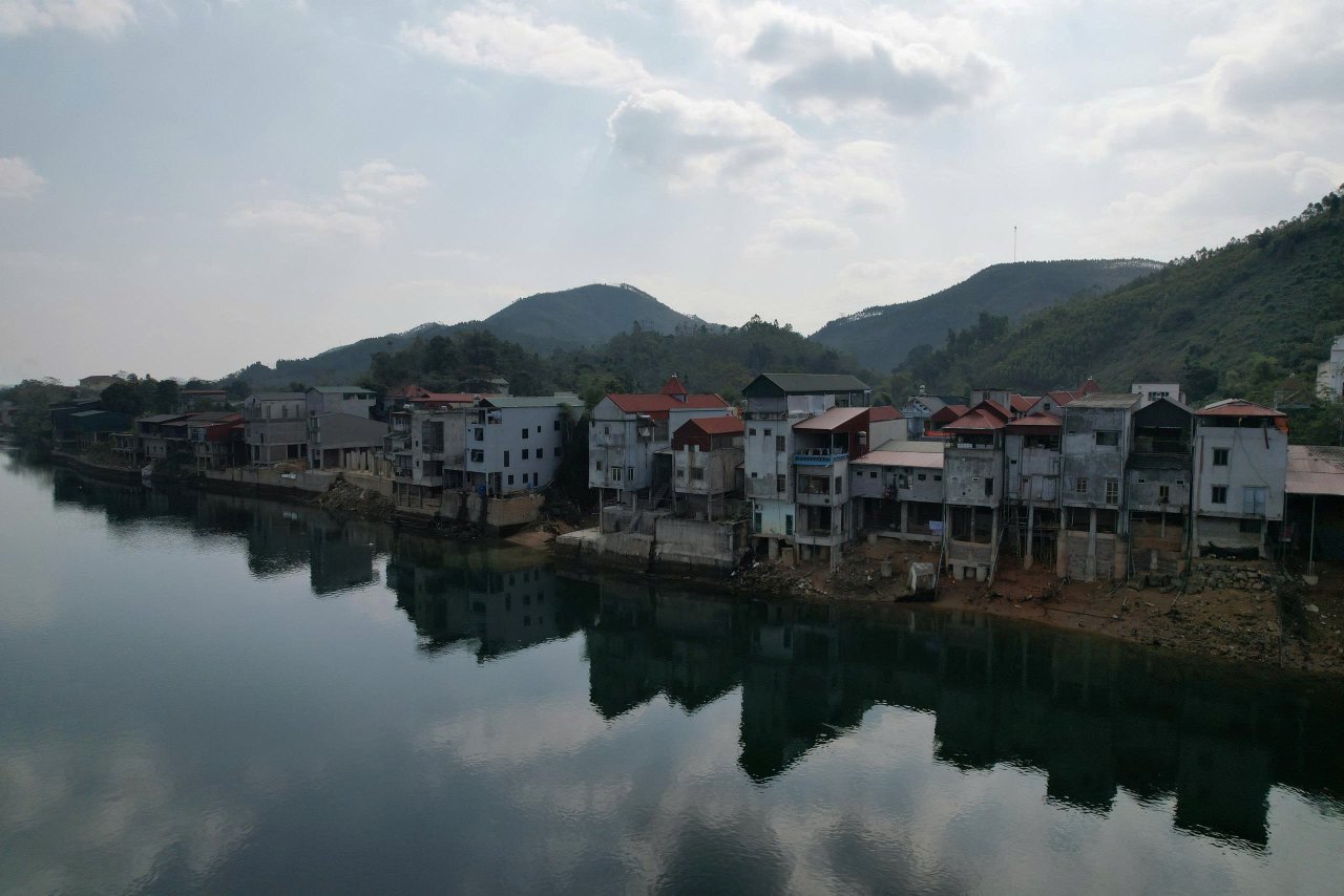
Many house foundations along the river are subsided
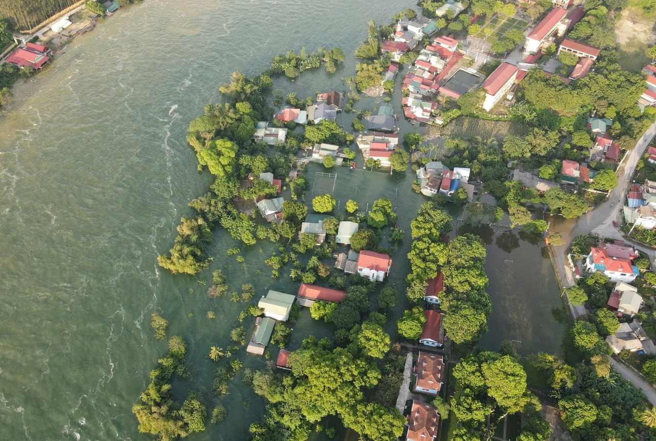
Prolonged rain and floods due to the circulation of storms No. 10 and 11, Thac Ba hydropower plant and Thac Ba 2 hydropower plant discharged floodwater with large flows, causing serious flooding and landslides along both banks of the Chay River.
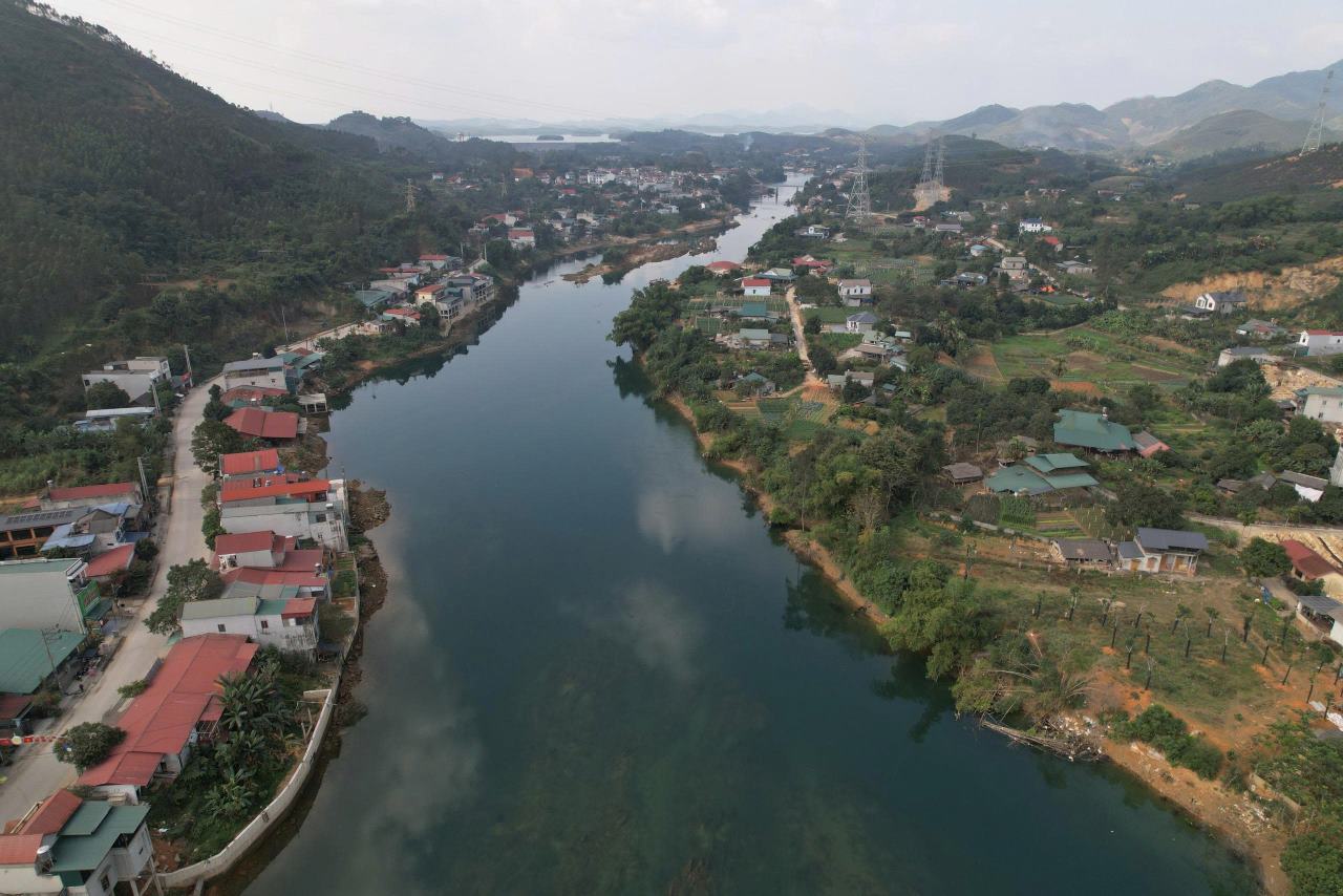
Many solid houses suddenly collapsed and submerged in the riverbed. Along both banks of the river, many house foundations have subsided, leaving only foundation structures and cracked walls, not ensuring safety for living.
After the natural disaster, to soon stabilize life, right on the landslide locations, people have leveled the foundation, built embankments, foundations, and pillars to reinforce... rebuilding the house.
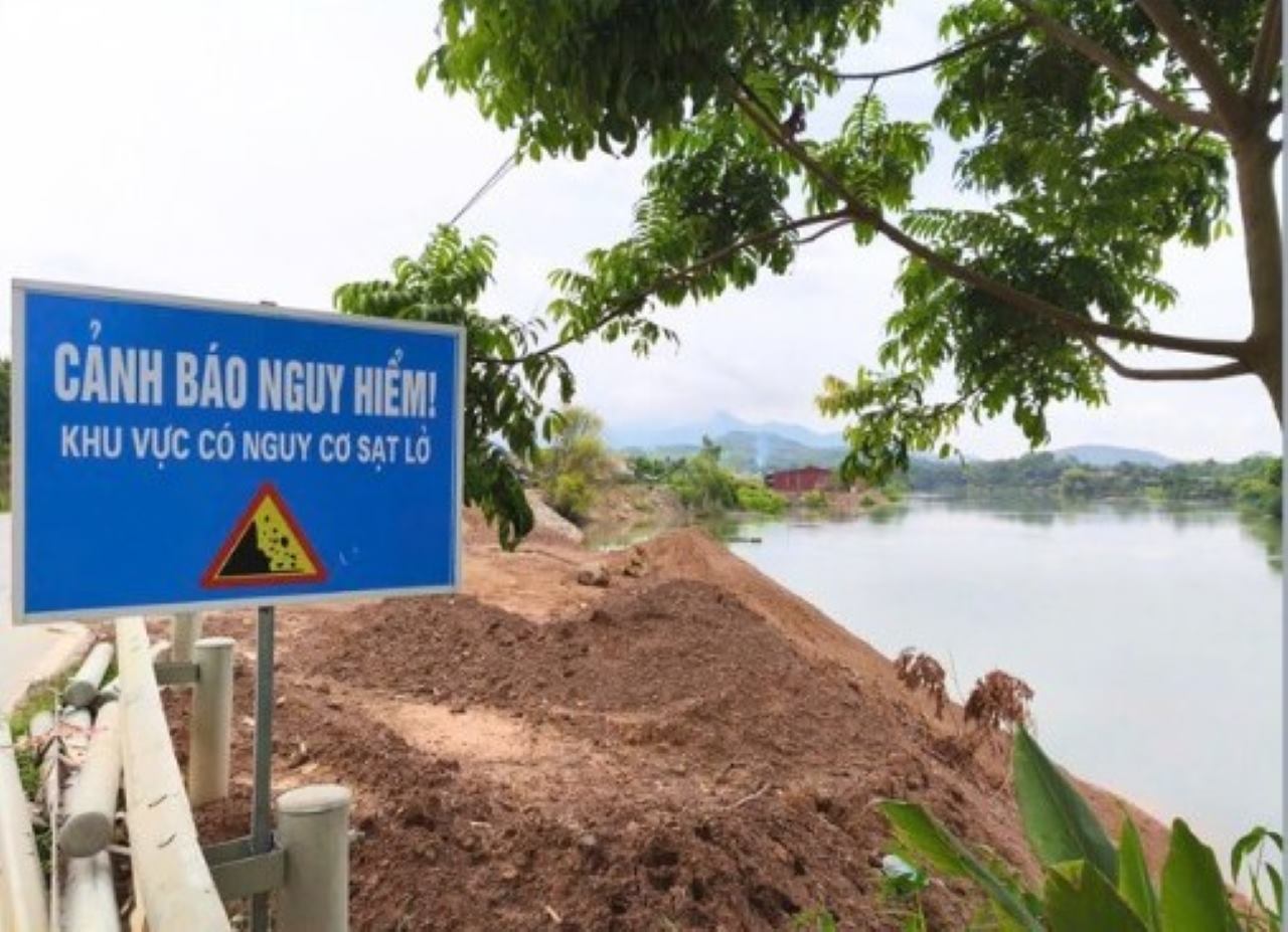
Local authorities intervened to determine that there are nearly 80 constructions, houses, and warehouses that have been and are being built violating the Chay River corridor.
However, local people said that if the house embankment is not reinforced, there will be a risk of being submerged by the Chay River at any time.
As one of 9 households located in a dangerous landslide area in hamlet 2, Thac Ba commune, Mr. Hoang Van Hung said that in April 2025, when Thac Ba 2 hydropower plant closed the dam to store water, the landslide situation became stronger.
Initially, it was a alluvial ground area, then auxiliary works, barns, and then people's houses. Up to now, the foundation, floor, and kitchen area of the family have seriously subsided.
The family is very worried when the landslide situation is becoming increasingly serious, while the identification of the cause as well as remedial measures by relevant units have not been implemented," Mr. Hung said.
Landslides are not related to hydropower plants accumulating water
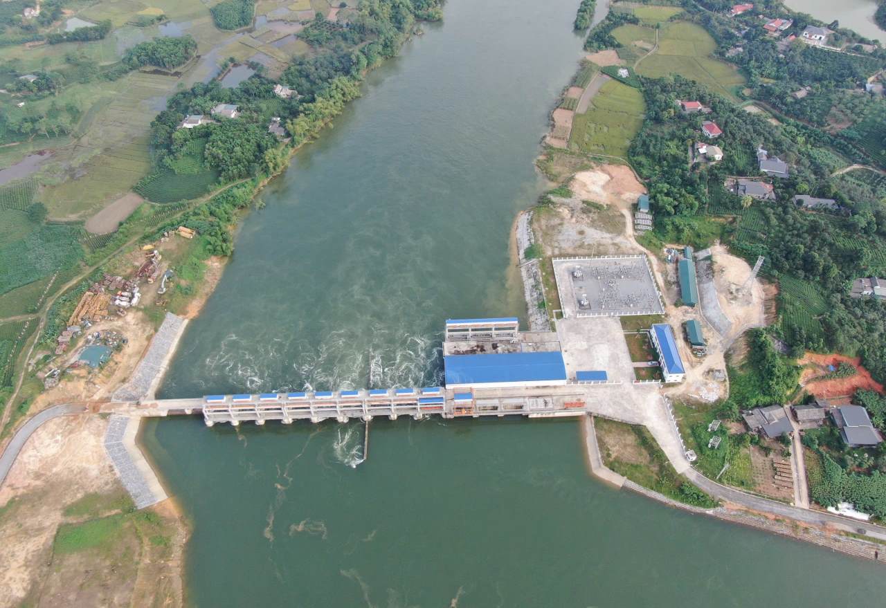
Talking to Lao Dong Newspaper, Mr. Hoang Anh Tuan - Director of Thac Ba 2 Hydropower Investment Joint Stock Company - affirmed: During operation, the plant complied with the correct procedures, and the water storage for power generation did not affect the houses of households on both sides of the river.
According to Mr. Tuan, the unit has never stored water exceeding the permissible limit, when rain and floods occur, all discharge gates are opened for flow.
After a period of storing water to generate electricity at Thac Ba 2 Hydropower Plant, the company has reviewed and supported affected households to move to safe accommodation.
Households whose houses were eroded in the recent rain and floods are not in the area affected by the hydropower reservoir, so the company is not responsible," Mr. Tuan emphasized.
Finding solutions to stabilize residents on the banks of the Chay River
Regarding the above issue, Mr. Pham Van Hien - Chairman of Thac Ba Commune People's Committee said that after the natural disaster, the locality coordinated with the inter-sectoral inspection team to review the entire Chay River route.
According to assessments, the initial cause of the phenomenon and risk of landslides may be due to the rising water level of the reservoir after the construction and operation of the dam, causing riverbank soil to be saturated, reduced stability and prone to landslides.
Heavy rain, floods and sudden water level fluctuations put pressure on the shoreline, increasing the risk of landslides.
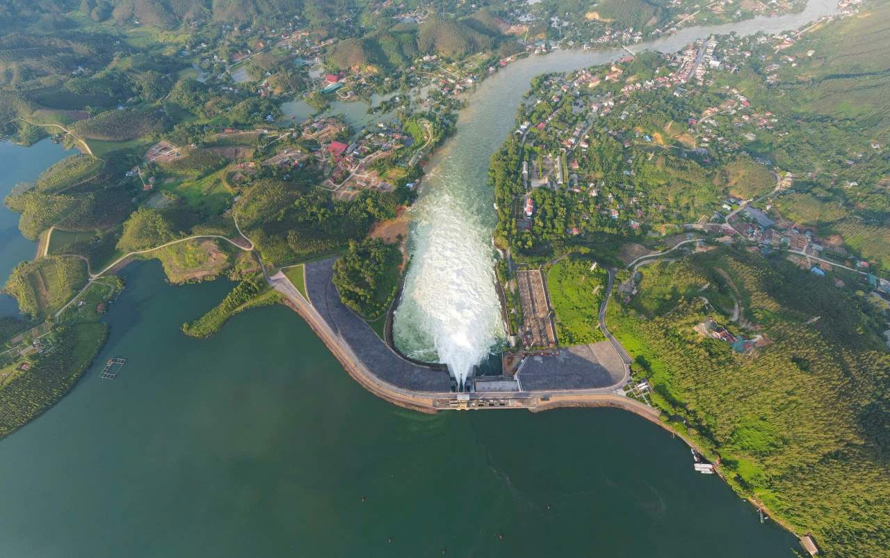
The power generation operation of Thac Ba Hydropower Plant with large flow (3 units and regular flow changes) and water storage of Thac Ba 2 Hydropower Plant, causing embankment erosion, water seeping into saturated soil leading to natural landslides and soil drifting along the flow.
Another reason pointed out by the inspection team is that households during the construction of reinforcing pillars and embankments, the excavated land here was poured out of the eroded area, not compacted and not reinforced, causing congestion and changing flow.
Furthermore, the location of house construction of households in the river corridor and soil pouring to narrow the flow is also a factor causing landslides.
To thoroughly solve this situation, Mr. Pham Van Hien said that in the period 2026 - 2030, the commune government plans to plan a resettlement area of about 15 hectares, located at the new administrative center planning location of the commune (far from the Chay River bank).
The locality will open a large road section 20 - 30 meters wide, about 3-4km long connecting from the main road to the new urban area. Here, electricity, road, school, and station infrastructure will be invested methodically from the beginning.
After that, build a solid embankment line, creating a premise for developing ecotourism and experiential tourism in the future," Mr. Hien informed.


