Super typhoon No. 3 Yagi increased by 8 levels compared to the time it entered the East Sea.

Tuyết Lan |

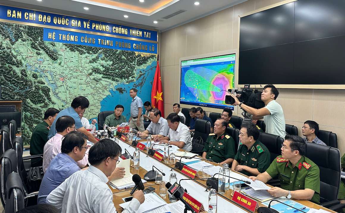
On the afternoon of September 5, Deputy Prime Minister Tran Hong Ha chaired a meeting with ministries, branches and provinces on responding to storm No. 3 Yagi .

Deputy Prime Minister Tran Hong Ha chaired a meeting to respond to storm No. 3 Yagi. Photo: Viet Anh

Reporting on the current status of storm No. 3 , Mr. Mai Van Khiem - Director of the Center for Hydrometeorology said that the storm is in the northern area of ​​the North East Sea, about 500km east of Hainan Island (China). The storm intensity is level 16 (super storm level), gusting above level 17.

This is a very strong storm with a wide circulation. The area with strong winds of level 8 has a radius of about 250km, the area with strong winds of level 10 is about 150km, and the area with strong winds of level 12 is about 80km around the center of the storm.

International storm forecasting centers all agree that storm No. 3 will continue to maintain super typhoon level (level 16 or higher) until it reaches the eastern coastal area of ​​Hainan Island. After that, storm No. 3 will move into the Gulf of Tonkin at level 13-14, gusting to level 16. When it affects the mainland, its intensity will likely be level 9-12, gusting to level 13-14.

According to Mr. Pham Duc Luan - Director of the Department of Dyke Management and Flood and Storm Prevention, on the afternoon of September 5, the storm center was about 450km east of Hainan Island (China) with a level 16 intensity, gusting to level 17 (8 levels higher than when entering the East Sea).

"The storm is forecast to move west at a speed of 10-15km/h; continue to maintain a very strong intensity of level 16, gusting over level 17 in the sea area east of Hainan Island (China). Natural disaster risk level 4 for the northern part of the North East Sea on September 5-6 and the eastern part of the Gulf of Tonkin on September 7, 2024.

Around the evening of September 7, the storm will make landfall in the Northern mainland (from Quang Ninh to Ninh Binh) with an intensity of level 9-12, gusting to level 13-14. The highest waves will be 10.0-12.0m on September 5-6, 2024. Tide at Hon Dau station: The highest is 2.0m at 5:00 p.m. on September 7, 2024 (during low tide)" - Mr. Pham Duc Luan reported.

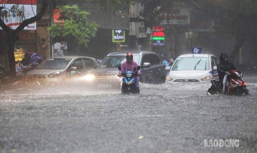
According to the Director of the Department of Dyke Management and Flood and Storm Prevention, from the night of September 6 to 9, the provinces of Quang Ninh, Hai Phong, Lang Son, Ha Giang, Phu Tho, Hoa Binh, the Northern Delta and Thanh Hoa had rain from 150-350mm, some places over 500mm; other places in the Northeast from 100-150mm.

From the afternoon of September 7-8, the Northwest region had 100-200mm of rain, especially in Lao Cai, Yen Bai, and Son La provinces, 150-250mm, and locally over 350mm.

From September 7-10, a flood will occur on the rivers and streams of the North and Thanh Hoa with the flood peak on Thao, Cau, Thuong, and Luc Nam rivers at level 1-2; Lo River at level 1; Hoang Long River at level 2; small rivers and upstream rivers in Quang Ninh, Lang Son, Cao Bang, Tuyen Quang, and Hoa Binh are likely to reach level 2-3.

Tuyết Lan
TIN LIÊN QUAN

Bão số 3 rất mạnh, kiên quyết kêu gọi tàu thuyền về nơi tránh trú

Phương Anh |

Bộ Nông nghiệp và Phát triển nông thôn yêu cầu các địa phương chủ động cao nhất ứng phó bão số 3 để hạn chế thấp nhất các thiệt hại.

Hải Phòng cẩu tàu thuyền lên bờ, "thần tốc" chống bão số 3

Mai Dung |

Đến ngày 5.9, huyện Bạch Long Vĩ (Hải Phòng) đã đưa hơn 100 phương tiện tàu thuyền lên bờ, sẵn sàng ứng phó bão số 3 đang tiệm cận siêu bão.

Dự báo thời điểm bão số 3 Yagi tác động mạnh nhất đến Hà Nội

AN AN |

Đại diện Đài Khí tượng Thủy văn Khu vực đồng bằng và trung du Bắc Bộ cho biết khả năng bão số 3 Yagi sẽ gây mưa to gió mạnh ở Hà Nội từ đêm 6.9 - 8.9.

Vinafco lãi 2,8 tỉ, chưa bồi thường vụ rơi pin xuống biển

Lục Giang |

Vinafco đang phối hợp cùng các chủ hàng, công ty bảo hiểm và các cơ quan chức năng giải quyết sự cố vụ 37 container rơi xuống biển, trong đó có hơn 10 tấn pin.

Người dân Đà Nẵng căng mình tát nước tràn vào nhà do mưa lớn

LINH THI |

Tại phường Thanh Khê Tây, quận Thanh Khê, TP Đà Nẵng, hàng chục hộ dân vẫn phải căng mình tát nước tràn vào nhà.

Giới đầu cơ có thể đứng sau loạt lô đất đấu giá bỏ cọc

ANH HUY |

Giới chuyên gia cho rằng, người tham gia đấu giá đất chủ yếu là nhóm nhà đầu tư chuyên nghiệp, rất ít người địa phương tham gia.

"Giải cứu" hàng trăm xe máy chìm trong nước lũ

LƯƠNG HẠNH |

Trong 2 ngày làm việc không ngừng nghỉ, 60 người thợ hỗ trợ sửa chữa 260 chiếc xe máy miễn phí tại tỉnh Yên Bái và Tuyên Quang.

Bắt 2 đối tượng mua bán trái phép hơn 2,5 tấn xyanua ở TPHCM

Minh Tâm |

TPHCM - Ngày 18.9, Công an quận Bình Thạnh đã bắt giữ 2 đối tượng mua bán trái phép chất độc xyanua với khối lượng lớn ra thị trường.

Storm No. 3 is very strong, strongly calling on ships to return to shelter

Phương Anh |

The Ministry of Agriculture and Rural Development requires localities to be proactive in responding to storm No. 3 to minimize damage.

Hai Phong hoists boats ashore, "speedily" fighting storm number 3

Mai Dung |

By September 5, Bach Long Vi district ( Hai Phong ) had brought more than 100 vessels ashore, ready to respond to storm No. 3, which is approaching a super storm.

Forecast of the time when storm No. 3 Yagi will have the strongest impact on Hanoi

AN AN |

A representative of the Hydrometeorological Station of the Northern Delta and Midlands said that storm No. 3 Yagi is likely to cause heavy rain and strong winds in Hanoi from the night of September 6 to September 8.