On September 16, Tam Lu Commune People's Committee, Thanh Hoa province said that as of the morning of the same day, there were 2 overflow culverts flooded in the area; 4 positive taluy landslide points and 3 negative taluy landslide points with unsafe risks. Faced with the above situation, the locality has evacuated 6 households with 20 people to safe places.
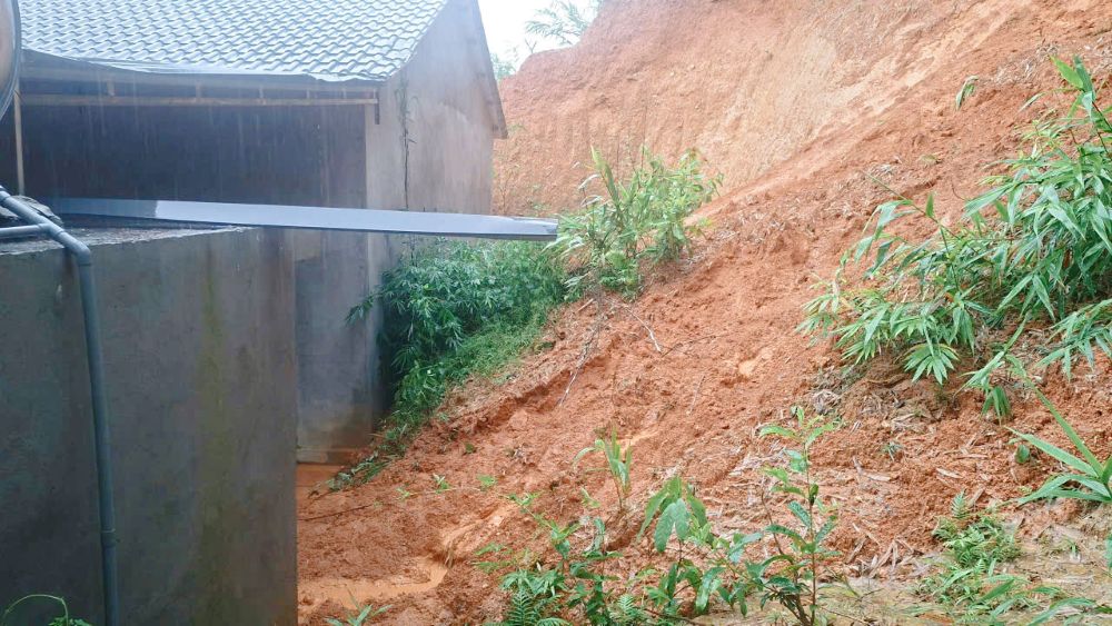
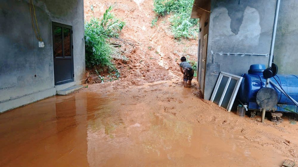
Due to prolonged heavy rain, the risk of flooding, flash floods and landslides is increasing, Tam Lu commune has mobilized forces to key areas, supporting people to move people and property out of unsafe locations.
The commune police, the Commune Military Command, the shock force for disaster prevention and control, along with officials and forces in the villages are assigned to directly go to areas at risk of flooding and landslides to inspect and grasp the situation.
Forces propagate and mobilize people to proactively leave dangerous areas; and at the same time support the transportation of food, foodstuffs, essential items, vehicles and livestock to safe places.
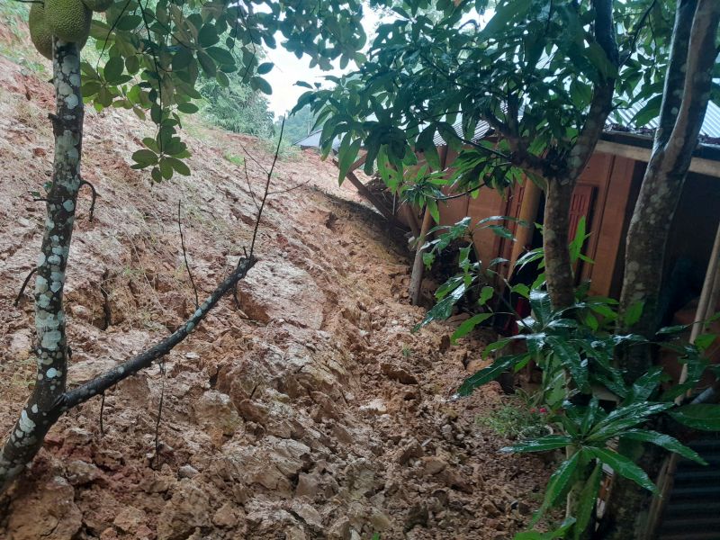
For households living in taluy, hillside, streamside areas and landslide-prone areas, functional forces should strengthen monitoring of terrain, water levels and landslide conditions. When signs of unsafety appear, people are required to move immediately to the prepared location.
The locality also deploys forces at key points, underground spillway areas and flooded roads to warn and guide people and vehicles; not to let people pass through areas with fast flowing water, deep flooding or risk of landslides.
According to Thanh Hoa Provincial Hydrometeorological Station, on September 16, the water level on rivers in the province is fluctuating upwards, and many places have exceeded the alarm level.
Notably, on the Buoi River, the water level at Thach Quang station reached 16.67m, 0.67m higher than alarm level 3; at Kim Tan station reached 11.08m, 0.08m higher than alarm level 2.
On the Am River, the water level at Lang Chanh station reached 50.49m, 0.49m higher than alarm level 2. On the Cau Chay River, the water level at Xuan Vinh reached 8.02m, 0.02m higher than alarm level 1 and is changing slowly.
The meteorological agency assesses that in the next 24 hours, flood water levels on rivers will continue to rise, posing a risk of flooding in low-lying areas, riverside areas and residential areas.
In the Yen River basin, areas warned of flooding risk include Nong Cong, Thang Binh, Truong Van, Trung Chinh, Thang Loi, Tuong Linh, Quang Chinh, Quang Yen, Quang Ngoc, Ngoc Son and Cac Son communes.
In the Buoi River basin, the risk of flooding is warned in Tay Do, Vinh Loc, Kim Tan, Thach Binh, Van Du, Thach Quang and Thanh Vinh communes.
On the Cau Chay river basin, Tho Lap, Xuan Tin, Xuan Lap, Thieu Hoa, Thieu Tien, Thieu Quang, Yen Dinh, Yen Phu, Yen Ninh and Dinh Hoa communes are also located in areas warned of flooding risk.
Towards the people affected by floods
In recent days, prolonged heavy rain has caused heavy damage to people and property, pushing many families in many localities across the country into extremely difficult circumstances.
One piece when hungry is equal to one package when full", with the spirit of mutual affection that has been a beautiful image of the Vietnamese people for generations, the Golden Heart Charity Fund calls on philanthropists at home and abroad to join hands to share with people affected by storms and floods to have food, clothing, shelter, and students to have books to go to school...
The Golden Heart Charity Fund sincerely thanks the precious feelings of agencies, businesses, and philanthropists at home and abroad.
All help please send to: Tam Long Vang Charity Fund, No. 51 Hang Bo, Hoan Kiem, Hanoi. Phone: 024. 39232756. Account number (STK): 113000000758 at Vietinbank Hoan Kiem Branch, Hanoi. Account number: 0021000303088 - at Vietcombank - Hanoi Branch, Account number: 12410001122556 - at BIDV - Hoan Kiem Branch. Or scan the QR code below: