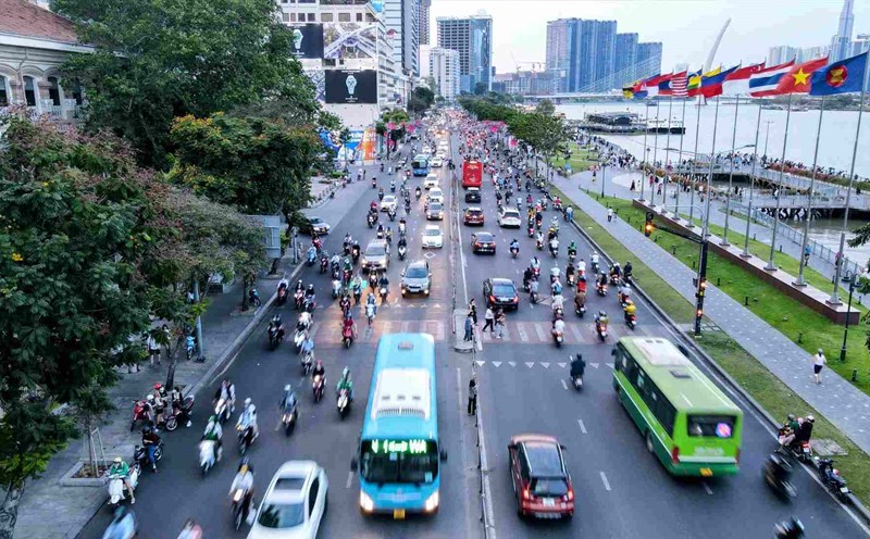
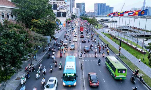
According to the Ho Chi Minh City Department of Construction, the project to build a riverside road from Ba Son Bridge to Saigon Bridge is 1.95 km long, with a cross-section of 31 - 33 m and a scale of 6 lanes.
This route will start from Ton Duc Thang Street (old District 1) and end in Tan Cang area (old Binh Thanh District), passing through many high-end urban areas.
The total estimated investment is about VND1,800 billion, using Ho Chi Minh City's budget.
When completed, the Saigon Riverside Road will create a new direction from the East to the center of Ho Chi Minh City, contributing to reducing pressure on existing traffic axes such as Nguyen Huu Canh, Dien Bien Phu, and Ton Duc Thang streets. At the same time, the project also helps people access the riverside space more easily - which is currently limited by internal roads or project fences.
Currently, some sections in this route have been developed by investors with a road surface of 15 - 30m wide, but the entire route is not yet smooth.

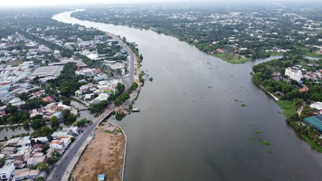
The section from Ba Son to Saigon Bridge is part of the overall Saigon River road with a total length of up to 78.2km, a wide cross-section of 4 - 8 lanes, stretching from Binh Khanh commune (old Can Gio district) to the border of Tay Ninh province.
This riverside traffic route plays the role of the North-South axis of Ho Chi Minh City, connecting key areas from the North such as Thu Duc City, the old Binh Duong to the city center and down to the Can Gio area in the South.
This is also a strategic route that helps connect with key traffic routes such as Ring Roads 2, 3, 4, Ben Luc - Long Thanh Expressway, Ho Chi Minh City - Moc Bai Expressway, National Highway 13, National Highway 22 ... thereby sharing traffic and reducing traffic pressure for current main routes.
Not only playing a role in transportation, the riverside route also creates a premise for the development of new urban spaces. Exploiting land funds along the route will contribute to the development of commercial - service urban areas, green space, tourism and attracting investment. This is also an opportunity to create a sustainable source of income from exploiting land funds to serve reinvestment for the city.
The route is also planned as a unique riverside landscape axis, connecting with inland waterway ports such as An Son and An Tay, promoting the waterway logistics ecosystem - an advantage that has been left unused for many years.
In parallel with the route through Ho Chi Minh City, the second Saigon River route passing through the old Binh Duong province is also being implemented.
This route has a total length of about 98.2 km, with a 32m wide roadbed. Some sections through Thuan An City and Thu Dau Mot City (old) were approved by the People's Council and the People's Committee of Binh Duong Province (before the merger).
In particular, the section from An Son port to Ho Chi Minh City Ring Road 3 has been adjusted to widen the road surface to 42m to better serve the needs of freight transport and inter-regional connectivity.
In addition, many sections of the riverside route in Ben Cat City (old) are attracting investors in urban projects such as: Tan An urban area, Tay Phu An urban area, Tay An Tay, the urban area North of Ring Road, Northwest of Ring Road 4...