On May 18, the Ho Chi Minh City Traffic Construction Investment Project Management Board (Traffic Board) said it was preparing procedures to start the Rach Tom Bridge project on Le Van Luong Street (Nha Be District).
The new Rach Tom Bridge is more than 683 m long, of which the bridge section is 171 m long and 15 m wide; the approach road is more than 512 m long and 29 m wide. The total investment is nearly 497 billion VND.
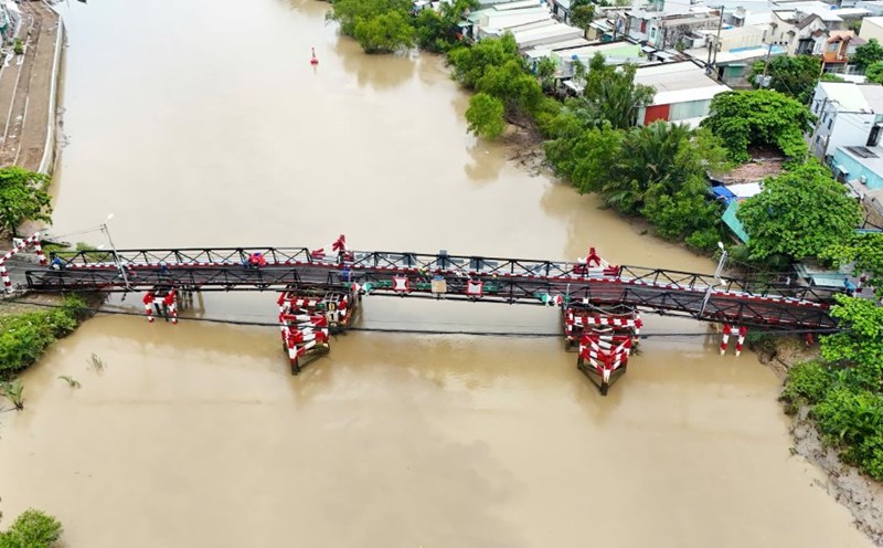
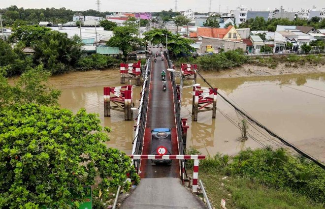
Built before 1975, the existing Rach Tom iron bridge has seriously degraded, causing traffic insecurity.
The new Rach Tom Bridge project was approved in 2019 but cannot be implemented yet.
By the end of 2024, the Ho Chi Minh City People's Council had approved the policy of reclaiming 3.1 hectares of land, paving the way for project implementation.
Continuing this project, Ho Chi Minh City aims to start construction of Rach Doi Bridge by the end of 2025. This is a bridge located on the same route as Le Van Luong, connecting Nha Be district with Long An province, helping to strengthen inter-regional traffic connections.
The new Rach Doi bridge is about 452 m long and 15 m wide. The approach road is about 300 m long and 29 m wide.
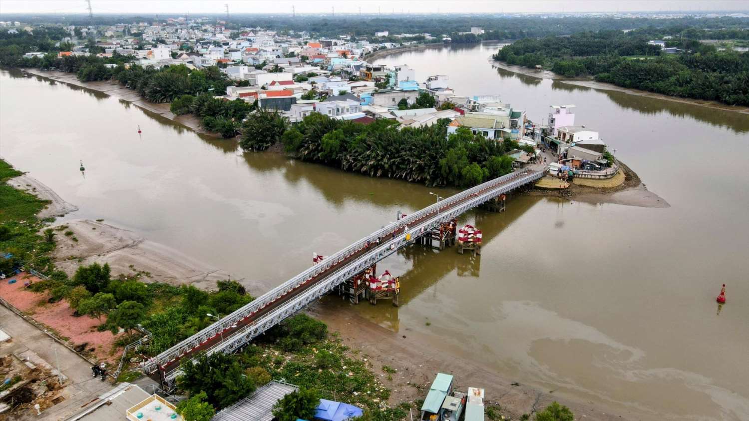
The Rach Doi Bridge construction project was approved by the Ho Chi Minh City People's Council in 2016 with a total investment of 781 billion VND, but has not yet been implemented due to waiting for capital allocation.
Previously, the two bridges Long Kieng and Rach Dia on Le Van Luong route were newly built and put into operation in 2023 and 2024, respectively.
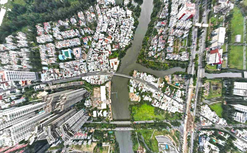
Another notable project is Can Gio bridge to replace Binh Khanh ferry, opening a smooth connection from the city center to Can Gio district.
The Ho Chi Minh City Department of Construction said it is completing the pre-feasibility study report for the Can Gio bridge project to submit to competent authorities for consideration, after the Project to adjust the Ho Chi Minh City Master Plan to 2040, with a vision to 2060 was approved by the Prime Minister.
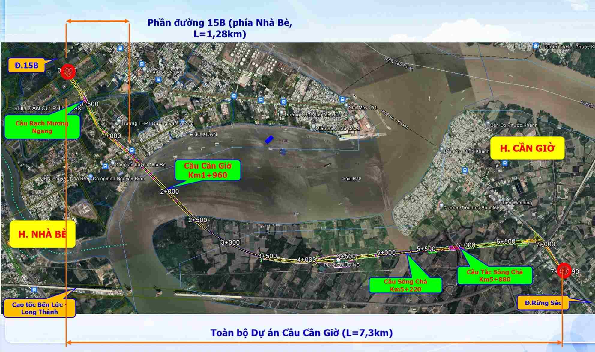
Can Gio Bridge has a total length of 7.3 km, of which the main bridge is nearly 3 km long, the approach road is more than 4.3 km long. The project has a scale of 6 lanes (including 4 lanes for motor vehicles, 2 lanes for non-motor vehicles) with a design speed of 60 km/h.
The bridge is built in the form of a cable-stayed bridge, with a 55 m clearance (equivalent to Binh Khanh bridge of the Ben Luc - Long Thanh expressway project) - the highest in Vietnam at the present time.
In addition to the main bridge, the project also builds three more bridges on the route: Song Cha Bridge (about 640 m long, 29.5 m wide); Tac Song Cha Bridge (about 64 m long, 40 m wide); Rach Muong Ngang Bridge (on the parallel road on the Nha Be side) 64 m long, 7.75 m wide.

Regarding the route, the starting point of the bridge is on Road 15B (Nha Be District), about 500 m north of Muong Ngang Canal, then cut through Nguyen Binh Street and cross the Soai Rap River. When entering Can Gio district, the bridge will connect with Rung Sac road at a location about 2.1 km south of Binh Khanh ferry.
With a total investment of about VND 10,500 billion, Ho Chi Minh City aims to deploy Can Gio Bridge in the period of 2025 - 2028.
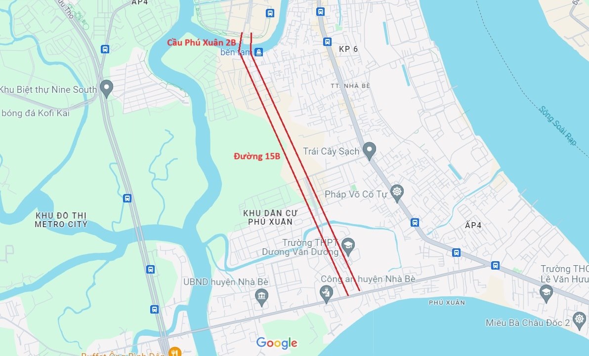
To synchronously connect with Can Gio Bridge, the city also plans to invest in Road 15B and Phu Xuan 2B Bridge in the period of 2025 - 2030.
Of which, Phu Xuan 2B bridge is about 660 m long, 30 m wide, with a total estimated investment of about 754 billion VND. The project is currently being proposed by the Department of Construction in coordination with Nha Be district, expected to be submitted to the investment policy in 2025.