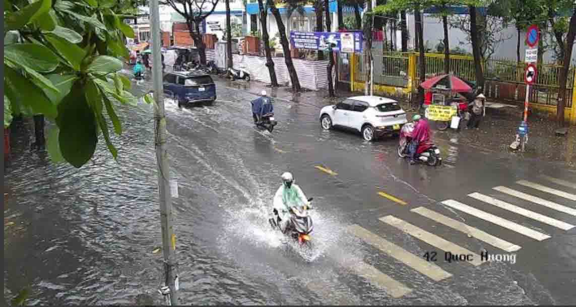
According to Lao Dong, Quoc Huong, Hiep Binh streets... started to rise, causing flooding. Vehicles moving through this area is quite difficult.
Monitoring on satellite cloud images, weather radar images and lightning positioning shows that the thunderstorm area is developing and causing rain with thunderstorms and lightning in all wards/communes such as Long Hoa, Dau Tieng, Binh Tan, Binh Hung Hoa, Binh Tri Dong, An Lac... and the sea areas of Ho Chi Minh City. The cloud area will move from East to West.
In the period from now until the next 3 hours, thunderstorms will continue to develop, causing showers accompanied by thunderstorms and lightning in all neighborhoods, groups, hamlets and villages in the above wards/communes.
After that, thunderstorms tend to expand to other neighborhoods, groups, hamlets, and villages in the same ward/commune; Thanh Thoi area - Can Gio commune; Hiep Binh, Tam Binh, Thu Duc, Linh Xuan, Long Binh, Tang Nhon Phu wards; Quarters 1 and 25, An Khanh ward; Binh Trung, Cat Lai... and continue to spread to other neighboring areas of Ho Chi Minh City. Rainfall is generally from 10-20 mm, in some places over 25 mm.
During thunderstorms, it is necessary to be on guard against tornadoes, lightning, hail, strong gusts of wind of level 5-8 (8-21 m/s) that can cause trees to fall, damage houses, traffic works and infrastructure; at the same time, heavy rain can cause local flooding in low-lying areas.


