Typhoon Noul rapidly intensifies when entering the East Sea on the night of July 24, gusting at level 14

AN AN |

Forecast tonight, July 24, Typhoon Noul will enter the northeastern sea area of the Northern East Sea and increase in intensity. Wind force level 11-12, gusts level 14.

Latest update from the National Center for Hydro-Meteorological Forecasting at 7:00 PM on July 24, the center of Typhoon Noul is located at about 19.4 degrees North latitude - 120.8 degrees East longitude, over the sea north of Luzon Island (Philippines). The strongest wind near the center of the typhoon is level 9-10 (75-102 km/h), gusting to level 12. The typhoon moves in a West-Northwest direction at a speed of about 25 km/h.
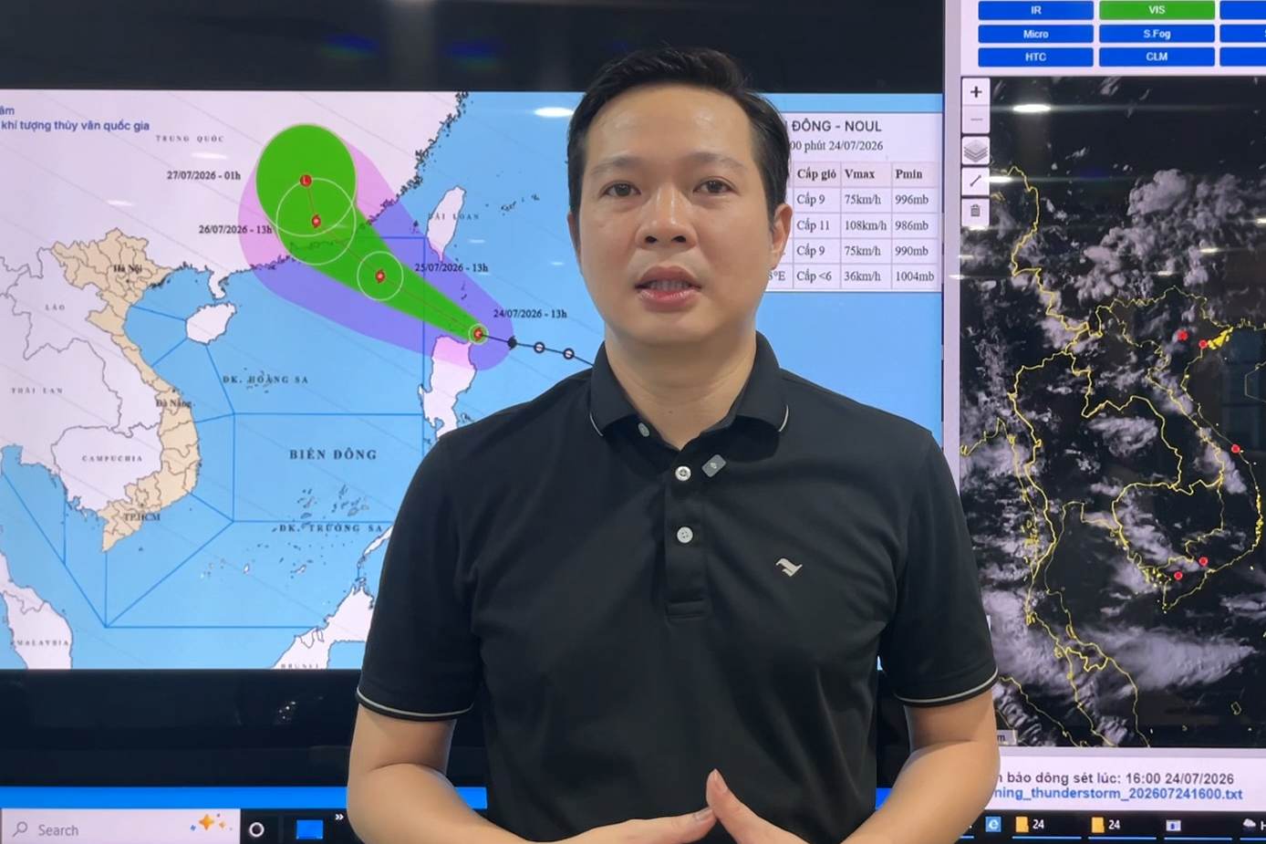
Ông Vũ Tuấn Anh cảnh báo thời tiết khu vực Đông Bắc của Bắc Biển Đông sẽ ảnh hưởng bởi bão Noul.
Mr. Vu Tuan Anh warned that the weather in the Northeast of the Northern East Sea will be affected by Typhoon Noul.

According to Mr. Vu Tuan Anh, Weather Forecast Department, National Center for Hydro-Meteorological Forecasting, it is forecasted that on the night of July 24, storm Noul will enter the northeastern sea area of the Northern East Sea.

When entering the East Sea, Typhoon Noul will become storm number 2 in the East Sea in 2026. According to current forecasts, Typhoon Noul will mainly move in the West-Northwest direction, with a high probability (over 80%) of making landfall in Guangdong province (China), with little possibility of directly affecting the mainland of Vietnam. However, it should be noted that when Typhoon Noul enters the East Sea, the storm's intensity may increase by 2 to 3 levels" - Mr. Tuan Anh said.

Mr. Vu Tuan Anh analyzes the developments of Typhoon Noul.

Forecast for the next 24 hours, the storm will move in a West-Northwest direction, at a speed of 20-25 km/h and is likely to strengthen further.

By 7:00 PM on July 25, the storm's center will be located at about 21.7 degrees North latitude - 116.8 degrees East longitude; in the northeast sea area of the Northern East Sea, about 270km southeast of Hong Kong (China). Wind intensity is strong at level 11-12, gusting at level 14.

Forecast for the next 48 hours, the storm will move in a West-Northwest direction, at a speed of 15-20 km/h and gradually weaken.

By 7:00 PM on July 26th, the storm's center will be located at approximately 24.3 degrees North latitude - 114.1 degrees East longitude; over the mainland area of Guangdong province (China). Wind intensity is strong at level 8, gusting at level 10.

Forecast for the next 60 hours, the storm will move in a North-Northwest direction at a speed of 15-20 km/h. The intensity gradually weakens into a tropical depression, then weakens into a low pressure area below level 6. By 7:00 AM on July 27, the center of the low pressure area will be located at about 26.2 degrees North latitude - 113.7 degrees East longitude, over the mainland of Guangdong province (China).

Regarding the impact of the storm, although it does not affect the mainland, when entering the East Sea, due to the storm strengthening, the northeastern sea area of the Northern East Sea area has winds gradually strengthening to level 6-7, then increasing to level 8-9, sea waves 3-5m high; the area near the storm center is strong at level 11-12, gusts at level 14, sea waves 5-7m high. The sea is violently rough. Ships operating in the above-mentioned dangerous areas are likely to be affected by thunderstorms, tornadoes, strong winds, and large waves" - Mr. Tuan Anh recommended.

AN AN
RELATED NEWS

Tonight, we welcome storm No. 2 Noul into the East Sea, forecast of storm making landfall area

|

From about midnight on July 24 to morning on July 25, Typhoon Noul will enter the North East Sea and become storm number 2. After that, it is likely to make landfall in Guangdong province (China).

Forecast of heavy rain in the North, with some places exceeding 200mm

|

The meteorological agency forecasts that not only the Northern region but also from this afternoon, July 24, heavy rain will expand to Thanh Hoa and Nghe An, with very heavy rain in some places.

Typhoon Noul is forecast to enter the East Sea tonight, July 24th, and continue to strengthen

|

Last night (July 23), the tropical depression strengthened into a storm and has the international name Noul.

Typhoon No. 2 Noul enters the East Sea, is about to strengthen to level 14 in the next 24 hours

|

On the evening of July 24, Typhoon Noul entered the northeastern sea area of the Northern East Sea, becoming storm number 2 in 2026.

Landslide on Cai San riverbank in Can Tho, 4 houses collapse

|

Can Tho - A serious landslide has just occurred on the bank of the Cai San River, completely collapsing 4 houses with total estimated damage of about 2.48 billion VND.

Live football Cambodia vs Singapore at ASEAN Cup 2026

|

Live football match Cambodia vs Singapore in Group A ASEAN Cup 2026 at 7:00 PM on July 24.

Vinh Quang Vietnam 2026 Press Conference: Spreading the spirit of creation and dedication

|

Hanoi - On the afternoon of July 24, the Vinh Quang Viet Nam 2026 press conference took place. This year's program continues to honor 13 typical advanced collectives and individuals.

Deputy Prime Minister Pham Thi Thanh Tra receives additional tasks

|

Deputy Prime Minister Pham Thi Thanh Tra is the Head of the Central Steering Committee for the National Target Program on Drug Prevention and Control to 2030.

Tonight, we welcome storm No. 2 Noul into the East Sea, forecast of storm making landfall area

LINH ANH |

From about midnight on July 24 to morning on July 25, Typhoon Noul will enter the North East Sea and become storm number 2. After that, it is likely to make landfall in Guangdong province (China).

Forecast of heavy rain in the North, with some places exceeding 200mm

LINH ANH |

The meteorological agency forecasts that not only the Northern region but also from this afternoon, July 24, heavy rain will expand to Thanh Hoa and Nghe An, with very heavy rain in some places.

Typhoon Noul is forecast to enter the East Sea tonight, July 24th, and continue to strengthen

AN AN |

Last night (July 23), the tropical depression strengthened into a storm and has the international name Noul.
