According to the National Center for Hydro-Meteorological Forecasting, through monitoring on satellite images, thunderstorm location data and weather radar, it was discovered that convective clouds were developing and causing thunderstorms in the areas of Hung Yen, Bac Ninh provinces, Hai Phong city and tended to move to the Hanoi area.
In the Hanoi area in the next 3 hours, this cloud area will continue to cause rain in the above areas, then spread to the wards/communes of the city. During thunderstorms, there is a possibility of tornadoes, lightning, hail and strong gusts of wind. Localized heavy rains are likely to cause flash floods on small rivers and streams, landslides on steep slopes and flooding in low-lying areas.
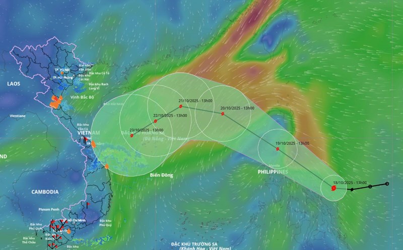
Area from Nghe An to Quang Ngai From the morning of October 19 to the end of the night of October 19, there is a forecast of moderate rain, heavy rain, locally very heavy rain and thunderstorms with common rainfall in the area from Hue city to Quang Ngai 40 - 80mm, locally over 150mm; in Nghe An to Quang Tri 20 - 50mm, locally over 100mm. Warning of the risk of heavy rain with rainfall greater than 80mm within 3 hours.
Heavy rain is likely to cause flooding in low-lying areas, urban and industrial areas; flash floods on small rivers and streams, landslides on steep slopes.
Real-time warning information for areas at risk of flash floods and landslides is provided online on the website of the Department of Hydrometeorology at: https://luquetsatlo.nchmf.gov.vn and in a separate bulletin warning of flash floods and landslides.


