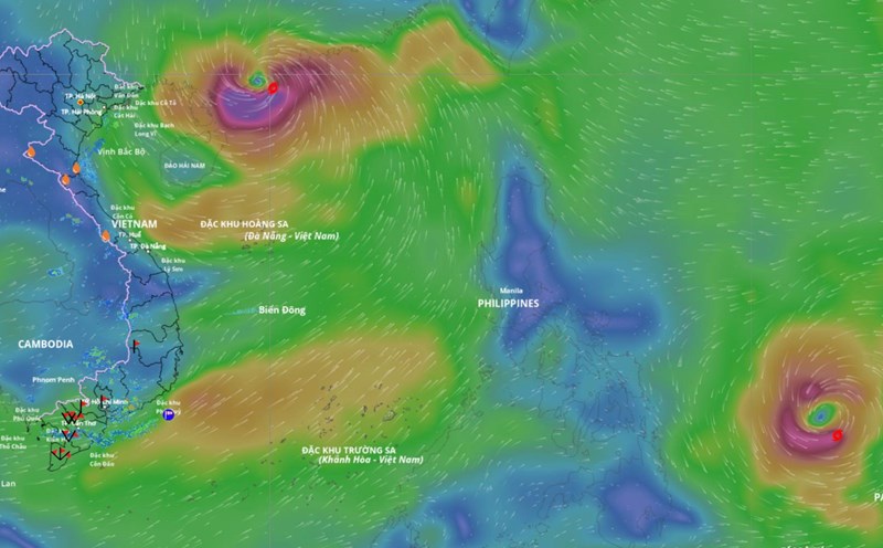
The latest update from the National Center for Hydro-Meteorological Forecasting, due to the impact of storm No. 9, in Bach Long Vi special zone, there were strong winds of level 7, gusting to level 8.
According to Mr. Mai Van Khiem - Director of the National Center for Hydro-Meteorological Forecasting, at 4:00 a.m. on September 25, the center of the storm was at about 21.5 degrees north latitude; 109.5 degrees east longitude, about 170 km east of Mong Cai (Quang Ninh). The strongest wind near the storm center is level 9 (75-88 km/h), gusting to level 11. The storm is moving westward at a speed of about 20 km/h.

"It is forecasted that this afternoon, September 25, storm No. 9 will make landfall in Quang Ninh province" - Mr. Khiem said.
It is forecasted that in the next 12 hours, the storm will move westward at a speed of about 20 km/h, gradually weakening into a tropical depression.
At 4:00 p.m. on September 25, the center of the tropical depression was at about 21.5 degrees north latitude; 106.9 degrees east longitude, on the mainland in the northeastern part of the North. Strong intensity level 6, gust level 8.
The danger zone is north of latitude 20 degrees north, west of longitude 111.5 degrees east. Level 3 natural disaster risk for the northwestern sea area of the North East Sea, the northern area of the Gulf of Tonkin and the northeastern coastal area.
Mr. Khiem said that in the next 24 hours, the tropical depression is forecast to continue moving westward at a speed of about 20 km/h, gradually weakening into a low pressure area.
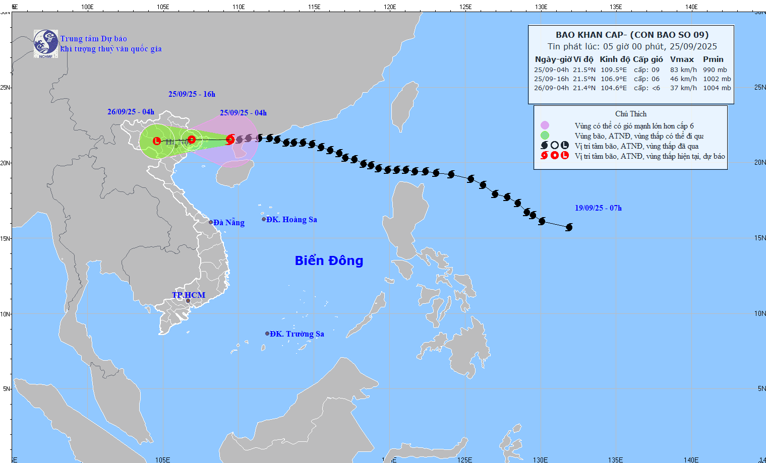
At 4:00 a.m. on September 26, the center of the low pressure area was at about 21.4 degrees north latitude; 104.6 degrees east longitude, on the mainland of the northwest of the North. Intensity below level 6.
According to Mr. Hoang Phuc Lam - Deputy Director of the National Center for Hydro-Meteorological Forecasting, regarding the impact of storms at sea, the northwestern sea area of the North East Sea will have strong winds of level 6-8, gusts of level 10, waves 3-5 m high, and rough seas.
The northern Gulf of Tonkin, including the special areas of Bach Long Vi, Van Don, Co To, Cat Hai and Hon Dau island, will have strong winds of level 6-7, waves 2-3 m high, near the storm center level 8-9, gusts of level 11, waves 3-4 m high, very rough seas. Ships and aquaculture areas in the danger zone are all affected by strong winds, high waves and rising sea levels due to storms.
On land, coastal areas from Quang Ninh to Hai Phong will have winds gradually increasing to level 6-7, near the storm center level 8, gusting to level 9-10. The deep inland areas of the Northeast will have strong winds of level 5, some places will have level 6, gusting to level 7-8.
According to Mr. Lam, from early morning of September 25 to the end of the night of September 26, in the Northern region, Thanh Hoa and Nghe An, there will be heavy to very heavy rain with common rainfall of 150-300 mm, locally over 450 mm, at risk of urban flooding.
"Specially note the eastern border of Hoang Lien Son range, in which the two old provinces of Lao Cai and Yen Bai will have heavy to very heavy rain during this rain. The rain will last until the night of September 26, with the peak rainfall during the day and the night of September 25" - Mr. Lam emphasized.
Regarding the hydrological situation, from September 25 to September 27, there is a possibility of flooding on rivers in the Northern region, Thanh Hoa and Nghe An. Flood peaks on Thao River and small rivers are likely to reach alert level 2-3; on Lo River, upstream of Thai Binh River, Hoang Long River, Buoi River, upstream of Ma River are at alert level 1-2, some rivers are above alert level 2. Heavy rain can cause flooding in low-lying areas, flash floods in small rivers and streams and landslides in mountainous areas.
Due to the influence of a wide storm circulation, it is necessary to be on guard against the risk of thunderstorms, tornadoes and strong gusts of wind both before and during the storm's landfall.