
The latest storm and low pressure news on the morning of August 18 from the Philippine Atmospheric, Geophysical and Astronomical Services Administration (PAGASA) said that low pressure 08f formed inside the Philippine Area of Responsibility (PAR) and is likely to strengthen into a tropical depression in the next 24 hours. Low pressure near the Philippines 08f is 1,140km east of Northern Luzon, Philippines.
Meanwhile, in the north of the East Sea, the 08g low pressure is being assessed as likely to moderately strengthen into a tropical depression in the next 24 hours. This low pressure in the East Sea is 298 km west-northwest of Laoag city, Ilocos Norte of the Philippines.
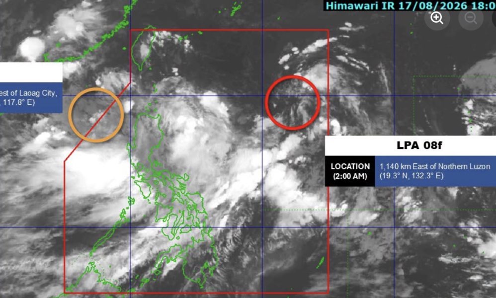
The appearance of these low pressures is relatively consistent with PAGASA's long-term forecast announced on August 17. Accordingly, in the week from now until August 23, there will be 3 storm or low pressure systems forming in PAGASA's forecast area.
The first system has the potential to strengthen into a storm from medium to high level and is likely to head towards Taiwan (China).
Right after this potential storm system, another system forms on the eastern boundary of PAGASA's TCID forecast area with the potential to strengthen into a storm from medium to high.
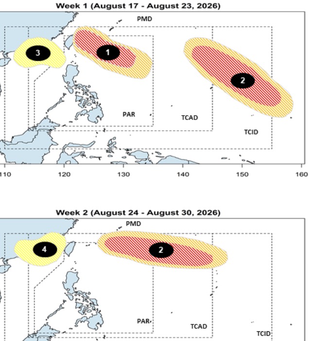
It is expected that the second system will expand its sphere of influence to the west, extend its duration to a week from August 24 to August 30 and enter the northeastern boundary of the Philippine Area of Responsibility (PAR) with the possibility of strengthening into a storm continuing to be maintained at an average to high level.
During the forecast period, there are 2 low pressure areas likely to form consecutively in the East Sea. The first low pressure area is expected to form in the week from now until August 23 with little possibility of strengthening into a storm or tropical depression. The second low pressure area is expected to form in the week from August 24 to August 30 also in the northern East Sea area and with little possibility of strengthening.


