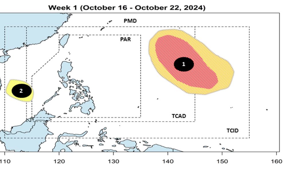
The Philippine Atmospheric, Geophysical and Astronomical Services Administration (PAGASA) Storm/Low Pressure Forecast Bulletin at 2:00 p.m. on October 16 said that during the week of October 16-22, 2024, a low pressure area near the East Sea is expected to appear west of the Philippine Forecast Area (PAR). The low pressure is unlikely to strengthen.
Also during the week of October 16-22, 2024, another low pressure area is expected to form within the Philippine typhoon/depression information area (TCID).
The possibility of this low pressure system strengthening is forecast by PAGASA at moderate to high. However, the low pressure system may change direction before entering the PAR forecast area.
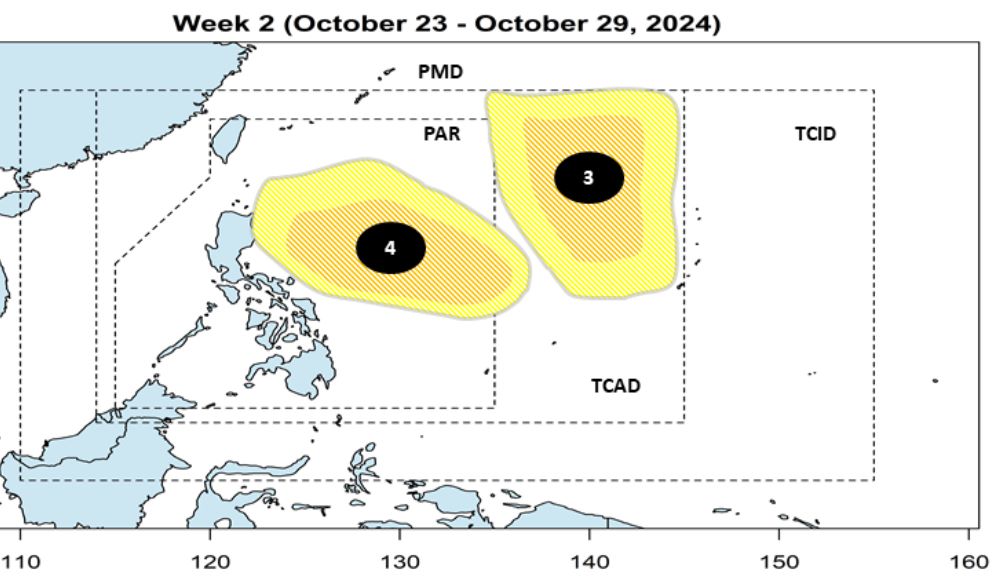
During the week of October 23-29, 2024, forecast models show that there is a possibility of two low pressure areas appearing near the Philippines.
One depression is expected to move toward Japan, while the other is forecast to enter PAR and possibly move inland into the Philippines. Both depressions have the potential to become low to moderate intensification.
PAGASA's weather bulletin for October 16 said the tropical convergence zone is affecting southern Mindanao. Easterly winds are affecting Luzon and eastern Visayas.
Areas affected by the tropical convergence zone such as Zamboanga Peninsula, Sarangani, Sultan Kudarat, Basilan, Sulu, Tawi-Tawi, Palawan, the rest of Soccsksargen and Barmm may experience flash floods or landslides due to moderate to heavy rains.
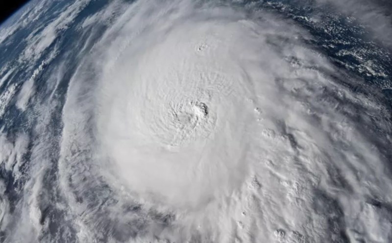
The Philippines has been battling a number of deadly storms in recent months, including Typhoon Gaemi in July, Typhoon Yagi in September and Typhoon Krathon in October.
Meanwhile, PAGASA predicted that most of the archipelago could experience above-average rainfall until the end of 2024 and 160 percent above average by January 2025.
The World Meteorological Organization predicts a 60% chance of a La Nina event by the end of 2024. Warmer sea surface temperatures also contribute to the development of hurricanes.
Research by scientists in the US and Singapore shows that climate warming is expected to increase the likelihood of storm formation and intensification near the coasts of Southeast Asian countries, such as the East Sea.
Vietnam could see more super typhoons, according to Benjamin Horton, director of the Earth Observatory of Singapore, who participated in the study.