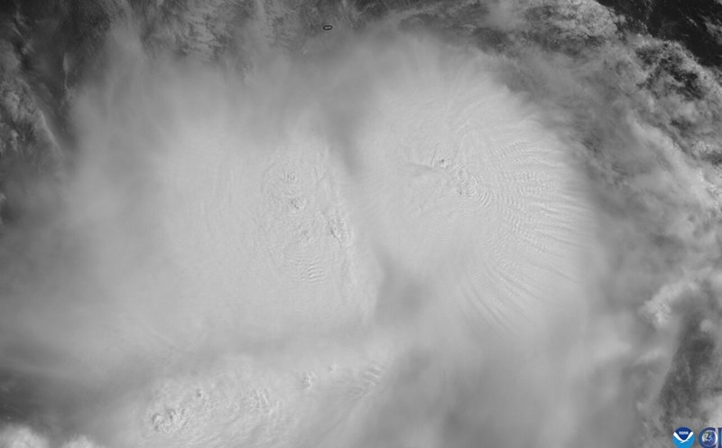
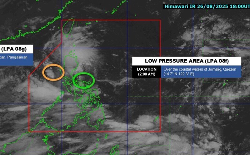
The latest storm and low pressure information on the morning of August 27 from the Philippine Atmospheric, Geophysical and Astronomical Services Administration (PAGASA) said that at 2:00 a.m. the same day, low pressure in the East Sea 08g formed. This new low pressure is currently inside the Philippine Forecast Area (PAR), about 190km from Dagupan, Pangasinan, Philippines.
Philippine typhoon forecasters said that the low pressure in the East Sea 08g has a moderate chance of strengthening into a typhoon and tropical depression in the next 24 hours.
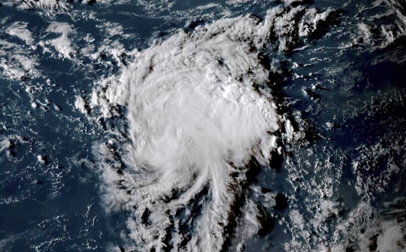
Meanwhile, low pressure near the East Sea 08f is still being monitored east of the Philippines, within the PAR forecast area. Low pressure 08f is in the offshore waters of Jomalig, Quezon and is unlikely to develop into a tropical depression within the next 24 hours.
According to PAGASA weather forecasters, the low pressure near the East Sea along with the southwest monsoon is expected to cause widespread rain across the Philippines. The areas most affected will be Luzon, Visayas and Mindanao.
PAGASA pointed out that the Manila urban area, Ilocos region, Cordillera region, Cagayan Valley, Central Luzon, Calabarzon, Camarines Norte and Camarines Sur will have clouds, scattered rain and thunderstorms due to low pressure near the East Sea.
The southwest monsoon will also bring scattered showers and thunderstorms to the Visayas, Mimaropa, Zamboanga Peninsula, Northern Mindanao, Bangsamoro Autonomous Region of Mindanao, Soccsksargen and the rest of the Bicol region. The rest of Mindanao could see scattered clouds, showers or thunderstorms.
Heavy rain is forecast for Palawan, Western Mindoro, Oriental Mindoro, Antique and Negros Western between the afternoon of August 27 and the afternoon of August 28.
PAGASA noted that the rainfall may be greater in mountainous and highland areas, with the worst impact likely in provinces that have experienced heavy rain in recent days.
PAGASA recommends that local people and disaster risk reduction agencies take measures to prevent floods and landslides.

Due to bad weather forecasts, the Civil Aviation Authority of the Philippines recorded a number of domestic flights being canceled for safety reasons. Court activities in some areas were also affected.
The forecast of strong winds, big waves and thunderstorms at sea from the Vietnam National Center for Hydro-Meteorological Forecasting issued at 4:00 a.m. on August 27, the tropical convergence zone with an axis through the northern East Sea connecting with the low pressure area in the east of the Philippines at 1:00 a.m. was located at about 15.5-16.5 degrees North latitude and 119.5-120.5 degrees East longitude. At Hon Ngu station (Nghe An), there are gusts of wind of level 8; Phu Quy station (Lam Dong) has strong winds of level 6, gusting to level 7.
Forecast, day and night of August 27: The sea area from Lam Dong to Ho Chi Minh City, the area between the East Sea, the northern sea area of the southern East Sea (including the sea area north of the Truong Sa archipelago) has southwest winds of level 6, gusting to level 7-8; rough seas. Wave height: 2.0-3.5m, southwest.
Other sea areas including the Gulf of Tonkin, the sea area from South Quang Tri to Ca Mau, Ca Mau to Kien Giang, the Gulf of Thailand, the North, Central and South East Sea areas (including the Hoang Sa and Truong Sa archipelagos) will have scattered showers and thunderstorms. During thunderstorms, there is a possibility of tornadoes, strong gusts of wind of level 6-7 and waves over 2.0m high.
The National Center for Hydro-Meteorological Forecasting noted that all ships operating in the above areas are at high risk of being affected by tornadoes, strong winds and big waves.