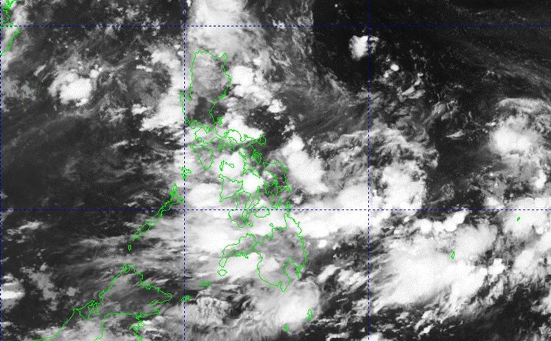
The latest storm information from the Philippine Atmospheric, Geophysical and Astronomical Services Administration (PAGASA) said that at 3:00 a.m. on July 2, the center of the low pressure was at about 16.9 degrees north latitude, 123.9 degrees east longitude, about 200km east-northeast of Casiguran (Aurora), and 235km east of Echague ( Isabela).
This low pressure is located in the Philippine Forecast Area (PAR) and is likely to develop into a tropical depression today (July 2).
Due to the distance close to land, a level 1 strong wind warning may be issued along the coastal provinces of Northeast and Northern Luzon immediately after the low pressure reaches tropical depression level.
Meanwhile, the southwest monsoon continues to affect Central Luzon, Southern Luzon, Visayas and Mindanao, causing widespread heavy rain. The rainfall is forecast to increase sharply in the next 48 hours, especially in the Northern and Central Luzon areas.
There is a high risk of localized flooding, landslides in mountainous areas and overflow in low-lying urban areas.
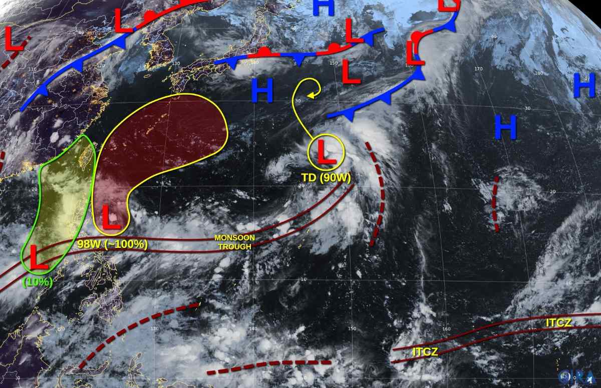
According to the US Joint Typhoon Warning Center (JTWC)'s storm forecast, the low pressure area is almost certain (100%) to strengthen into a tropical depression or storm in the next 1-2 days. This system has a clear convective center, is gradually becoming stronger and tends to move slowly northward, affecting the east coast of Luzon (Philippines), Taiwan (China) and Okinawa Island (Japan) in the coming days.
In addition to the PAR, another tropical depression (Invest 90W) is active about 2,660km north of Luzon, moving slowly north-northeast with sustained winds of 55 km/h, gusting to 70 km/h.
On the East Sea, the Vietnam National Center for Hydro-Meteorological Forecasting said that on the day and night of July 2, scattered showers and thunderstorms will continue to appear in: Gulf of Tonkin; Northern, Central and South East Sea (including Hoang Tri and Truong Sa); The sea area from Quang Tri to Ca Mau; From Ca Mau to An Giang; Gulf of Thailand
During thunderstorms, there is a possibility of tornadoes, strong gusts of wind of level 6-7, waves over 2.0m high
In the sea area from Lam Dong to Ca Mau, there are strong southwest winds of level 5, sometimes level 6, gusting to level 7, waves 1.5-2.5m high, rough seas.
Regarding rain forecast, on July 2, the North and Thanh Hoa will continue to have moderate rain, heavy rain and thunderstorms, with some places having very heavy rain. The common rainfall is 20-50mm, locally over 100mm.
On the night of July 2, the Northwest and Thanh Hoa regions will have moderate rain, heavy rain and thunderstorms, with some places having very heavy rain. The common rainfall is 15-40mm, locally over 80mm. Warning of the risk of local heavy rain (>100mm/6 hours).
Day and night of July 2, the Central and Southern regions will have showers and thunderstorms, with some places having heavy rain. The common rainfall is 10-30mm, locally over 70mm (concentrated in the afternoon and evening).
On the morning of July 2, the inner city of Hanoi and neighboring areas continued to have heavy rain with common rainfall ranging from 20-30mm, some places over 50mm.
This rain is likely to cause flooding for many streets with a common depth of 15-20cm; some streets are likely to be flooded deeper with a depth of 20-40cm.