Neneng low pressure approaches the mainland, may make landfall in the next 24 hours

Châu Anh |

Tropical depression Neneng is moving rapidly in a west-northwest direction, possibly approaching or making landfall in the next 24 hours.

On August 19 (Philippines time), according to the latest weather forecast from the Philippine Atmospheric, Geophysical and Astronomical Services Administration (PAGASA), tropical depression Neneng continues to maintain its intensity as it moves west-northwest over the sea area southeast of Taiwan (China).

The center of the tropical depression Neneng at 10:00 AM on August 19 was determined to be located about 530km east-northeast of Itbayat, Batanes province, at coordinates 22.6 degrees North latitude and 126.6 degrees East longitude.

Neneng has the strongest sustained wind near the center of 55 km/h, gusts up to 70 km/h, central pressure 1,002 hPa. The system is moving west-northwest at a speed of 30 km/h. The area with strong winds extends to 380km from the center of the low pressure.
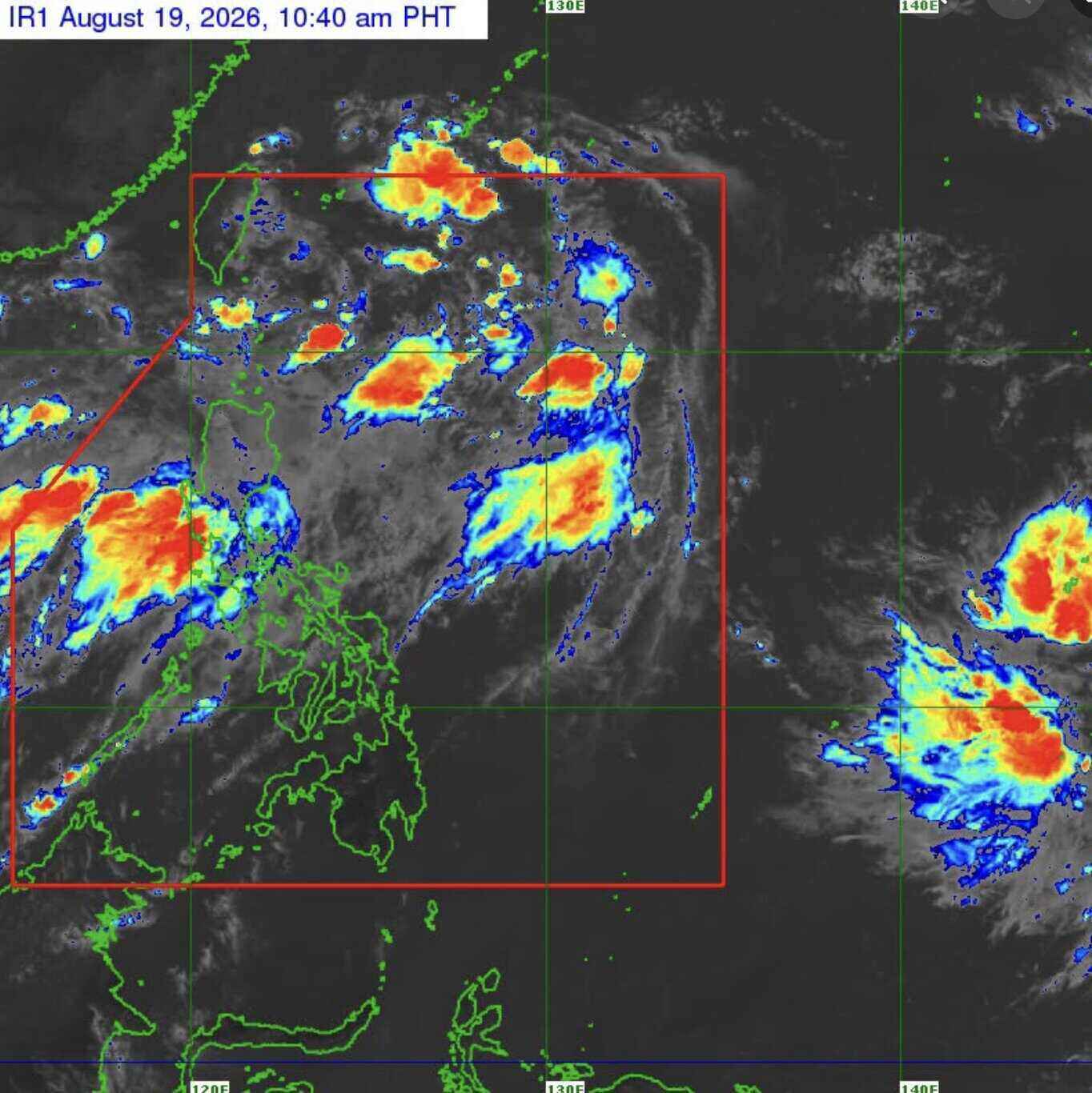
Ảnh vệ tinh cho thấy áp thấp nhiệt đới Neneng trên khu vực biển phía đông Philippines ngày 19.8. Ảnh: PAGASA
Satellite images show tropical depression Neneng over the sea area east of the Philippines on August 19. Photo: PAGASA

PAGASA said that people need to monitor heavy rain warnings caused by the southwest monsoon (Habagat).

Forecast for August 19 and August 20, the southwest monsoon will cause strong winds to gusts in most of Luzon and Visayas islands, Zamboanga peninsula, North Mindanao and Davao area.

By August 21, affected areas included most of Luzon, Panay Island, Negros Occidental, North Samar and Davao Oriental.

In the next 24 hours, strong rough seas are forecast in some coastal areas. Waves can reach up to 3.5m high in the Ilocos Norte, Zambales and Lubang Islands; the western waters of Batanes, Babuyan, Pangasinan, Bataan and Kalayaan Islands.

Waves up to 3m high are forecast in the waters of Ilocos Sur and La Union, some areas of Batanes, Pangasinan, Batangas, Occidental Mindoro, the Calamian Islands and Kalayaan.

PAGASA recommends small boat operators, especially motorboats, to be cautious when going to sea and, if possible, avoid operating in rough seas.

According to PAGASA's forecast, low pressure Neneng will continue to move mainly in the west-northwest direction and may approach or make landfall on the northern coast of Taiwan (China) in the afternoon or evening of August 20.

The low pressure center is forecast to remain in the Philippine Sea throughout the forecast period.

Neneng is forecast to maintain a tropical depression for the next 36 hours, before weakening into a remaining low pressure area above or near Taiwan (China) on the morning of August 21. However, PAGASA does not rule out the possibility that the system will weaken sooner.

This agency recommends that people and disaster risk management agencies proactively take necessary measures to protect people and property, and at the same time comply with the guidance of local authorities in areas at high risk of being affected by heavy rain, strong winds and rough seas.

Châu Anh
RELATED NEWS

Tropical depression Nengneng forms, forecast continuous heavy rain

|

The low pressure in the east of the Philippines has strengthened into the tropical depression Nengneng, while the low pressure in the East Sea is also forecast to quickly strengthen.

2 consecutive low pressures appear in the East Sea after 2 strong storms

|

It is forecasted that after 2 strong storms in the western Pacific basin, 2 low pressure areas will appear continuously in the northern East Sea area.

New low pressure strengthens into Typhoon Nangka, forecast direction in the next 24 hours

|

Tropical storm Nangka formed from a low pressure area and is currently more than 2,000km north of the northern tip of Luzon Island, moving eastward.

Ho Chi Minh City residents experience the moment Uncle Ho reads the Declaration of Independence

|

Ho Chi Minh City - Virtual reality technology brought people back to Ba Dinh Square in the autumn of 1945, immersing themselves in the moment Uncle Ho read the Declaration of Independence.

Neneng low pressure approaches the mainland, may make landfall in the next 24 hours

|

Tropical depression Neneng is moving rapidly in a west-northwest direction, possibly approaching or making landfall in the next 24 hours.

Instructions to switch to a postpaid wallet when you don't want to use a VETC wallet

|

In case they do not want to use VETC e-wallets, vehicle owners can switch to linking with postpaid wallets of banks.

Tropical depression Nengneng forms, forecast continuous heavy rain

Thanh Hà |

The low pressure in the east of the Philippines has strengthened into the tropical depression Nengneng, while the low pressure in the East Sea is also forecast to quickly strengthen.

2 consecutive low pressures appear in the East Sea after 2 strong storms

Thanh Hà |

It is forecasted that after 2 strong storms in the western Pacific basin, 2 low pressure areas will appear continuously in the northern East Sea area.

New low pressure strengthens into Typhoon Nangka, forecast direction in the next 24 hours

Châu Anh |

Tropical storm Nangka formed from a low pressure area and is currently more than 2,000km north of the northern tip of Luzon Island, moving eastward.
