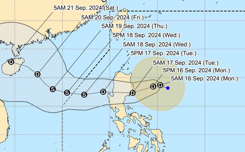
The Philippine Atmospheric, Geophysical and Astronomical Services Administration (PAGASA) said that early this afternoon, tropical depression Gener strengthened slightly as it left mainland Luzon and entered the West Philippine Sea (South China Sea).
At 1:00 p.m. on September 17, the center of the tropical depression was at about 17.0 degrees north latitude, 118.3 degrees east longitude, 255 km northwest of Baguio City, Philippines, in the eastern sea of the North East Sea, about 820 km east of the Paracel Islands.
Winds near the center of the tropical depression are strong at 55 km/h, gusting to 70 km/h, with central pressure of 996 hPa.
The tropical depression is moving west at 45km per hour. Strong winds extend up to 200km from the center of the depression.
According to PAGASA's storm forecast, by September 19, the tropical depression will approach Central Vietnam.
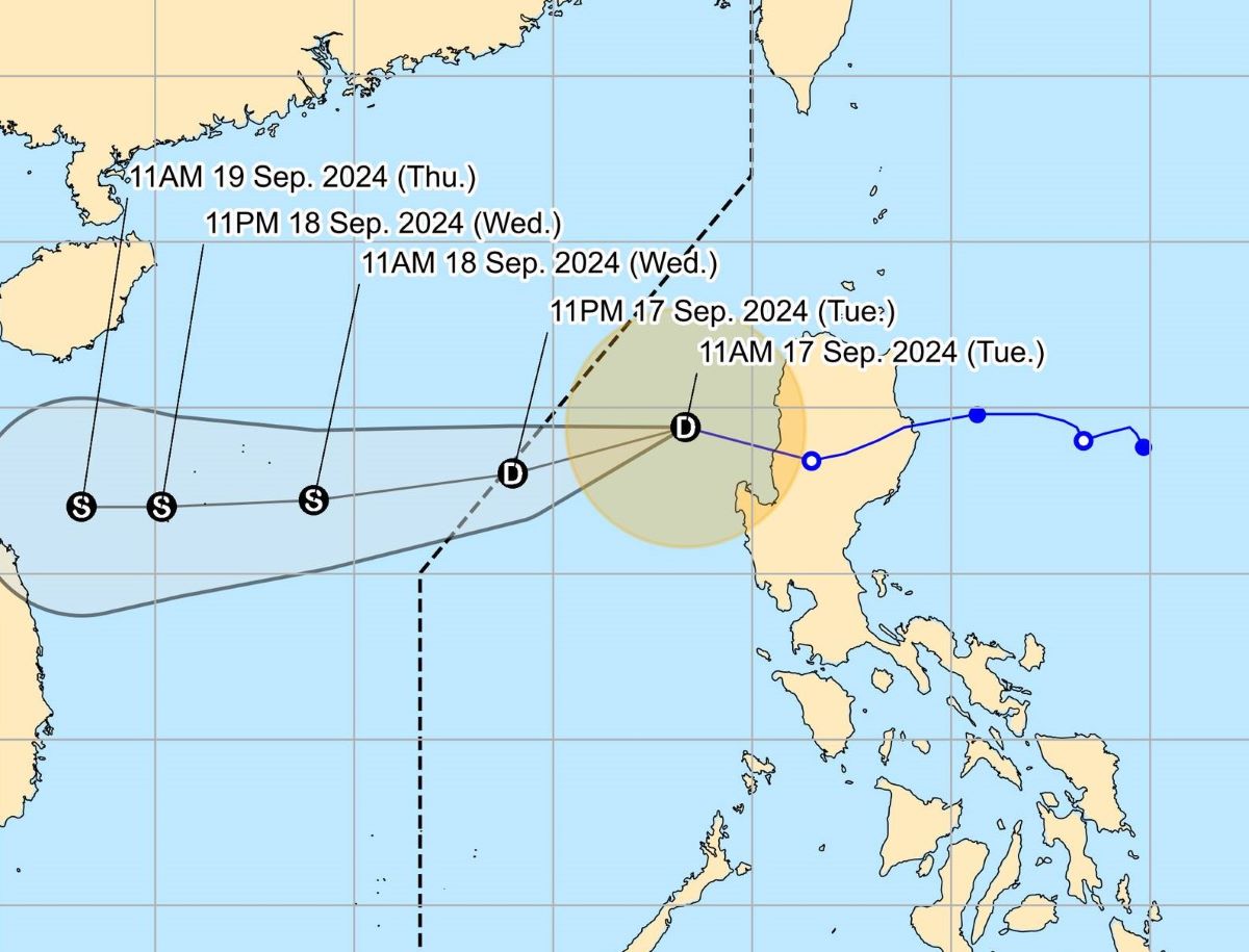
Gener made landfall in Palanan, Isabela (Philippines) at 11 p.m. on September 16, then crossed northern Luzon. The tropical depression may strengthen into a tropical storm by the morning of September 18.
Gener is expected to exit the Philippine Forecast Area (PAR) tonight or early tomorrow morning (September 18). Outside the PAR, Gener will continue to move westward across the South China Sea.
According to the forecast of the Vietnam National Center for Hydro-Meteorological Forecasting, in the next 24 to 48 hours, the tropical depression is likely to strengthen into a storm, level 8-9 intensity, gusting to level 10-11.
Meanwhile, Tropical Storm Pulasan was last spotted 1,845km east of Northern Luzon or 1,800km east of the northernmost tip of Luzon at 10am on September 17.
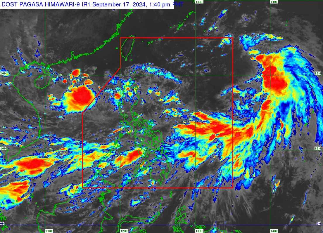
Pulasan is moving north-northwest at 25 km/h and may enter PAR on the evening of September 17 or early morning of September 18. Once inside PAR, the local name of the storm will be Helen.
So far, Pulasan still has maximum sustained winds of 65 km/h and gusts of up to 80 km/h, but PAGASA does not rule out the possibility of it strengthening into a severe tropical storm.
Typhoon Pulasan is still far from the Philippine mainland and will only be in the PAR for less than a day, possibly exiting in the afternoon or early evening of September 18. After leaving the PAR, the storm may head toward the East China Sea and pass near or over Japan's Ryukyu Islands in the evening of September 18 or early morning of September 19.
Although Typhoon Pulasan is unlikely to make landfall in the Philippines, it is also strengthening the southwest monsoon.
Gener is the Philippines' 7th typhoon of 2024 and the 3rd typhoon of September. If Pulasan enters the PAR, it will be the 8th typhoon of the year and the 4th typhoon of September.