On August 18, due to the impact of the tropical depression, all classes in Hong Kong (China) were suspended after the red storm warning signal was raised as heavy rain fell on the city.
According to the Hong Kong Observatory (China), more than 60mm of rain was recorded in many places in this special administrative zone. Heavy rain even exceeded 100mm in Dao Dao and Don Mon.
The Vietnam National Center for Hydro-Meteorological Forecasting said that at 1:00 p.m. on August 18, the center of the tropical depression in the East Sea was at about 19.4 degrees North latitude; 107.8 degrees East longitude, about 70km south of Bach Long Vi Special Zone. The strongest wind near the center of the tropical depression is level 6-7 (39-61km/h), gusting to level 9; moving in the North Northwest direction at a speed of about 15km/h.
Due to the impact of the tropical depression, the Gulf of Tonkin (including the special areas of Bach Long Vi, Cat Hai, Co To and Van Don) will have thunderstorms and strong winds of level 6-7, gusts of level 9, waves 2.0-3.5m high, rough seas.
On land, from the afternoon of August 18, coastal areas from Quang Ninh and Hai Phong will have strong winds of level 6, gusting to level 8.
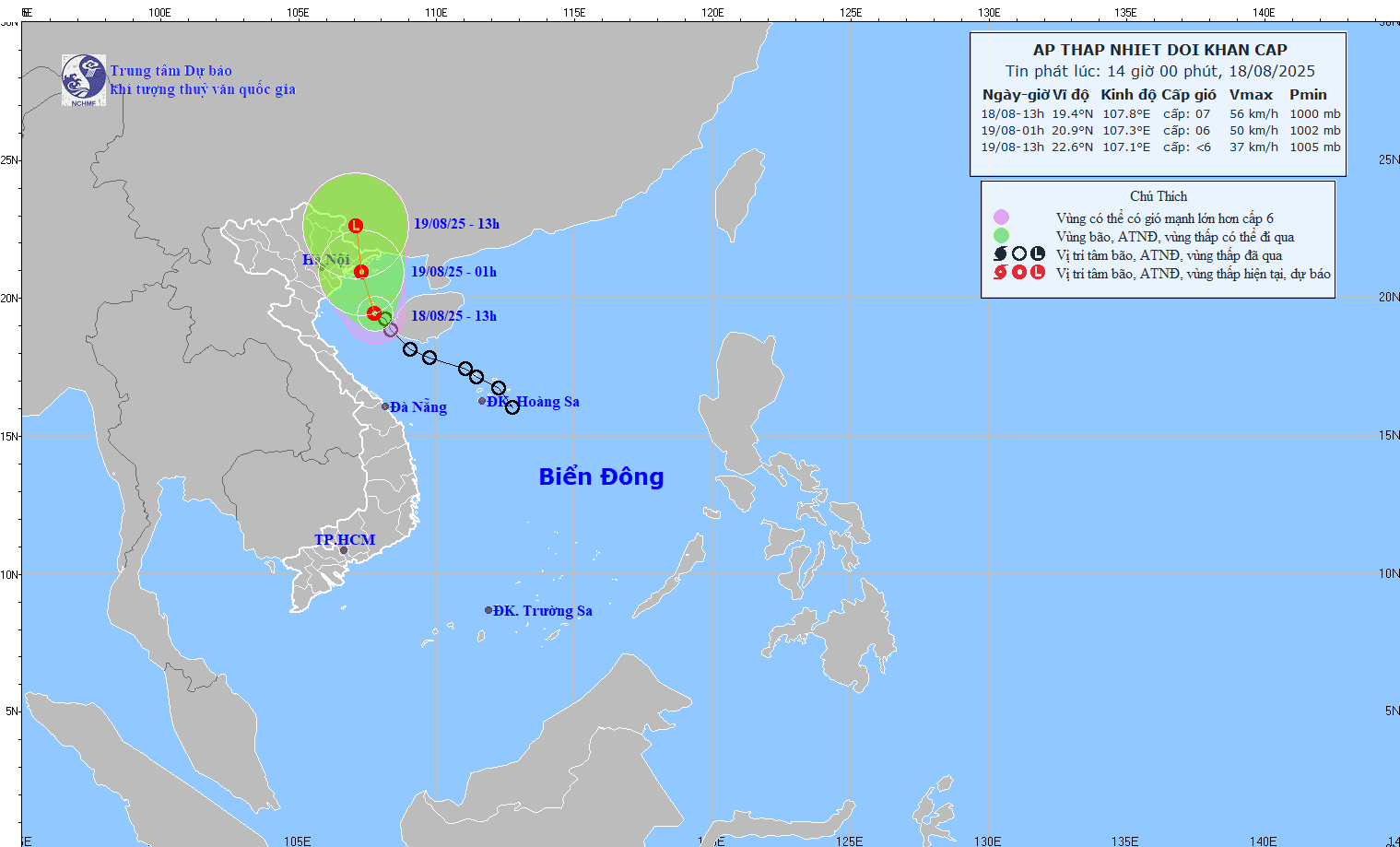
Regarding rain forecast, from the afternoon of August 18 to the night of August 19, the Northeast and Thanh Hoa will have moderate rain, heavy rain and thunderstorms with common rainfall of 50-150mm, locally very heavy rain over 300mm.
On the afternoon and night of August 18, Nghe An and Ha Tinh will have moderate rain, heavy rain and thunderstorms with common rainfall of 20-50mm, locally very heavy rain over 100mm.
The Hong Kong Observatory (China) forecasts that from now until the end of the year, there may be up to 5 more storms entering the 500km range of this special zone - a level much higher than the average of many years.
Since the beginning of the year, there have been 14 storms affecting the North Pacific and the East Sea, of which 5 have approached Hong Kong (China), exceeding the average of 3.8 storms typically recorded in the first 8 months of the year. The main reason, according to meteorologists, is due to higher-than-average sea surface temperatures and strong and prolonged subtropical high pressure.
The unusual warming of the sea surface of the western Pacific has created more heat energy, causing atmosphere instability, triggering strong convection and creating conditions for tropical storm development. At the same time, the subtropical high pressure spreading to the West throughout the summer, especially in June and August, has opened an "East wind corridor" bringing tropical cyclones from the East of the Philippines into the North East Sea.
This has significantly increased the probability of storms entering the area near Hong Kong (China). The Observatory predicts that the period from September to December will have more rain and be hotter than the average of many years.
In July, super typhoon Wipha paralyzed the area, injuring dozens of people and leaving tens of thousands of passengers unrolled.
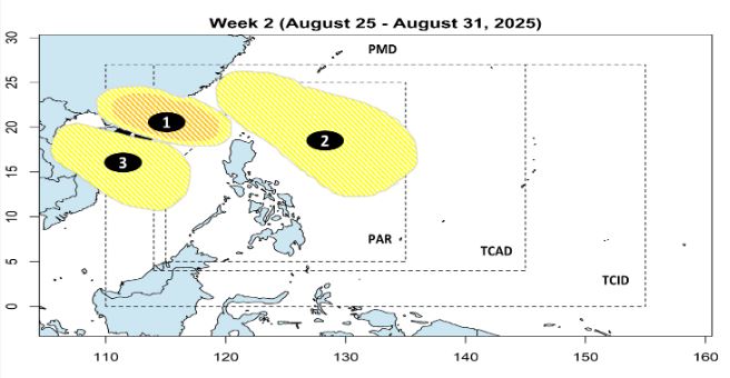
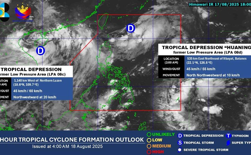
Meanwhile, according to the storm/low pressure forecast of the Philippine Atmospheric, Geophysical and Astronomical Services Administration, in the next 2 weeks (from 18-31.8), in addition to the current tropical depression in the East Sea and tropical depression Huaning off the northeast of Batanes Island, there will be 3 new low pressure areas, of which 2 are close to the East Sea.