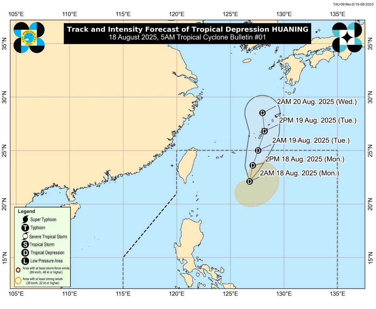
The latest storm/low pressure information from the Philippine Atmospheric, Geophysical and Astronomical Services Administration (PAGASA) said that early this morning, the low pressure area off the northeast of Batanes island strengthened into tropical depression Huaning.
At 4:00 a.m. on August 18, the center of tropical depression Huaning was located about 520 km east-northeast of Itbayat (Batanes), at coordinates 22.3 degrees North latitude; 126.6 degrees East longitude.
The strongest wind near the center reaches 45 km/h, gusting to 55 km/h; central pressure 1008 hPa.
Tropical depression Huaning is moving north-northwest at a speed of 10 km/h.
The strong wind radius is about 270km from the center of the tropical depression.
Currently, no area is under the storm warning level.
It is forecasted that in the next 48 hours, Huaning is unlikely to directly affect the Philippines.
At sea: Mid-level waves (up to 2m high) in the Batanes; North and West Babuyan Islands; Northwest and West Ilocos Norte; West Ilocos Sur, Pangasinan, Zambales, Bataan, Occidental Mindoro, Lubang and Palawan islands.
Huaning is forecast to continue northward until the end of tonight, then turn north-northeastward from early tomorrow morning, towards the Ryukyu Islands (Japan).
On the forecast track, Huaning could exit the Philippine Forecast Area (PAR) tonight or early tomorrow morning. The system will remain a tropical depression throughout the forecast period.
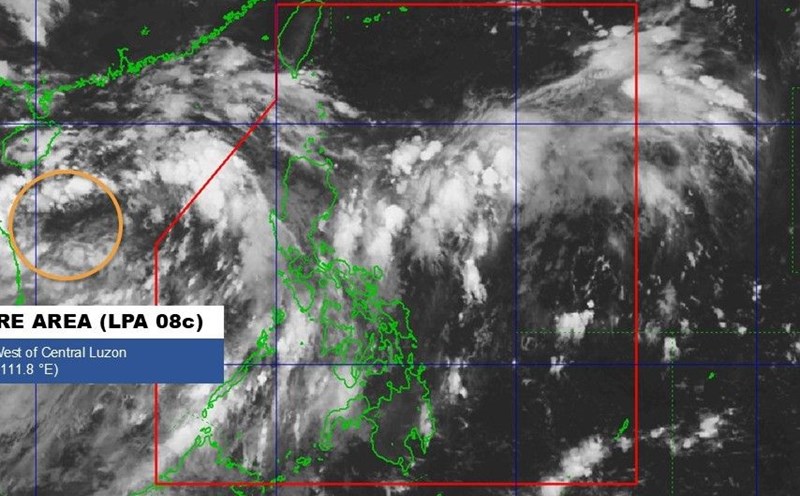
With the tropical depression in the East Sea (08c), PAGASA said that this tropical depression has left PAR, 1,140km west of Northern Luzon.
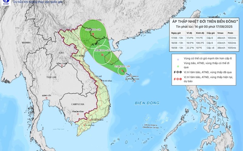
According to the storm/low pressure forecast bulletin of the Vietnam National Center for Hydro-Meteorological Forecasting, at 1:00 a.m. on August 18, the center of the tropical depression was at 18.1 degrees North latitude, 109.1 degrees East longitude, south of Hainan Island (China).
The strongest wind is level 6 (39-49 km/h), gusting to level 8. Moving northwest, speed about 15 km/h.
It is forecasted that by 1:00 a.m. on August 19, the tropical depression will be at 20.3 degrees North latitude, 107.7 degrees East longitude, in the North of the Gulf of Tonkin. Intensity level 6, gust level 8. Photo: Eastern sea area from Quang Tri to Hue and the Gulf of Tonkin (including Bach Long Vi, Co To). Natural disaster risk: level 3.
By 1:00 a.m. on August 20, the tropical depression gradually weakened into a low pressure area, located at 23.2 degrees North latitude, 106.7 degrees East longitude (south of Guangxi province, China). Intensity below level 6. The low pressure affects the North of the Gulf of Tonkin (including Bach Long Vi, Co To). Natural disaster risk: level 3.
Regarding rain forecast, from August 18 to the night of August 19, the Northeast and Thanh Hoa will have moderate rain, heavy rain, locally very heavy rain (50-130mm, some places over 250mm).
On the day and night of August 18, Nghe An will have moderate rain, heavy rain (30-60mm, some places over 120mm).
On August 18, Ha Tinh and Quang Tri will have moderate to heavy rain (20-50mm, some places over 80mm).
Day and night of August 18: The Northwest, from Hue to Lam Dong and the South will have scattered showers and thunderstorms (15-30mm, some places over 80mm, concentrated in the afternoon and night).
Warning of the risk of heavy rain (>100 mm/3 hours).