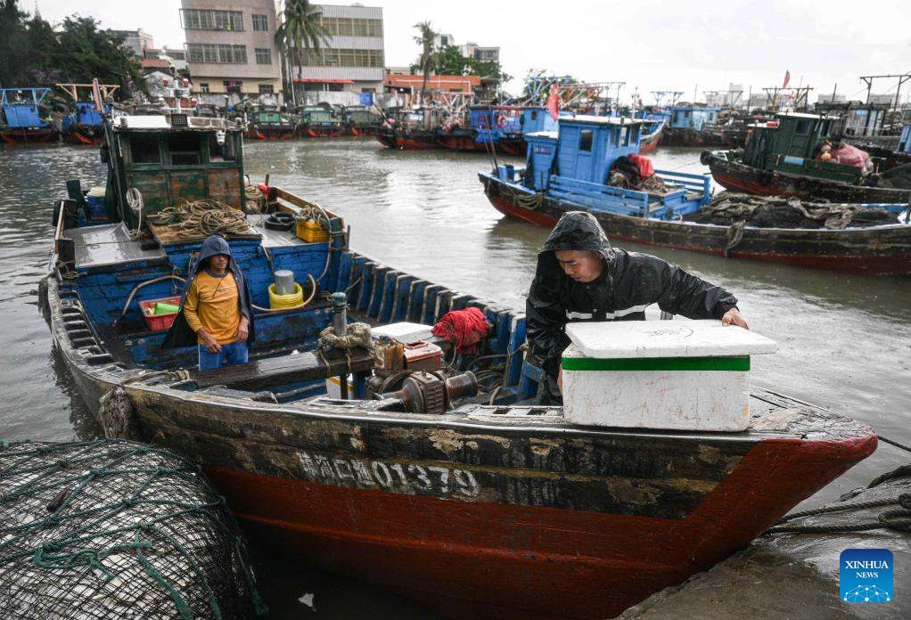
The Hong Kong Meteorological Agency (China) HKO announced that the storm signal will be maintained until at least 8:00 p.m. on August 17, due to the influence of the tropical depression in the East Sea. Although the center of the low pressure is still more than 600km from Hong Kong, thunderstorms with gusts of wind have begun to affect coastal areas.
A series of beaches in Hong Kong (China) such as Stanley Main, Cheung Chau Tung Wan, hap Mun Bay and Clear Water Bay (Sai Kung) have hung red flags, advising people not to swim in the sea due to high waves.
In Macau (China), the meteorological and Geophysical Department has issued a signal for storm No. 3 since noon on August 17. The overpasses recorded strong winds and gusts, and the authorities warned people to pay attention to traffic safety. All preschool, primary and special education classes have been temporarily suspended, while secondary schools are still maintained.
In parallel with the development of the tropical depression in the East Sea, China continues to face extreme weather. The National Meteorological Center (NMC) issued a blue alert for storms on August 16, forecasting heavy rain in many provinces from the Northeast to the Southwest, including: Cat Lam, Lieu Ninh, Son Dong, Hebei, Ha Nam, Sichuan, Guangdong, Guangxi and Hainan.
The Ministry of Water Resources and the China Meteorological Administration simultaneously issued a yellow alert (2nd severe level) for the risk of flash floods in Shandong and Hainan. The Ministry of Natural Resources also issued a yellow warning of the risk of landslides in Hebei, Son Tay, Son Dong, Yunnan and Xiem Tay.
Meanwhile, a flash flood that occurred on the night of August 16 at a wild camping spot in the Inner Mongolia Autonomous Region killed 8 people and left 4 people missing.
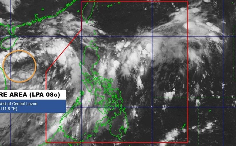
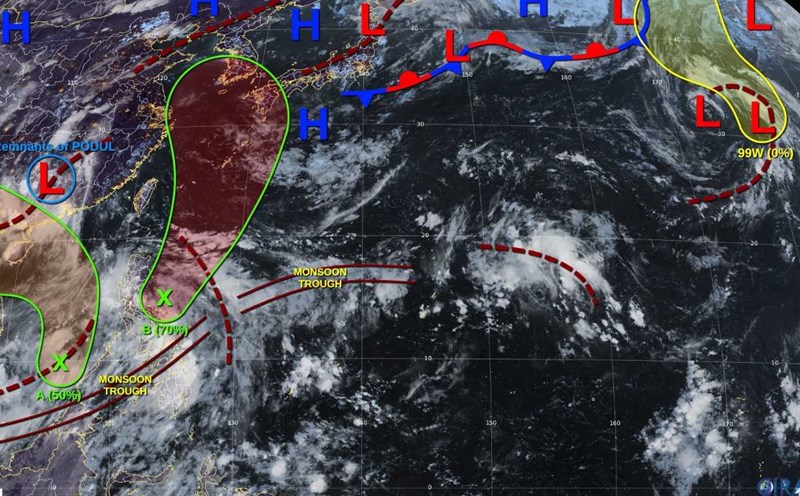
The storm/low pressure forecast bulletin of the Vietnam National Center for Hydro-Meteorological Forecasting said that at 1:00 p.m. on August 17, the center of the tropical depression was at about 17.4 degrees North latitude; 111.1 degrees East longitude, in the northwest sea of Hoang Sa special zone. The strongest wind near the center of the tropical depression is level 6 (39-49km/h), gusting to level 8; moving northwest at a speed of about 15km/h.
It is forecasted that by 1:00 p.m. on August 18, the tropical depression will be at 19.5 degrees North latitude, 108.3 degrees East longitude; in the North of the Gulf of Tonkin. Strong winds of level 6, gusting to level 8, moving northwest, about 15km/h. The sea area west of the North East Sea (including the sea area of Hoang Sa special zone), the Gulf of Tonkin area (including the special zone of Bach Long Vi) is at risk of natural disaster level 3.
At 1:00 p.m. on August 19, the tropical depression was at 22.2 degrees North latitude, 107.0 degrees East longitude; in the area south of Guangxi province (China). Winds below level 6, moving in the North-Northwest direction, 10-15km/h and gradually weakening into a low pressure area. The Northern Gulf of Tonkin area (including Bach Long Vi special zone and Co To special zone) is at risk of level 3 natural disasters.
Due to the impact of the tropical depression, the sea area west of the North East Sea (including the sea area of Hoang Sa) will have thunderstorms and strong winds of level 6-7, gusts of level 8-9, waves 2.0-3.5m high, rough seas.
The Gulf of Tonkin area will have winds gradually increasing to level 6, gusts of level 8, waves 2.0-3.0m high, rough seas.
Ship operating in the above-mentioned dangerous areas are likely to be affected by thunderstorms, whirlwinds, strong winds, and large waves.