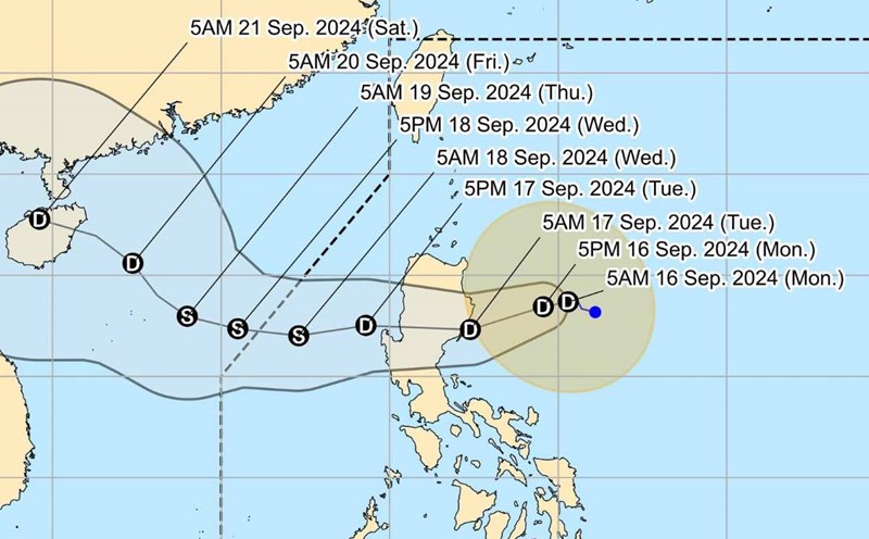
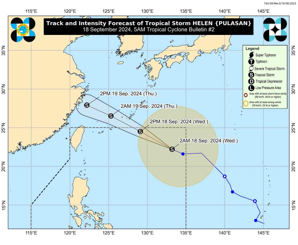
According to the latest storm information from the Philippine Atmospheric, Geophysical and Astronomical Services Administration (PAGASA), tropical storm Pulasan entered PAR at 6:30 p.m. on September 17.
Typhoon Pulasan, locally named Helen, is the 8th typhoon in the Philippines in 2024. It is also the 4th typhoon in September.
At 3:00 a.m. on September 18, the center of Typhoon Pulasan (Helen) was at approximately 22.3 degrees north latitude, 132.9 degrees east longitude, 1,155 km east of the northernmost tip of Luzon. The strongest winds near the center of the storm were 85 km/h, gusting up to 105 km/h. The storm was moving northwest at 25 km/h.
There are no rain warnings or tropical cyclone signals from Helen, as the storm is expected to remain far from the Philippine mainland and may also leave PAR by the afternoon of September 18.
However, like Gener, Hurricane Helen is strengthening the southwest monsoon.
Meanwhile, tropical depression Gener is currently in the East Sea. According to the Vietnam National Center for Hydro-Meteorological Forecasting, at 4:00 a.m. on September 18, the center of the tropical depression was at about 16.7 degrees north latitude; 113.8 degrees east longitude, about 250km east of the Hoang Sa archipelago.
The strongest wind near the center of the tropical depression is level 7 (50-61km/h), gusting to level 9; moving mainly west at a speed of about 25km/h.
It is forecasted that in the next 24 hours, the tropical depression will likely strengthen into a storm, level 8 intensity, gusting to level 10.
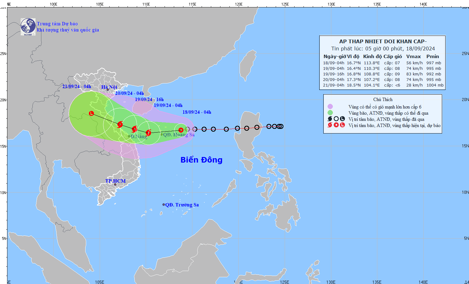
At 4:00 a.m. on September 19, the tropical depression was about 340 km east-southeast of the mainland from Quang Binh to Da Nang provinces, with a level 8 intensity, gusting to level 10, moving west-southwest at 15-20 km per hour, strengthening into a storm.
Level 3 natural disaster risk in the western sea area of the North East Sea (including the Hoang Sa archipelago); the sea area from Quang Tri to Quang Ngai (including Ly Son island, Cu Lao Cham, Con Co).
At 4:00 a.m. on September 20, the storm in the coastal area from Quang Binh province to Da Nang, level 8 intensity, gust level 10, moving west-northwest, traveling 10-15km per hour and weakening into a low pressure area in the Central Laos region.
Level 3 natural disaster risk in the western sea area of the North East Sea (including the Hoang Sa archipelago); the sea area from Nghe An to Quang Ngai (including Ly Son island, Cu Lao Cham, Con Co, Hon Ngu).