The latest storm news on July 30 said that the US National Hurricane Center (NHC) is monitoring 5 systems of storms and depressions in the Pacific Ocean, including strong storm Iona and tropical storm Keli.
Located about 1,270 km southeast of Honolulu, Typhoon Keli has reached its strongest continuous winds of nearly 64 km/h.
US forecasters expect the latest storm in the Pacific Ocean to continue moving westward over the next few days with " little change in strength" before dissipating on July 31. Currently, Typhoon Keli is moving west at a speed of 24 km/h.
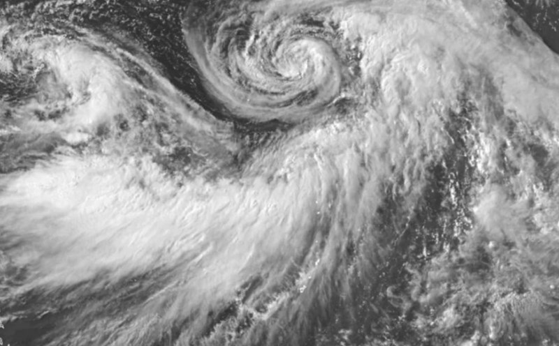
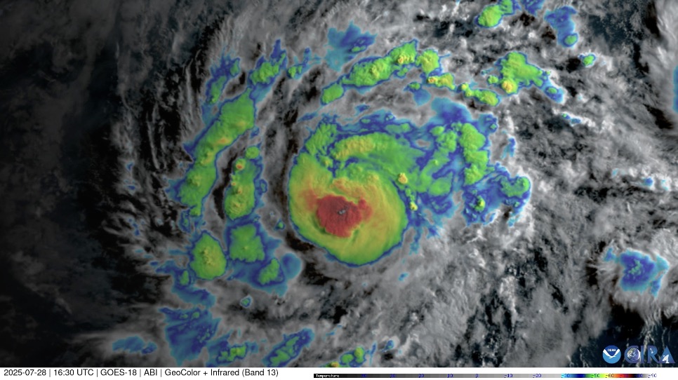
Meanwhile, storm Iona has strengthened into a major storm near level 4, with maximum sustained winds of nearly 200 km/h and stronger gusts. Forecasters had previously determined that the storm would only reach the peak of a Category 2 storm. January is also heading westward with a forecast speed increase over the next few days. Iona is currently moving west at a speed of 22 km/h.
Forecasters also said that after reaching its peak on the night of July 29, storm Iona is likely to gradually weaken on July 30.
January 1 was the first named storm of the mid-Pacific hurricane season to form on July 27 from a tropical depression. After forming, the storm continuously moves westward through the vast, warm ocean.
In the central and eastern Pacific basin, in addition to storms January 1 and October 2 and tropical storm Keli, forecasters in the US are also monitoring 3 more depressions, including 2 that are likely to continue to strengthen.
The Invest 98E depression is in the eastern Pacific Ocean, closest to the two storms Iona and Keli. The system has a 70% chance of developing into a tropical depression or tropical storm in the next 2 days.
Similarly, low pressure Invest 99E is also in the eastern Pacific. The system has an 80% chance of strengthening into a tropical depression or tropical storm in the next 2 days.
Right next to the Invest 99E low pressure system, the system is named District 3, with a 30% chance of strengthening over the next 7 days.
In the eastern Pacific, Typhoon Co May (known as Emong in the Philippines and Typhoon No. 8) is active 250 km south-southeast of Shanghai, China. The storm has been moving north-northwest at a speed of 17 km/h for the past 6 hours.
Forecasters at the US Navy's Joint Typhoon Warning Center (JTWC) said that Typhoon Co May is expected to continue moving northwest and making landfall on islands southeast of Shanghai, China within the next 12 hours.
Also in the eastern Pacific basin, Typhoon Krosa (Storm No. 9 in Japan) is 789 km south-southeast of Yokosuka, Japan.
In addition to the two storms, low pressure Invest 92W was also detected by weather experts in the western Pacific. This low pressure has maximum sustained winds of about 30 km/h.
A tropical depression will become a named tropical storm when sustained winds reach 69 km/h. When winds reach 110 km/h, the storm officially became a typhoon.