On July 29, 2025, storm forecasts from major meteorological centers around the world continued to record a complex weather picture in the Northwest Pacific and neighboring areas of the East Sea, with three tropical cyclones active along with a new pressure area likely to develop.
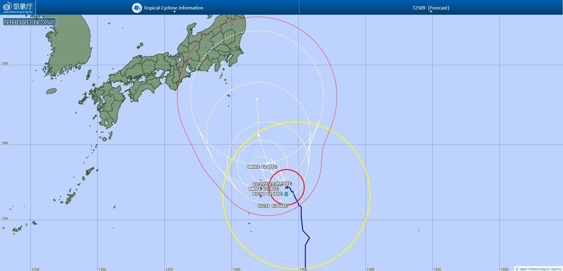
Tropical depression Comay (11W): Weakened but may regenerate
Comay (formerly storm No. 4 in the East Sea), which is located in the west-northwest of Okinawa Island (Japan), has significantly decreased in intensity over the past 24 hours. Maximum winds of about 55 km/h, which are not qualified for tropical storm maintenance, have caused Comay to be downgraded to a tropical depression.
However, meteorological forecast models still maintain the view that the Comay could intensify as it moves into the East China Sea, where sea surface temperatures are high and wind shear is low - ideal conditions for tropical cyclones to develop.
Comay is expected to gradually strengthen, making landfall near Shanghai (China) on July 30, then weakening rapidly due to terrain and the collapse of the approach line.
However, many storm forecast models also show the possibility of Comay returning to the Hoang Hai Sea this weekend and recovering to a storm again.
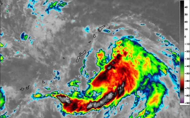
Typhoon Krosa (12W): Loops near Ogasawara, may strengthen again
Typhoon Krosa is moving slowly near the Ogasawara Islands (Japan), in a weak pressure area between two systems - one monsoon in the west and one high pressure edge of the subtropical high pressure in the east. This delay caused Krosa to experience the phenomenon of the sea water cooling due to deep suction (upwelling), combined with the encroached dry air, causing the flow to drop sharply.
The eye of the storm was blurred and the cloud wall almost disappeared, weakening Krosa, currently maintaining only about 130 km/h of winds.
It is forecasted that in the next few days, Krosa will continue to hide near Ogasawara in both favorable and unfavorable weather conditions: warm sea and weak winds, but dry and cooled by the water that the storm sucks up.
Krosa is likely to weaken into a tropical depression on July 30. However, from August 1 onwards, when it leaves its own cold water and has a high wind trough cutting through, Krosa could reorganize and reach typhoon level.
Typhoon Iona (01C): May enter the West Pacific
Further east, storm Iona is active in the Central Pacific, about 1,440km southeast of Hawaii, with winds of about 120km/h.
Iona is forecast to continue moving westward and possibly cross the Western Pacific border this weekend, but is likely to weaken due to unfavorable environmental conditions.
New stir: A monsoon is about to form
In addition to the three main systems mentioned above, a disturbance zone (Disturbance A) is being monitored southeast of Okinawa (Japan), located in a long monsoon trough. The forecast shows that the possibility of tropical cyclone formation from this disturbance is low in the next 7 days (about 10%), due to unfavorable upper-level winds. However, this is still a point to watch as it moves northeast.
Sea warning: Strong southwest monsoon in areas near the East Sea
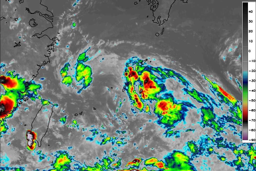
A strong wind warning has been issued for the western and central Philippine seas, including the waters east of Luzon Island, southeast of Taiwan (China) and south of the Ryukyu Islands (Japan). The southwest monsoon forecast in this area will reach 56-65 km/h in the next 24 hours, then gradually decrease below the threshold of 56 km/h on July 30.