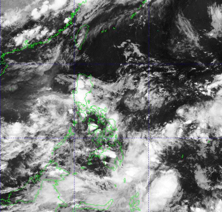
The latest storm information at 2:00 a.m. on June 22 from the Philippine Atmospheric, Geophysical and Astronomical Services Administration (PAGASA) said that the low pressure area being monitored outside the Philippine Forecast Area (PAR) is likely to develop into a tropical depression in the next 24 hours.
At 2:00 a.m. on June 22, the center of the low pressure was at about 22.9 degrees north latitude, 146.3 degrees east longitude, 2,530 km east of the northernmost tip of Luzon.
According to PAGASA's weather bulletin, the southwest monsoon is affecting Central and Southern Luzon, and the western regions of Visayas and Mindanao.
Meanwhile, the Intertropical Convergence Zone (ITCZ) is affecting the eastern part of Mindanao.
Pagasa noted that the ITCZ will bring cloudy skies with scattered showers and thunderstorms over Davao and Surigao del Sur.
The southwest monsoon also causes cloudy skies with scattered showers and thunderstorms in Metro Manila, Calabarzon (Cavite, Laguna, Batangas, Rizal and Quezon), Soccsksargen (South Cotabato, Cotabato, Sultan Kudarat, Sarangani and General Santos City), Pangasinan, Zambales, Bataan, Western Mindoro and Palawan.
Scattered showers or thunderstorms also occurred in the Bicol region, Western Visayas, Negros Peninsula, Zamboanga Peninsula, Bangsamoro and the rest of Central Luzon and Mimaropa (Mindoro, Marinduque, Romblon and Palawan).
The rest of the Philippines will have cloudy skies with scattered showers or thunderstorms.
PAGASA warns of the possibility of flash floods or landslides due to moderate to heavy rains and severe thunderstorms.
The Vietnam National Center for Hydro-Meteorological Forecasting said that on the night of June 22 and June 23, the sea areas: Central East Sea, North South East Sea (including Truong Sa), from Binh Thuan to Ca Mau, Ca Mau to Kien Giang and the Gulf of Thailand will continue to have showers and thunderstorms, with the risk of tornadoes, strong gusts of wind of level 6-7, waves over 2m high.
The sea area from Binh Thuan to Ca Mau has strong southwest winds of level 5, sometimes level 6, gusting to level 7, rough seas.
Regarding rain forecast, in the evening and night of June 22, the provinces of Hoa Binh, Yen Bai, Ha Giang, Tuyen Quang, Cao Bang, Bac Kan, Lang Son, Phu Tho, Thai Nguyen, Vinh Phuc, Bac Giang, Bac Ninh, Hanoi will have moderate rain, heavy rain, and very heavy rain in some places. The common rainfall is 20-50mm, in some places over 150mm.
On the night of June 22 and June 23, the remaining places in the North and Thanh Hoa will have scattered showers and thunderstorms, some places will have heavy rain (10-25mm, locally over 50mm).
In the late afternoon and evening of June 22, the Central Highlands and the South will have scattered showers and thunderstorms, locally heavy to very heavy rain (10-30mm, some places over 80mm).
It is forecasted that from June 23, heavy rain in the North will gradually decrease.