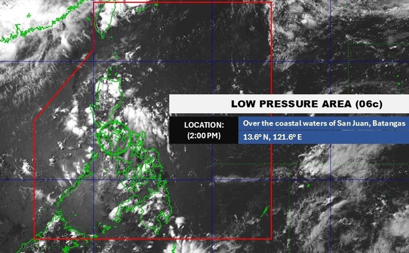
The Philippine Atmospheric, Geophysical and Astronomical Services Administration said that at 3:00 a.m. on June 18, the center of low pressure area 6d was at about 16.9 degrees north latitude, 118.8 degrees east longitude, about 170km west of Bacnotan town (La Union province), near the western edge of the East Sea.
PAGASA forecasts that the low pressure is unlikely to strengthen into a storm in the next 24 hours. However, due to the direct impact of the low pressure near the East Sea, many areas in the Philippines have recorded clear weather changes.
Provinces and cities such as Metro Manila, La Union, Pangasinan, Bataan, Zambales, Oriental Mindoro, Occidental Mindoro, Batangas and Cavite have moderate to heavy rain, with the potential risk of flash floods and landslides in mountainous areas.
Meanwhile, the weather forecast bulletin of the Vietnam National Center for Hydro-Meteorological Forecasting said that in the evening and night of June 19, the mountainous and midland areas of the North will have rain, moderate rain and scattered thunderstorms, locally heavy to very heavy rain with common rainfall of 20-40mm, some places over 100mm.
Other areas of the North will have scattered showers and thunderstorms, locally heavy rain, common rainfall of 10-30mm, some places over 70mm.
Warning of the possibility of tornadoes, lightning, hail and strong gusts of wind during thunderstorms. Risk of flash floods, landslides in mountainous areas and flooding in low-lying areas.
While the eastern Pacific has begun a vibrant hurricane season, the western Pacific - including the South China Sea - is starting the 2025 hurricane season slower than usual. So far, only Typhoon No. 1 Wutip in the East Sea has made landfall twice in southeastern China.
However, according to medium-term weather forecast models such as the Global Comprehensive Forecast System GEFS of the US National Oceanic and Atmospheric Administration (NOAA) and the ECMWF model of the European Center for Medium-term Weather Forecasting, the week from June 25 to July will witness a strong increase in the sea from the Philippines to 140 degrees east longitude, and the appearance of a low-level cyclone spreading towards the East Sea.
This leads to a 40-60% chance of storm formation, of which 20-40% is likely to occur in the East Sea.
Some climate models even show that the low-intensity convective zone will last for many weeks, extending into the week of July 2-8, the peak of the regional storm season.
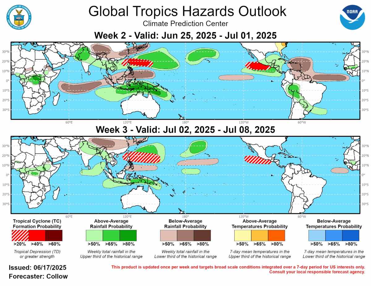
The absence of large-scale regulating factors such as El Nino or La Nina makes rain forecasting models largely dependent on operational data from dynamic models. In the current scenario, the sea area from India to Southeast Asia and the West Pacific will have higher-than-average rainfall, causing the risk of localized flooding and flash flooding.
In contrast, areas such as inland China, Japan and the western Indian Ocean will see less rain, while Indonesia and Papua New Guinea could face extreme weather due to multi-day rainfall.