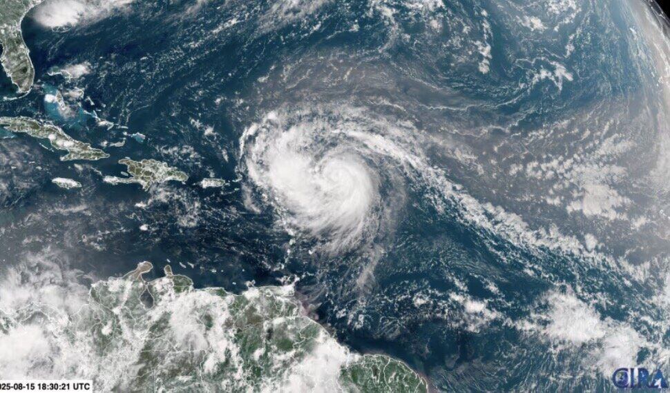
The latest hurricane information from the US National Hurricane Center (NHC) said that Hurricane Erin quickly strengthened into a Category 4 hurricane in the Caribbean on the morning of August 16, with sustained winds of about 209 km/h.
Hurricane Erin is about 240 km northeast of Anguilla. The storm is moving north of the Leeward Islands, Virgin Islands and Puerto Rico this weekend and is gradually turning north. Erin is unlikely to make landfall directly on any of the northeastern Caribbean islands.
Previously, Erin reached the intensity of a Category 3 hurricane early on the morning of August 16 and forecasters from the US National Hurricane Center predicted that Erin would strengthen into a Category 4 hurricane on the night of August 16.
The rapidly intensifying storm occurs when the wind around the center of the storm increases by at least 56 km/h within less than 24 hours. Last year, nine storms in the Atlantic basin rapidly intensified, including Hurricane Helene and Hurricane Milton.
Due to the impact of Hurricane Erin, a tropical storm warning is being applied to St. Martin, St. Petersburg. Barthelemy and Sint Maarten. According to the US National Hurricane Center in Miami, rainfall is expected to reach 100mm, with localized rainfall reaching 150mm.
Erin is forecast to move northward across the western Atlantic next week, away from the United States and Bermuda, but the storm's course could change if it turns stronger or weaker than currently forecast.
Hurricane expert Michael Lowry said Erin was expected to suddenly turn northeast, as it traveled between the United States and Bermuda.
"All major forecast models show Erin will change direction safely to the eastern United States next week. However, the situation will be more tense for Bermuda, as the island could be east of, a stronger area, Erin," he said.
Erin is expected to continue to strengthen throughout August 16 as Atlantic temperatures are above normal for fuel. In the middle of next week, the range of Erin will double or trip, causing rough seas in the western Atlantic.
The US government has deployed more than 200 personnel from the Federal Emergency Management Agency and other agencies to Puerto Rico to prevent the effects of Hurricane Erin as forecasters issued flood warnings across the US from late on August 15 to August 18.
In the Bahamas, authorities have prepared several public shelters in advance to prevent and urge residents to monitor the path and developments of the storm.
"Storms are very unstable and can change direction abruptly," said Aarone Sargent, managing director of the Bahamas' Disaster Risk Management Agency.
Erin is the fifth storm of the Atlantic hurricane season, which runs from June 1 to November 30. This is the first storm to reach typhoon level. Erin reached Category 1 hurricane status on the morning of August 15 and then strengthened to a Category 2 storm that night.
The 2025 typhoon season is expected to be unusually intense. Long-term storm forecasts show that there are expected to be 6 to 10 typhoons, of which 3 to 5 have winds of up to over 177 km/h.