A low pressure is increasingly strengthening as it approaches the Cabo Verde Islands on the night of August 10, according to the latest storm news on August 11.
The new low pressure will quickly strengthen into a tropical depression before interacting with the archipelago, forecasters say.
Current weather conditions are also very favorable for the depression to strengthen after moving out of the islands and operating in the Atlantic basin during the week.
A tropical depression or storm is expected to form in the middle of the week as the system continues to move west-northwest of the Atlantic at a speed of 24-32 km/h.
Weather experts in the US believe that this will be a long-term storm and is expected to last until the end of the week.
Forecast models show that the path of the system with the potential to strengthen into a typhoon is very stable, in a west-northwest direction in the northern part of the Leeward Islands.
According to the forecast track of some computer models, the storm is likely to turn north and then northeast this weekend. With this direction, by the end of the week, the storm will be completely off the U.S. coast.
There are also other scenarios that suggest the storm is likely to turn westward, but these options are less feasible.
The system is expected to rapidly strengthen into the first hurricane of the 2025 Atlantic hurricane season, and even strengthen into a major hurricane by the end of next week.
Hurricanes, which have winds of 119 km/h or higher and major hurricanes, from level 3, 4 or 5, with winds of 178 km/h or higher.
In the 2025 Atlantic hurricane season, four tropical storms Andrea, Barry, Chantal and Dexter have formed since the start of the season. The next storm name for this year's hurricane season is Erin.
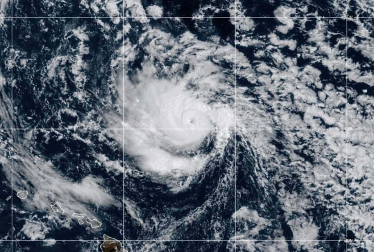
Meanwhile, the latest hurricane report from the US National Hurricane Center said Tropical Storm Henriette quickly strengthened into a hurricane on August 10 in the central Pacific.
Hurricane Henriette is about 720km north-northeast of Hilo, Hawaii, with maximum sustained winds of 130km/h. The storm is moving northwest at a speed of 28 km/h as it is expected to leave the Hawaiian Islands and northward over the next few days.
The storm is forecast to continue to strengthen on August 11 but poses no threat to land. The storm will then weaken from August 12.
In the Pacific, US hurricane experts are also monitoring tropical storm Ivo. The storm is about 755km west of Baja California, Mexico. They are expected to weaken into a tropical depression on August 11.