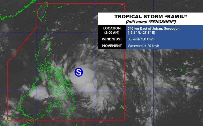
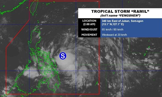
The latest storm information on the afternoon of October 18 from the Philippine Atmospheric, Geophysical and Astronomical Services Administration (PAGASA) said that Typhoon Fengshen (called Ramil in the Philippines) is weakening slightly in the North Samar sea, Philippines.
The center of the storm is in the coastal waters of Laoang, Northern Samar. The storm is moving west at a speed of 25 km/h, with maximum sustained winds of nearly 65 km/h near the center and gusts of up to 90 km/h.
Forecasters in the Philippines said that after slightly turning west-southwest, Typhoon Fengshen is forecast to move mainly west-northwest or northwest. The center of the storm could make landfall or pass near Northern Samar in the next few hours before passing through Catanduanes in the afternoon or evening of October 18.
Based on the observed movements of the latest typhoon in the Philippines, the likelihood of the typhoon making landfall in Albay or Sorsogon is increasing. The storm will then continue moving west-northwest, approaching or passing over the Bicol mainland and the Polillo Islands.
According to the forecast track, Typhoon Fengshen could make another landfall in the vicinity of Aurora in the morning or afternoon of October 19. The possibility of making landfall in northern Quezon or southern Isabela instead of Aurora is also not ruled out.
After making landfall in Aurora, Typhoon Fengshen will pass through the mountainous terrain of Northern Luzon and enter the coastal waters of Pangasinan or La Union on the evening of October 19. The storm will operate in the East Sea as storm No. 12 and leave the Philippine forecast area on October 20.
Philippine forecasters note that when entering the East Sea, the possibility of storm No. 12 Fengshen strengthening again is very high.
Philippine media reported that thousands of people living on an island in the Philippines along the Pacific coast evacuated on October 18 as weather experts warned of coastal flooding ahead of Typhoon Fengshen making landfall. Catanduanes, where the eye of the storm is forecast to make landfall with gusts of up to 80 km/h, is a poor island with 270,000 people.
The Philippine weather agency said that Fengshen will bring heavy rain, along with a "minimum to moderate risk of coastal flooding" with waves 1-2m high pushing to shore.
More than 9,000 Catanduanes residents have moved to safer places. The island is typically the first major landfall to be hit by storms forming in the western Pacific.
Catanduanes provincial authorities have issued an order for local authorities to "activate corresponding evacuation plans" for residents in "high-risk areas", including coastal areas, low-lying communities and landslide-prone slopes.
neighboring provinces of Sorsogon and Albay have also called for evacuations before the storm hit.
The Philippines experiences an average of 20 typhoons per year. Typhoons often hit disaster-prone areas, where millions of people live in poverty.
Forecasters warn that storms are getting stronger as the planet heats up due to climate change.
Typhoon Fenghen formed as the Philippines was hit by a series of major earthquakes that killed at least 87 people in the past three weeks.