Storm No. 12 is forecast to suddenly change direction due to the influence of cold air.
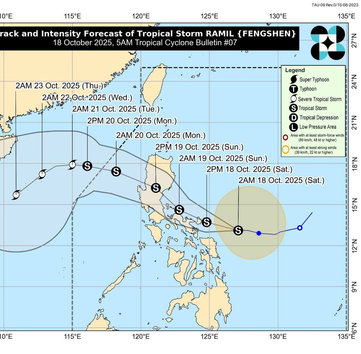
The latest storm information from the Philippine Atmospheric, Geophysical and Astronomical Services Administration (PAGASA) said that on the morning of October 18, Typhoon Ramil strengthened into a tropical storm with the strongest wind near the center of the storm at 65 km/h, gusting to 80 km/h.
At 4:00 a.m. on October 18, the center of the storm was located at 13.1 degrees north latitude; 126.9 degrees east longitude, about 305km east of Juban (Sorsogon province), moving west at a speed of 20 km/h.
Ramil is forecast to make landfall or approach Catanduanes this afternoon or evening (18.), then continue to make landfall Aurora or Isabela on October 19. As it passes Luzon's high mountainous terrain, the storm is expected to temporarily weaken but re-strengthen as it moves into the South China Sea, becoming the 12th storm.
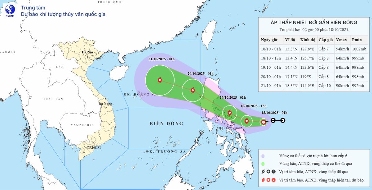
According to the typhoon forecast model of the Hong Kong Observatory HKO (China), typhoon No. 12 Fengshen (Ramil) may reach strong typhoon intensity when entering the East Sea, with winds expected to exceed 100 km/h on October 21.
However, at that time, a strong cold air mass from the northeast monsoon is expected to sweep across the area, which could cause the storm to suddenly change direction to 90 degrees southwest, rather than continue approaching the mainland as usual.
According to HKO, the interaction between storm No. 12 Fengshen and cold air can make the weather in the northern sea of the East Sea very complicated, with strong winds of level 7-8, gusts of level 9-10, waves 3-5m high and widespread heavy rain. Hong Kong (China) is expected to be affected by strong winds from October 19 with temperatures dropping to about 20 degrees Celsius in the middle of next week.
The Vietnam National Center for Hydro-Meteorological Forecasting said that on October 18, the cold air will continue to move south.
Around the morning of October 19, cold air will affect the Northeast region; from October 20-22, cold air will be strengthened and affect other places in the Northeast, North Central, some places in the Northwest and Central Central.
In the Northeast region, there will be scattered rain, showers and thunderstorms in some places.
The wind will shift to the Northeast at level 2-3, and the coastal areas at level 3-4.
From the evening and night of October 19, the weather in the North will turn cool; from the night of October 20, the night and morning will be cold, the mountainous areas will be cold.
The lowest temperature in this cold air mass: Northern Delta generally 19-21 degrees Celsius; Mountainous and midland areas 17-19 degrees Celsius; High mountainous areas below 16 degrees Celsius.
The Hanoi area will have scattered rain, showers and thunderstorms in some places. From the night of October 19, the weather will turn cool; from the night of October 20, the night and morning will be cold. The lowest temperature is commonly 19-21 degrees Celsius.
At sea, from October 19, the North East Sea will have strong northeast winds of level 6, gusting to level 7-8, rough seas; the eastern sea will have winds gradually increasing to level 6-7, near the storm center strong level 8, gusting to level 10, rough seas, waves 2.5-4.5m high.
From the evening and night of October 19, in the Gulf of Tonkin, the Northeast wind will gradually increase to level 6, gusting to level 7-8, rough seas, waves 1.5-3.0m high.
Due to the influence of cold air, from the evening and night of October 19, in the North and Central Central regions, there will be rain, moderate rain and thunderstorms, with some places in the South having heavy rain.