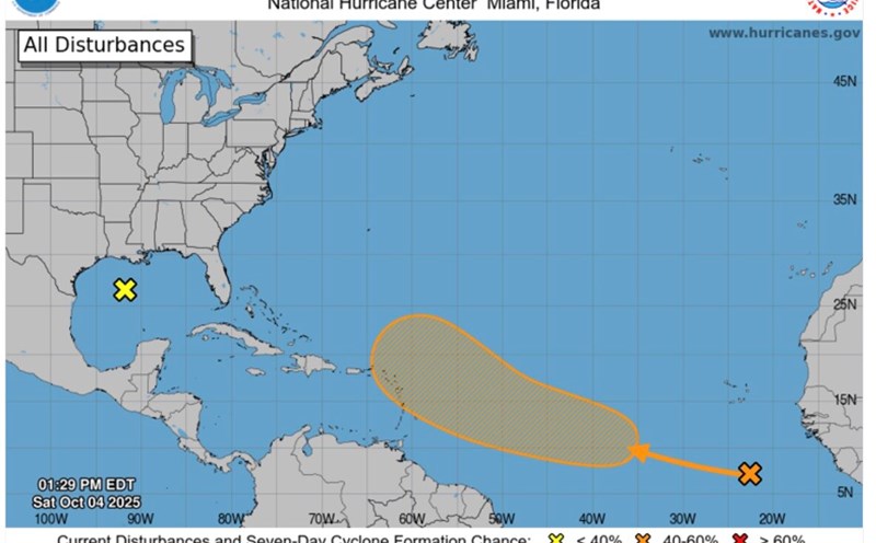
The latest storm news on October 7 from the US National Hurricane Center said that the Invest 95L (AL95) low pressure area has a 70% chance of forming in the next 48 hours and an 80% chance of appearing in the next 7 days.
The next storm name for the 2025 Atlantic hurricane season is Hurricane No. 10 Jerry.
The storm center said that environmental conditions are favorable for the depression to gradually strengthen and a tropical depression is likely to form in the middle of this week.
"The system is expected to be close to or north of the Leeward Islands on October 9 and 10," the hurricane bulletin said.
A second potential low pressure is causing an unregulated area of large-scale showers and thunderstorms in the northwestern Caribbean. The system is expected to move across the Yucatan Peninsula through October 7, then pass through Campeche Bay.
The center's weather forecasters predict the potential for the low pressure to form at just 10%. Regardless of whether it strengthens or not, the system is expected to bring heavy rain and strong gusts across the Yucatan Peninsula, Belize and southern Mexico this week.
The four named storms typically form in October and November in the Atlantic. Last year's end-of-season storm began in late September as Hurricane Helene brought catastrophic flooding and gusts of wind to the southeastern United States. The end of last year's hurricane season was marked by Milton's rapid strengthening to Category 5 before weakening as it made landfall on the Florida peninsula in early October.
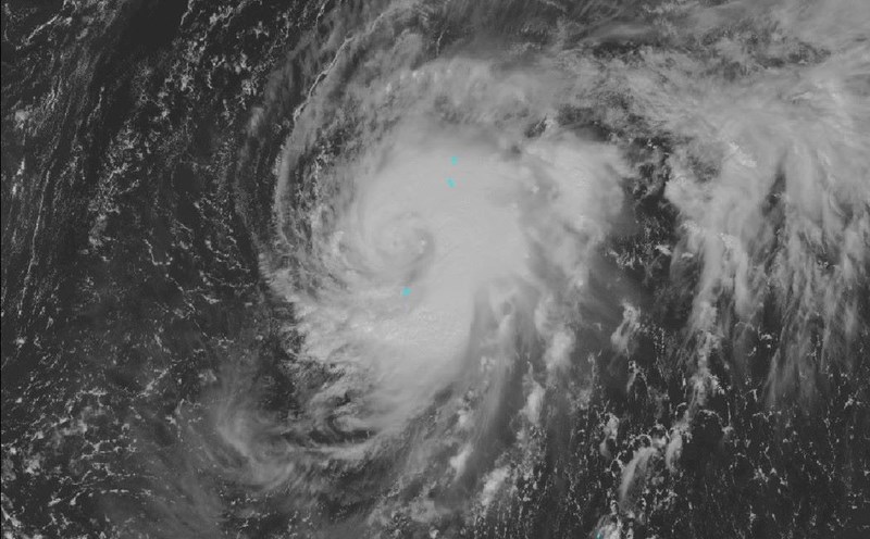
Forecasters note that a similar increase in activity in late September has occurred this year, with a series of three storms Gabrielle, Humberto and Imelda forming within 2 weeks. Hurricanes Gabrielle and Humberto also rapidly strengthened as Hurricane Erin. Gabrielle is expected to explode to Category 4, while Humberto will become the second Category 5 storm of this year's hurricane season.
Meanwhile, in the Pacific, Hurricane Priscilla is threatening southwestern Mexico, Tropical Storm Octave is weakening as it moves east.
Forecasters note that Priscilla continues to strengthen, with heavy rain and strong gusts of wind forecast in some areas in southwestern Mexico.
Priscilla is about 692km south-southeast of the southern tip of Baja California with maximum sustained winds of 137 km/h, with stronger gusts. The storm is expected to continue to strengthen and Priscilla could reach major typhoon status in the next few days before weakening by midweek.
Priscilla is expected to bring heavy rain to the coastal areas of Michoacan and the extreme west of Guerrero, with rainfall expected to reach 50 to 100mm. Across Colima, western Jalisco and the rest of Guerrero, rain is forecast to reach 25 to 76mm. The storm forecasting center noted that heavy rain will cause the risk of flash floods.