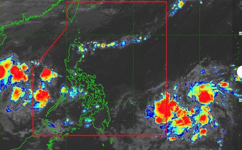
The latest storm information from the Philippine Atmospheric, Geophysical and Astronomical Services Administration (PAGASA) said that storm Kalmaegi has strengthened into a typhoon, with winds of 120 km/h and gusts of up to 150 km/h.
The storm near the Philippines is moving west-southwest at a speed of 25 km/h.
The center of storm Kalmaegi is about 340km east-southeast of Guiuan, Eastern Samar, Philippines.
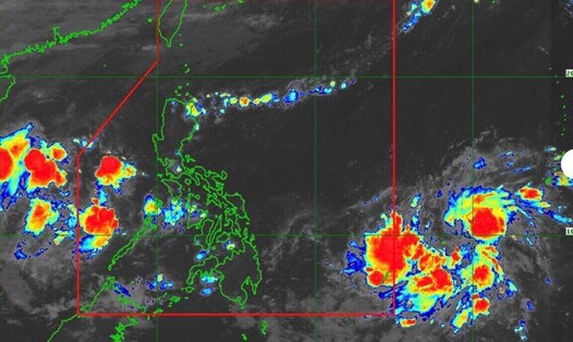
In the forecast for the morning of November 3, Typhoon Kalmaegi is forecast to " have the potential to make a first landfall at or near peak intensity".
"Based on forecast scenarios and climate data, the possibility of reaching super typhoon status cannot be ruled out," PAGASA stressed.
PAGASA typhoon forecaster Daniel James Villamil also said that the possibility of typhoon Kalmaegi rapidly strengthening is very high.
The sea area where the center of storm Kalmaegi passed through has high sea surface temperatures, making it more favorable for further strengthening.
Typhoon Kalmaegi is forecast to make its first landfall in Eastern Samar, South Leyte or Dinagat Islands early on November 4.
The storm is expected to pass through the Visayas and northern Palawan of the Philippines before entering the South China Sea, becoming the 13th storm in the morning or afternoon of November 5.
Philippine weather forecasters note that although interaction with the terrain will cause the storm to weaken slightly, Kalmaegi is expected to remain a typhoon throughout the sweep of the Philippine mainland.