The latest storm information from the Philippine Atmospheric, Geophysical and Astronomical Services Administration (PAGASA) said that the low pressure in the East Sea of 10j is 225km from Pagasa, Kalayaan, Palawan islands. The low pressure in the East Sea is forecast to have little chance of strengthening into a tropical depression in the next 24 hours.
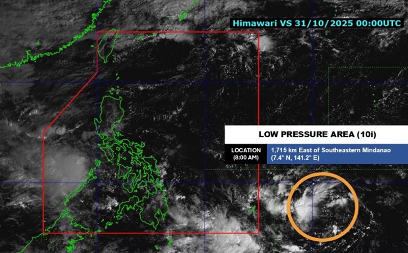
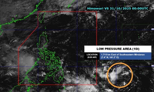
Meanwhile, the tropical depression near the 10i East Sea is 1,385km east of southeast Mindanao, Philippines. The tropical depression is forecast to strengthen into storm Tino, moving west-northwest at a speed of 15 km/h, with winds of 55 km/h and gusts of up to 70 km/h.
It is forecasted that from November 3, the Philippines is likely to record heavy rain and strong winds due to the influence of the tropical depression entering the Philippine Forecast Area (PAR). The system is forecast to strengthen into a typhoon when it hits the Philippines.
When it enters PAR on November 2, the system will be named Tino in the Philippines. According to their forecast, the storm could make first landfall in the Caraga or Eastern Visayas region between the evening of November 3 and the morning of November 4.
Hurricane Tino is also expected to cross the Lapu-Lapu city sea on November 4. The storm will then pass through most of the Visayas, moving north of the Sulu Sea and north of Palawan before entering the South China Sea on November 5.
Al Quiblat, PAGASA's weather service chief in the Visayas, said forecasters are monitoring the storm's two potential paths.
"We are considering two scenarios. The system could reach northern Cebu or could pass through the center of Cebu," he said. The exact path of the potential storm Tino could shift north or south in the coming days.
"By November 3, Cebu may have heavy rain in the afternoon or evening. The heavy rains could last until November 4," Quiblat added.
The Philippine weather forecasting agency said that based on current forecasts, the possibility of this system strengthening into a super typhoon is very low.
As the storm approaches the Philippine mainland, updated storm forecasts will increase to three hours per bulletin, Quiblat said.
He explained that the path of the potential storm Tino, not intensity, is being compared to super typhoon Yolanda (Haiyan - Haiyan) in 2013 and super typhoon Odette (Rai) in 2021.
"We have not seen any scenario to suggest a super typhoon status so far," he noted.
However, he called on people to continue to be cautious and update all changes in the path and intensity of the system.
All are possible. It is best to update and prepare for all scenarios. If we have prepared for Odette, we should also prepare for this storm. Because the storm is still quite far from the mainland, many changes can still occur. We should not rule out the possibility of the storm reaching super typhoon level," he warned.