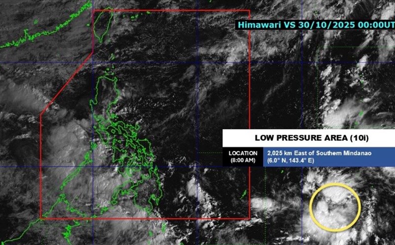
The latest storm and low pressure information from the Philippine Atmospheric, Geophysical and Astronomical Services Administration (PAGASA) on the morning of October 31 said that low pressure 10i outside the Philippine Forecast Area (PAR) is likely to strengthen into a tropical depression within the next 24 hours.
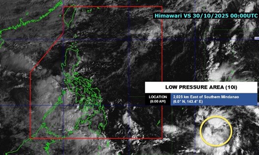
At 8:00 a.m. on October 31, Depression 10i was 1,715 km east of southeast Mindanao. Earlier, at 2:00 a.m. the same day, the depression was 1,710 km east of southeast Mindanao.
The new depression has formed outside the PAR since October 30 and is forecast to become the next tropical storm of this year's hurricane season. By 10:00 p.m. on October 30, PAGASA said that the possibility of low pressure area 10i strengthening into a tropical depression within the next 24 hours has been upgraded from low to medium.
This potential tropical depression may enter PAR on November 2 and continue to strengthen into a storm in the Philippine Sea.
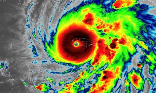
PAGASA expert Leanne Loreto said that low pressure 10i could eventually reach typhoon level. The Philippine weather agency also does not rule out the possibility of this system strengthening into a super typhoon before making landfall in the Philippines. The potential super typhoon is expected to make landfall in the Eastern Visayas region early next week.
However, the forecast is still uncertain as the depression is far from land and is still outside the PAR.
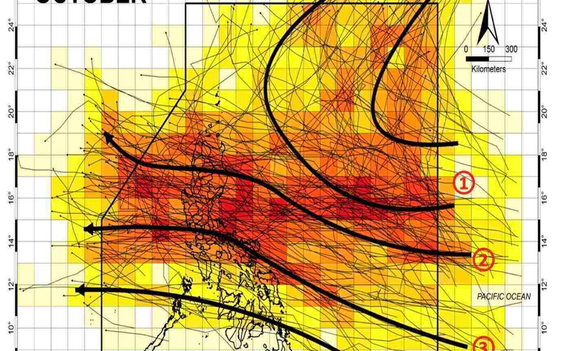
However, according to PAGASA's October 30 forecast, two or three storms are expected to form within the PAR or enter the PAR in November. The next three named storms in the Philippines are Tino, Uwan and Verbena.
PAGASA's October 30 forecast bulletin notes that the low pressure area forming at the southeastern boundary of PAGASA's TCAD and PAR forecast areas is likely to strengthen into a storm during the week of October 30 to November 5. This low pressure is forecast to approach Visayas and Southern Luzon. This low pressure is forecast to make landfall in Visayas - South Luzon, Philippines then move into the East Sea during the week of November 6 to November 12. According to the forecast, this potential storm entering the East Sea could affect Vietnam.
In addition to low pressure 10i, the weather in the Philippines is currently affected by the intertropical convergence zone (ITCZ) and wind shear. The heaviest rain is expected to hit Palawan. Moderate to heavy rain (50-100mm) is forecast for the next 24 hours, according to the bulletin at 11pm on October 30 from PAGASA.
Meanwhile, wind shear, or the point where cold air from the northeast monsoon converges with the easterly wind with warm air from the Pacific Ocean, is causing scattered rain and thunderstorms locally in Cagayan, Isabela and Aurora.
Areas affected by the intertropical convergence zone and wind shear are warned of the risk of flash floods and landslides. Meanwhile, the northeast monsoon will also bring light rains to Batanes.