The latest hurricane report from the US National Hurricane Center in Miami said that Kiko in the eastern Pacific Ocean strengthened into a hurricane on September 2 while the tropical depression in the eastern Pacific basin strengthened into Tropical Storm Lorena.
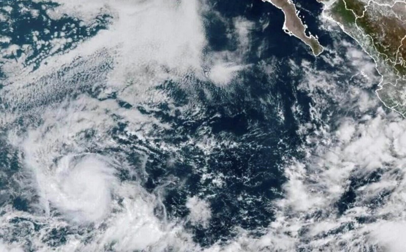
Lorena is forecast to strengthen into a hurricane on September 3 in the area off the west coast of Mexico. The center of Lorena is about 495km west of Manzanillo, Mexico. Forecasters say the latest storm in the Pacific is moving northwest at 24 km/h.
Strong winds and up to 300mm of rain are forecast across parts of Baja California Sur and southwestern Sonora state through the end of the week. The weather forecast agency warns that rainfall may fluctuate depending on the path of the storm, and flash floods are possible.
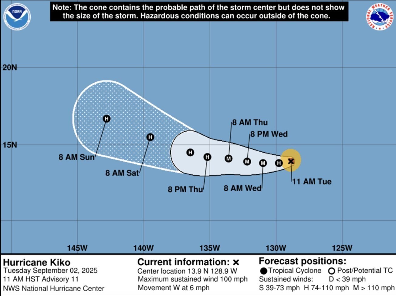
Meanwhile, Kiko has strengthened into a hurricane, with maximum sustained winds of 155 km/h as the storm is about 2,855 km east of Hilo, Hawaii.
Kiko is currently a Category 2 hurricane on the Saffir-Simpson hurricane scale, with an intensity of Category 1 to Category 5. Storms of Category 3 or higher are considered major storms.
There are no warnings or tracking of hurricane Kiko and the storm poses no danger to land. Kiko is expected to gradually strengthen over the next few days and could become a major hurricane on September 3.
Meanwhile, in the Atlantic, the latest hurricane report from the US National Hurricane Center said that a depression is likely to strengthen into a tropical depression this week and could become Tropical Storm Gabrielle, the seventh storm of the 2025 Atlantic hurricane season.
The potential depression of storm Gabrielle is currently located south of the Cabo Verde Islands, in the tropical waters of the eastern Atlantic. This system is causing showers and thunderstorms, with favorable environmental conditions for increased strength.
This low pressure has a 70% chance of becoming a tropical depression this week or the end of the week. The system is forecast to continue moving west-northwest at a speed of 24 km/h across the tropical waters of the eastern and central Atlantic through the end of the week.
FOX 35 forecaster Brooks Garner points out that there are two environmental factors that could cause the potential system of Gabrielle to move away from Florida, USA: High wind shear and a high pressure range could cause the system to turn north and out to sea.