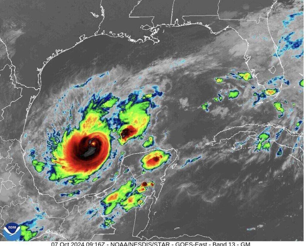
According to the latest storm information from the US National Hurricane Center, Hurricane Milton is exploding in strength and is a Category 4 storm with sustained winds of 240 km/h and stronger gusts than on the morning of October 7, local time. The wind speed in Hurricane Milton when reaching the intensity of a Category 4 storm has increased to 40 km/h compared to 1 hour ago.
Before that, just a few hours in the morning of October 7, hurricane level 1 Milton continuously increased to level 2, level 3 and level 4.
Milton was just a tropical storm with sustained winds of 60 mph on October 6. Just 24 hours later, Milton surged into a Category 3 hurricane, then a Category 4 — a 2.5-fold increase in strength in just one day.
CNN's latest hurricane report says Hurricane Milton is rapidly strengthening and will get stronger as it moves through the record-warm Gulf of Mexico and is likely to become a Category 5 hurricane.
Forecasters with the US National Hurricane Center predict the storm will make landfall on the Gulf Coast west of Florida as a major hurricane by midweek.
Hurricane forecasters say Milton is likely to make landfall on or near Tampa Bay on October 9. The storm will maintain hurricane strength as it moves through central Florida into the Atlantic.
Hurricane Milton's projected path will avoid other southeastern US states devastated by Hurricane Helene last week.
While Milton is expected to be a smaller storm than Helene, with a smaller wind field, the latest storm of the Atlantic hurricane season is headed toward a much more populated area and storm surge could have major impacts on many areas, according to CBS News senior meteorologist David Parkinson.
"Milton is moving slowly but is expected to rapidly intensify," the US National Hurricane Center warned. Latest forecasts show Milton could make landfall with winds of 120 mph (193 km/h).
Hurricane Milton rapidly intensified as it moved across the Gulf of Mexico with temperatures hovering around 29 degrees Celsius - a level experts described as "high octane fuel for any hurricane".
Forecaster Parkinson noted that the latest advisory from the US National Hurricane Center shows Milton peaking as a Category 4 storm, with winds above 230 km/h and a landfall intensity of Category 3.
However, people need to prepare for the possibility of a higher level storm, which means preparing for a maximum of a level 5 storm and a strong landfall of a level 4 storm."
The latest hurricane models show Milton heading toward the west coast of Florida. Parkinson said Milton’s path is a major concern. Instead of running parallel to the coast, Milton is coming in at a 90-degree angle.
“That means storm surges will come ashore,” Parkinson said, comparing it to what happened in New Jersey during Hurricane Sandy.