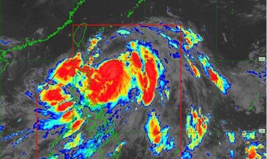
The latest news on Hurricane No. 9 Helene from the US National Hurricane Center (NHC) at 11:00 a.m. ET on September 24 (ie 10:00 p.m. the same day, Vietnam time) said that the latest storm was about 290 km east-southeast of Cozumel, Mexico, with maximum sustained winds of 72 km/h.
According to the US National Hurricane Center, Hurricane No. 9 Helene is moving northwest at a speed of about 19 km/h and is forecast to maintain this direction until the morning of September 25. Helene will then turn north-northeast at a faster pace on September 26 and 27.
"The center of Hurricane Helene is forecast to move across the northwestern Caribbean Sea overnight on September 24, then move across the eastern Gulf of Mexico on September 25 and 26 with the possibility of reaching Florida's Gulf Coast late on September 26," the NHC said in its latest hurricane forecast bulletin for Hurricane No. 9.
Forecasters at the US National Hurricane Center also said that the latest storm in the Atlantic will strengthen further, in which Helene is expected to strengthen into a hurricane on September 25. After that, Hurricane No. 9 Helene continues to maintain its momentum, potentially becoming a major hurricane on September 26.
According to the latest storm report from AP, two major weather systems, including Hurricane No. 9 Helene, are bringing heavy rain, strong winds and many other natural disasters to Mexico's southern Pacific coast and Mexico's Caribbean coast.
Tropical storm John hit Mexico late on September 23 with the potential to cause flooding after rapidly strengthening to a Category 3 storm in just a few hours.
The storm made landfall near the town of Punta Maldonado before weakening back to a tropical storm on the morning of September 24 and is expected to weaken rapidly. However, the US National Hurricane Center warned that the slow movement and heavy rain from Hurricane John could lead to flash floods and landslides.
According to the latest storm report from AP, forecasters warn that Helene could strengthen into a major hurricane as it approaches the southeastern United States.
In addition to the Atlantic storm No. 9 Helene, the center of the storm is also continuing to monitor a low pressure area near the Cabo Verde Islands.
The latest NHC storm and low pressure forecast states that a tropical depression is "likely to form within a few days" as the low pressure area moves westward in a west-northwest direction, passing through the eastern and central areas of the tropical Atlantic. This low pressure area has an 80% chance of strengthening over the next 7 days.