The US Joint Typhoon Warning Center (JTWC) issued a storm forecast bulletin on the morning of September 4 saying it was simultaneously monitoring two low pressure disturbances in the West Pacific, including a low pressure in the central East Sea, near the coast of Vietnam.
The low pressure area (Disturbance B) is currently located off the coast of Central Vietnam, causing scattered rain but showing no signs of strengthening. The JTWC assessed that the system will move slowly northward, then deviate northwestward over the next few days. The possibility of storm formation in the past 7 days is only at a low of 10%, but there is still a potential risk of local heavy rain for the coast of Vietnam.
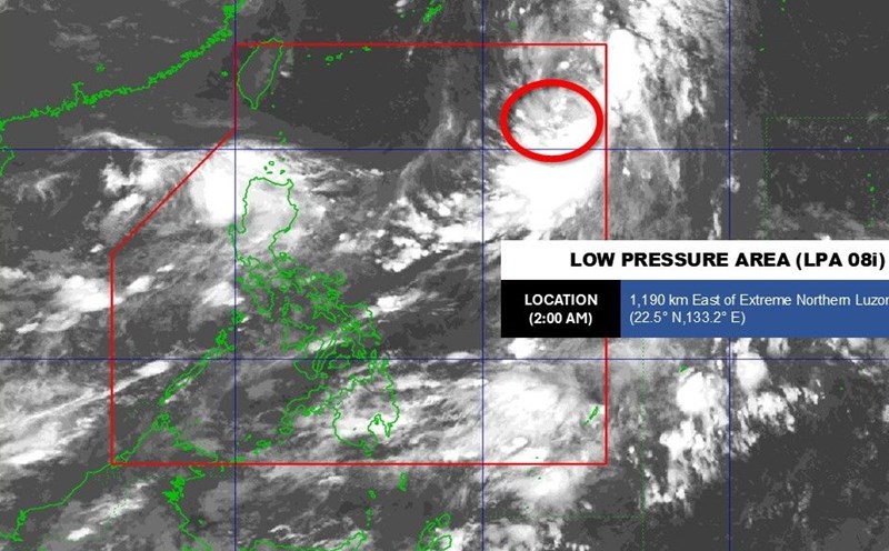
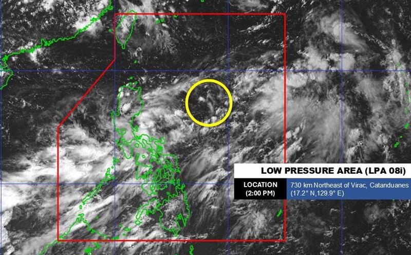
Meanwhile, another low pressure area (Disturbance A) in the Philippine Sea, southeast of Luzon Island, is assessed to have the potential to develop more strongly. It is forecasted that over the weekend, when moving northwest, the system will encounter more favorable conditions and could strengthen into a tropical depression, even a storm as it approaches Taiwan (China), the Batanes - Babuyan Islands and northeastern Luzon (Philippines). The JTWC warned that the probability of storm formation in the next 7 days is at a high level of 70%.
The storm forecast also notes that tropical depression 21W is active south of Kyushu Island (Japan), showing that the Northwest Pacific Ocean is entering the peak of the storm season.
According to the weather forecast bulletin at 4:00 a.m. on September 4 of the Vietnam National Center for Hydro-Meteorological Forecasting, the tropical convergence zone with an axis at about 14-17 degrees north latitude connecting with the low pressure area in the central East Sea was located at about 15.5-16.5 degrees north latitude at about 15.5-16.5 degrees east longitude at 1:00 a.m. on September 4.
The sea area from Da Nang to Ca Mau, Ca Mau to An Giang, the Gulf of Thailand, the eastern sea area of the North East Sea and the central East Sea area will have scattered showers and thunderstorms.
Forecast for the day and night of September 4, the sea area from Da Nang to Ca Mau, Ca Mau to An Giang, the Gulf of Thailand, the eastern sea area of the northern East Sea, the central and southern East Sea (including Truong Sa special area) will have scattered showers and thunderstorms.
Warning: During thunderstorms, there is a possibility of tornadoes, strong gusts of wind of level 6-7, waves over 2m high.
Regarding today's Hanoi weather forecast: Lowest temperature 26-28 degrees Celsius. Highest temperature 34-36 degrees Celsius. Cloudy, hot sunny during the day; showers and thunderstorms in some places in the evening and at night. Light wind.
Ho Chi Minh City: Lowest temperature 25-27 degrees Celsius. Highest temperature 31-33 degrees Celsius, some places above 33 degrees Celsius. Cloudy, scattered showers and thunderstorms in some places, scattered showers and thunderstorms in the afternoon and evening, locally heavy to very heavy rain. Southwest wind level 2-3. During thunderstorms, there is a possibility of tornadoes, lightning, hail and strong gusts of wind.