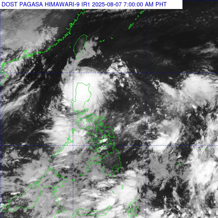
The latest storm/low pressure information from the Philippine Atmospheric, Geophysical and Astronomical Services Administration (PAGASA) said that low pressure 08a inside the Philippine Forecast Area (PAR) is affecting almost all of Luzon on August 7.
At 3:00 a.m. on August 7, the center of this low pressure near the East Sea was at about 16.2 degrees north latitude, 125.8 degrees east longitude, 380 km east of Casiguran, Aurora, Philippines.
Scattered to thunderstorms are expected over a wide area in the Cagayan Valley, Cordillera Administrative Area and Aurora on August 7.
The low pressure will also bring scattered showers and thunderstorms to Metro Manila, Ilocos region, the rest of Central Luzon, Calabarzon, Bicol, Western Mindoro, Oriental Mindoro, Marinduque, Romblon and Northern Samar. There is a possibility of flash floods and landslides.
PAGASA said the low pressure is still likely to develop into a tropical depression within the next 24 hours.
However, according to PAGASA weather forecaster Chenel Dominguez, the tropical depression is expected to cross the Luzon mainland between the evening of August 7 and the morning of August 8.
Expert Dominguez added that after crossing the mainland, the low pressure may become a tropical depression in the West Philippine Sea (South China Sea).
PAGASA had previously forecast that two or three tropical storms could form in or enter the PAR in August. The next three storms will be locally named Fabian, Gorio and Huaning.
In addition to the low pressure 08a off Luzon, another low pressure (08b) is also being monitored, outside the PAR.
At 3:00 a.m. on August 7, the center of low pressure 08b was at about 18.2 degrees north latitude, 148.3 degrees east longitude, 2,815 km east of Northern Luzon. Although this low pressure is still far away and does not affect the Philippine mainland, it is not ruled out the possibility of entering the PAR.
In addition, low pressure 08b is currently likely to "average" to develop into a tropical depression in the next 24 hours, upgraded from "low".
The southwest monsoon is affecting Palawan, Visayas and Mindanao on August 7. These areas also need to be on guard against possible flash floods and landslides.
Meanwhile, the weather forecast bulletin of the Vietnam National Center for Hydro-Meteorological Forecasting said that on August 7, in the North, there will be scattered showers and thunderstorms, with some places having heavy rain; in mountainous and midland areas, there will be moderate rain, heavy rain and thunderstorms, some places having very heavy rain.
The area from Thanh Hoa to Da Nang and the South Central Coast, in the evening and at night, there will be showers and thunderstorms in some places; hot sunny days, some places will be very hot.
Central and Southern highlands, showers and thunderstorms in some places in the evening and at night, especially in the South, there are scattered showers and thunderstorms, locally heavy rain; sunny during the day.
During thunderstorms, there is a possibility of tornadoes, lightning, hail and strong gusts of wind.