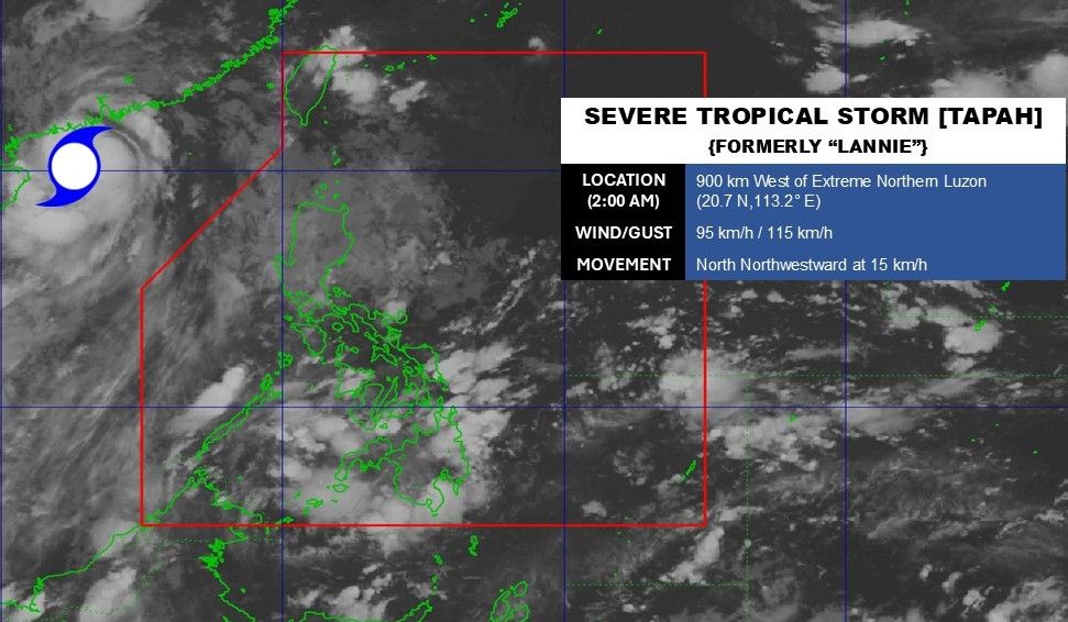
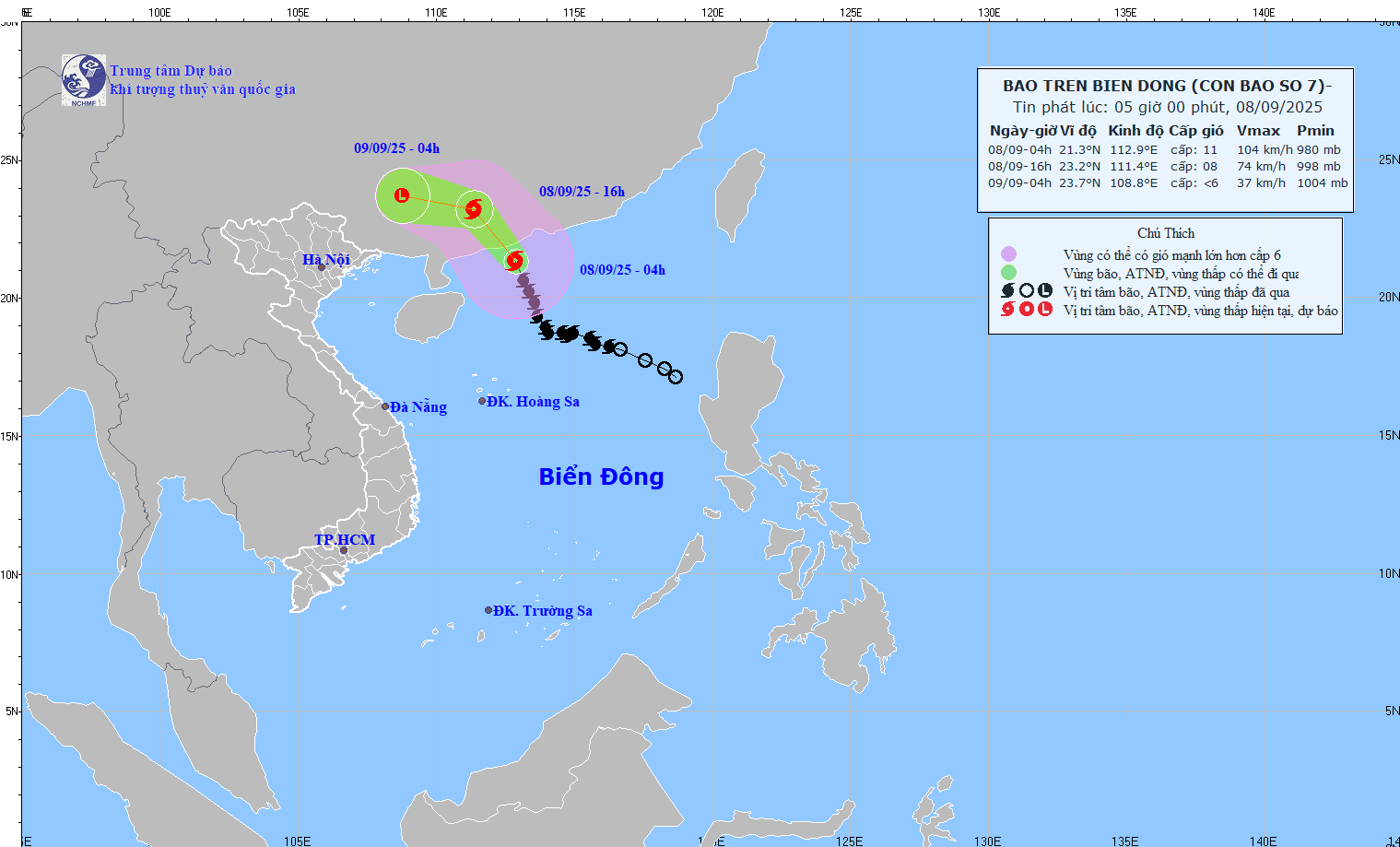
The latest storm information from the Philippine Atmospheric, Geophysical and Astronomical Services Administration (PAGASA) said that at 4:00 a.m. on September 8, the center of storm No. 7 Tapah was at 21.3 degrees North latitude, 112.9 degrees East longitude, 900km west of the northernmost tip of Luzon, in the northwest sea of the North East Sea. The strongest wind near the center of the storm is 95 km/h, gusting to 115 km/h, moving in the North-Northwest direction, traveling 20-25 km/h.
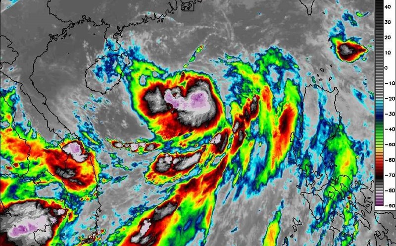
radar data from the Hong Kong - China Meteorological Station (HKO) and the China Meteorological Administration (CMA) shows that Tapah continues to organize better as it approaches mainland China. Convective cloud bands are forming around the center of the circulation, while part of the eye has appeared and surrounded about half of the center. At the same time, a strong convective mass has developed in the northeast of the system and begun to wrap around the center, forming a dense central cloud area.
As the storm's core is rapidly developing, Tapah's chance of intensifying before making landfall in southern China on the morning of September 8 is becoming increasingly clear, with a gusts of level 13.
In China's Guangdong province, schools have closed, trains and ferries have temporarily stopped operating and people have to evacuate as Typhoon Tapah approaches.
Typhoon Tapah is expected to make landfall along the coast between the two cities of Giang Mon and Mau Danh, causing heavy rain across the southern and western Chau Giang River Delta of Quang Dong until the end of September 9.
In Duong Giang city alone, the authorities said that as of 9:00 a.m. on September 7, a total of 1,785 workers had been evacuated from 26 offshore wind power drilling rigs, along with 2,026 people from fish farms and 342 people from marine farms. 12 coastal tourist attractions have also been closed.
China's National Observatory has extended the gold warning - the third highest in the four-level weather warning system - for Typhoon Tapah. Meanwhile, China's Ministry of Water Resources has also activated emergency flood response response to level IV in Guangdong and neighboring Guangxi Zhuang Autonomous Region.
It is forecasted that by 4:00 p.m. on September 8, storm No. 7 Tapah will be on the mainland of Quang Dong province, strong at level 8, gusting to level 10. By 4:00 a.m. on September 9, the storm weakened to below level 6 in the mainland of Guangxi province, China.
The low pressure area weakened by the storm will flow west and affect Vietnam. Although not directly affected by the storm's circulation, areas on the far edge of the storm's circulation such as the Gulf of Tonkin and the eastern coastal areas of the North may experience thunderstorms, whirlwinds and strong gusts of wind.
It is forecasted that from September 9 to the night of September 10, the mountainous and midland areas of the North are likely to experience widespread heavy rain with common rainfall of 70-150mm, locally over 300mm, high risk of flash floods and landslides in Lang Son, Cao Bang, Tuyen Quang, Lao Cai, Dien Bien and Lai Chau. The Northern Delta is expected to have a lot of rain, but the rainfall is not as heavy as in the mountainous areas.