The latest storm news at 5:00 a.m. on November 11 from the Philippine Atmospheric, Geophysical and Astronomical Services Administration (PAGASA) said that storm Toraji had strengthened into a typhoon before dawn. The center of the storm is located at about 16.0 degrees north latitude, 123.0 degrees east longitude, 100 km east-southeast of Casiguran, Aurora in the sea east of Luzon Island.
Maximum winds near the center of the storm are 120 km/h, up from 110 km/h previously, gusting up to 150 km/h compared to 135 km/h previously.
The storm is moving west-northwest at a speed of 20 km/h, slightly slower than the previous 25 km/h speed.
Typhoon Toraji is expected to make landfall in Isabela or Aurora on the morning of November 11, then cross the Luzon mainland before emerging in the sea west of Ilocos Sur on the evening of November 11.
PAGASA said Typhoon Toraji "may intensify in the coming hours before making landfall," but it could weaken back to a severe tropical storm as it passes over the Luzon mainland.
PAGASA's latest rain warning issued at 5am on November 11 shows that 20 provinces in Luzon are suffering heavy rain from the storm, which could cause flooding and landslides.
Toraji (Nika) is the 14th tropical storm to hit the Philippines in 2024 and the second in November, following Typhoon Marce ( Typhoon No. 7 Yinxing) that hit Northern Luzon. Yinxing has since weakened into a severe tropical storm outside the Philippine Forecast Area (PAR).
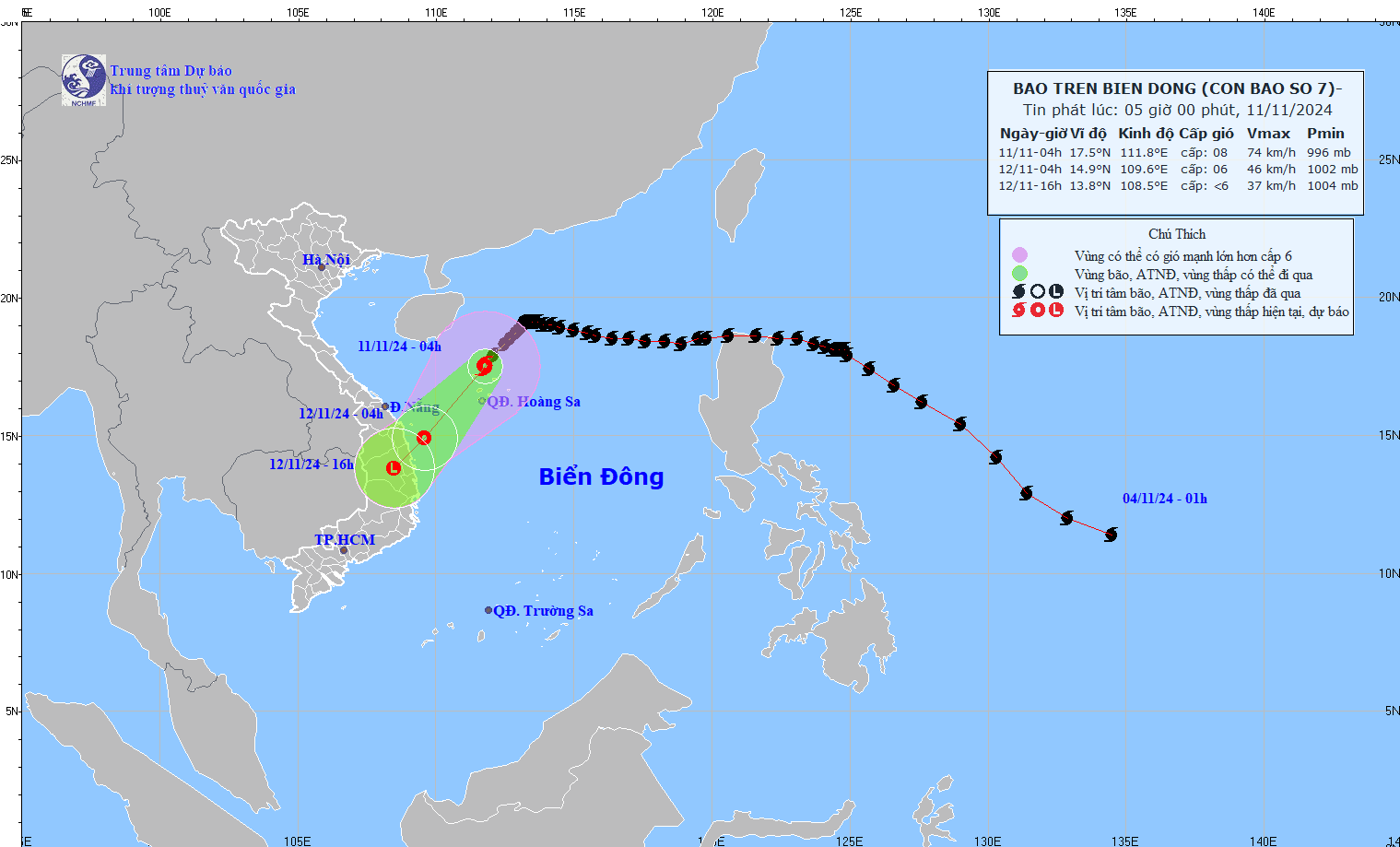
At 4:00 a.m. on November 11, the center of Typhoon Yinxing was at about 17.5 degrees north latitude; 111.8 degrees east longitude, in the sea north of the Hoang Sa archipelago of Vietnam. The strongest wind near the storm center is level 8 (62-74 km/h), gusting to level 10. The storm is moving southwest at a speed of about 15 km/h.

It is forecasted that by 4:00 a.m. on November 12, storm No. 7 Yinxing will weaken into a tropical depression in the waters of Quang Ngai - Binh Dinh.
Meanwhile, the low pressure area that formed outside the PAR on November 8 developed into a tropical depression early this morning, November 11.
The tropical depression was 1,685 km east of Eastern Visayas at 3:00 a.m. on November 11, moving west-northwest at a relatively fast speed of 35 km/h.
Maximum sustained winds near the center of the tropical depression were 45 km/h and gusts of up to 55 km/h.
PAGASA weather forecaster Aldczar Aurelio said the tropical depression could enter PAR this week, strengthen into a storm and be locally named Ofel.
In addition to the tropical depression, another tropical cyclone outside the PAR is also being monitored - a tropical storm with the international name Man-yi.
Tropical Storm Man-yi was 3,555 km east of Central Luzon at 3:00 a.m. on November 11, moving slowly eastward or away from PAR. The storm has maximum sustained winds of 85 km/h, gusting up to 105 km/h.
Thus, there are currently 3 storms and 1 tropical depression active in the northwest Pacific: Storm No. 7 Yinxing; Storm Toraji and Storm Man-yi, along with a tropical depression between Storm Toraji and Storm Man-yi.
These three storms and one tropical depression are all located on the tropical convergence zone - the axis passing through the northern part of the East Sea. This is the reason why the East Sea continuously welcomes storms or tropical depressions.


