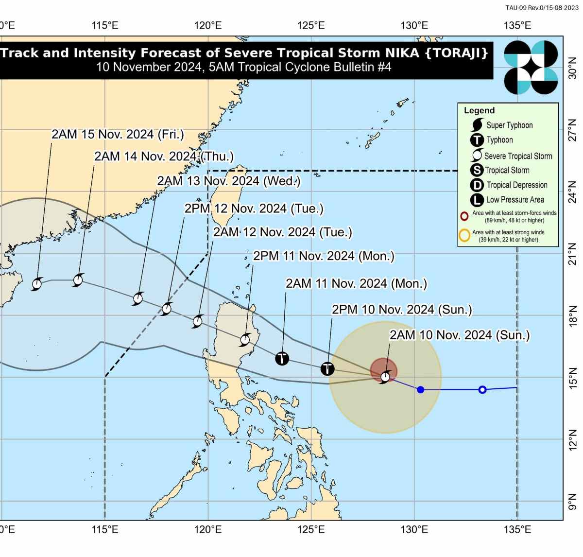
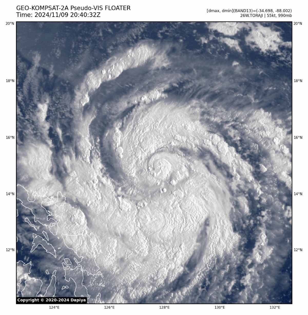
The latest storm news from the Philippine Atmospheric, Geophysical and Astronomical Services Administration (PAGASA) said that at 4:00 a.m. on November 10, the center of storm Nika, as it is called in the Philippines (international name is Toraji), was at about 15.0 degrees north latitude, 128.1 degrees east longitude, 690 km east of Infanta, Quezon.
The strongest wind near the storm center is 100 km/h, gusting up to 125 km/h, barometric pressure 985 hPa, storm cloud radius 300 km.
The storm is moving west-northwest at 30 km/h.
Luzon is on alert as Nika approaches. With its current track, Nika is expected to make landfall in Isabela or Aurora provinces on the afternoon of November 11.
The storm is expected to reach peak intensity before making landfall and could even strengthen into a hurricane.
Although it may weaken upon interacting with mainland Luzon, Nika is forecast to remain a severe tropical storm when it enters the South China Sea as a No. 8 storm.

PAGASA has issued Tropical Storm Wind Signal (TCWS) No. 2, warning of strong winds in parts of Isabela and Aurora. Meanwhile, TCWS No. 1 is in effect over areas including Cagayan, Nueva Ecija, Quirino, Mountain Province, Ifugao, and parts of Quezon and Bicol.
PAGASA forecasts heavy to heavy rains in some parts of Cagayan and Isabela on November 11 and 12. Minor to moderate impacts from strong winds are expected across the affected areas.
As severe tropical storm Nika approaches, authorities are urging residents to follow local advisories and prepare for possible evacuation.

Rough to very rough seas with waves up to 4.5 m high on the east coast of Isabela and north of Aurora; north coast of Camarines Norte.
Typhoon Nika is expected to move mainly west-northwest throughout the forecast period. According to the storm forecast, Nika could make landfall in Isabela or Aurora tomorrow afternoon (November 11).
Regardless of the landfall location, PAGASA stressed that there may still be hazards in areas outside the landfall point or within the forecast range.
The tropical storm is rapidly intensifying and could reach hurricane strength by today (November 10). It could reach peak intensity before making landfall.
Meanwhile, at 4:00 a.m. on November 10, the center of storm No. 7 Yinxing (Philippines calls it Marce) was at about 19.1 degrees north latitude; 113.2 degrees east longitude, in the northwest sea of the northern East Sea, about 335 km north-northeast of Vietnam's Hoang Sa archipelago.
The strongest wind near the storm center is level 14 (150-166 km/h), gusting to level 17. The storm moves west at a speed of about 5 km/h.
Typhoon Yinxing made landfall in the northern Philippines on November 7 with winds of 175 km/h. The storm flooded villages, toppled trees and power poles, and damaged homes and buildings in Cagayan province. More than 40,000 villagers were evacuated to safer areas in the province.
Yinxing is the third storm in less than a month to hit the Philippines after severe tropical storm Trami and super typhoon Kong-rey, which killed at least 158 people.
Also on November 10, PAGASA is monitoring a low pressure area (11c) east of northeastern Mindanao. The low pressure area has a high chance of developing into a tropical depression within the next 24 hours.


