
According to the latest weather forecast from the Philippine Atmospheric, Geophysical and Astronomical Services Administration (PAGASA), the risk of tropical cyclones continues to be maintained in September, with many cyclone systems likely to form in the coming days.
From September 1-7, Typhoon Pilandok continued to operate in the northeast of the Philippine Area of Responsibility (PAR) and is forecast to move south of Japan.
Meanwhile, Typhoon Saudel is forecast to be able to return to the northwest PAR area.
PAGASA is also monitoring a cyclone characterized as a tropical cyclone (TCLV), coded TCLV1, in the eastern area of the Tropical Cyclone Information Zone (TCID). This system is forecast to change direction towards Japan, with the possibility of forming a low to moderate tropical cyclone in the first week.
From September 8-14, 3 more cyclones are likely to form. All 3 systems are assessed to have the potential to develop into tropical cyclones at a low to medium level.
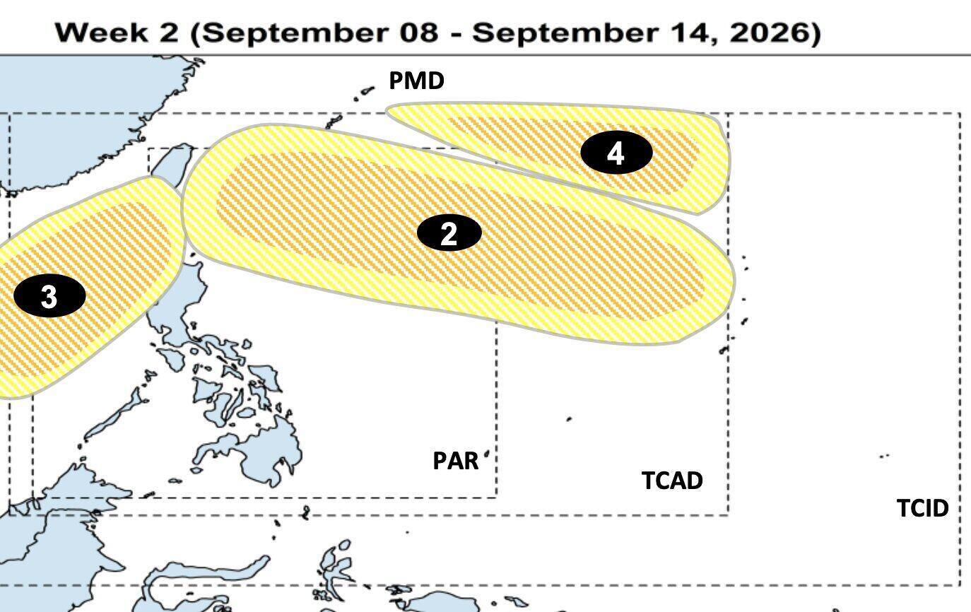
TCLV2 is expected to appear in the east of the Tropical Cyclone Warning Area (TCAD) and is likely to enter the northeast PAR area.
TCLV3 is forecast to form on the western edge of PMD, then may enter PAR.
Meanwhile, TCLV4 is forecast to appear in the northeast of PMD and is likely to change direction to the south of Japan.
The agency said it will continue to monitor changes in the weather forecast model and update when necessary.
Regarding climate trends in September, PAGASA said that tropical cyclones usually form in the east of PAR, then move northwest.
Some non-landing systems may change direction towards Japan or South Korea. Meanwhile, landing systems may pass through the northern Luzon area or the central and southern Luzon areas before heading south to China or Vietnam.


