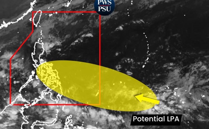
The Philippine Atmospheric, Geophysical and Astronomical Services Administration (PAGASA) warned that a thunderstorm area that is active outside the Philippine Forecast Area (PAR) is at high risk of developing into a low pressure area this weekend.
International and regional storm forecast models all show the possibility of the formation of another tropical cyclone is increasing rapidly.
If it strengthens into a storm when it enters PAR, the system will be named Hurricane Verbena - the 22nd storm in the Philippines this year.
According to PAGASA, when it forms, the low pressure is likely to move towards Eastern Visayas early next week, before crossing the Visayas - Southern Luzon regions around November 25-26.
After sweeping across the Philippines, the system is expected to enter the South China Sea around November 26-27, becoming the 15th storm.
Storm No. 15 may strengthen depending on sea and monsoon conditions, moving westward to the South Central Coast of Vietnam.
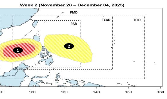
The meteorological agency stressed that the path and intensity of the system could still change as storm forecast models continue to update in the coming days. The expanded forecast from ECMWF shows a 40% chance of typhoon formation in the Philippines and the South China Sea during the week of November 26 to December 2.
PAGASA also released a weather forecast bulletin from November 22-28, showing that many types of weather are causing widespread rain at the same time. Accordingly, the wind break will continue to cause scattered showers and thunderstorms in Cagayan, Isabela, Apayao, Kalinga.
The tropical convergence zone caused rain in many places in Caraga, Davao, Northern Mindanao, Soccsksargen, Palawan.
The northeast monsoon will bring scattered light rains to Ilocos and Batanes.
Other areas will maintain cloudy weather, localized thunderstorms due to winter winds.
In particular, from November 24-26, it will be an important period when the low pressure may move through the Philippines, causing widespread rain in Visayas, Bicol, Mimaropa, Calabarzon, Metro Manila, Caraga, Northern Mindanao...
PAGASA noted that the possibility of changing the path and intensity of the low pressure/storm is very high, especially during the formation period. People in high-risk areas - especially Eastern Visayas, Bicol and the central Philippines - need to closely monitor the next storm forecasts.