The latest storm and low pressure information on November 21 from the Philippine Atmospheric, Geophysical and Astronomical Services Administration (PAGASA) said that the new low pressure is likely to strengthen into a storm near the East Sea and enter the East Sea during the week from November 21 to November 27.
The low pressure area has the potential to strengthen into a storm, expected to appear at the northeastern boundary of the Philippine Forecast Area (PAR), making landfall in Northern Mindanao, Visayas and Southern Luzon, Philippines and starting to enter the East Sea.
Notably, compared to the previous forecast on November 19, PAGASA's typhoon forecasters have adjusted their forecast for the possibility of the system strengthening into a low to moderate to high typhoon, showing a high chance of a new typhoon.
The next storm name for this year's typhoon season in the Philippines is Typhoon Veberna. Meanwhile, the most recent storm to enter the East Sea is Typhoon No. 14 Fung-wong.
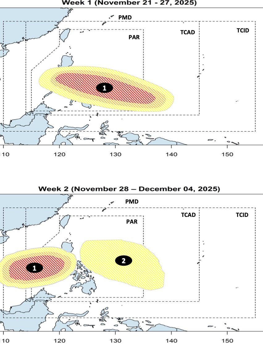
When entering the East Sea during the week from November 28 to December 4, the potential system to become storm No. 15 in the East Sea will continue to move westward to near Vietnam. Philippine typhoon forecasters say the system is likely to maintain typhoon intensity over the South China Sea.
In addition to the potential system to become storm No. 15 in the East Sea, also during the forecast period, a new low pressure is likely to appear near the East Sea. This low pressure forms at the eastern boundary of the PMD forecast area, with little chance of strengthening into a storm.
According to Philippine weather forecasters, in the context of two consecutive systems of storms and depressions forming, the Philippines is expected to record more than normal rain across the country during the period from November 21 to December 4.


