According to the latest storm news, Typhoon Podul is forecast to make landfall near Taitung City, southeast of Taiwan (China) at around 2:00 p.m. on August 13, bringing heavy rain, strong winds and coastal flooding across Taiwan (China), southern Japan and the northern Philippines in the next 48 hours.
After making a first landfall, the storm is likely to make a second landfall in the southern-central coastal region of China and may move further inland.
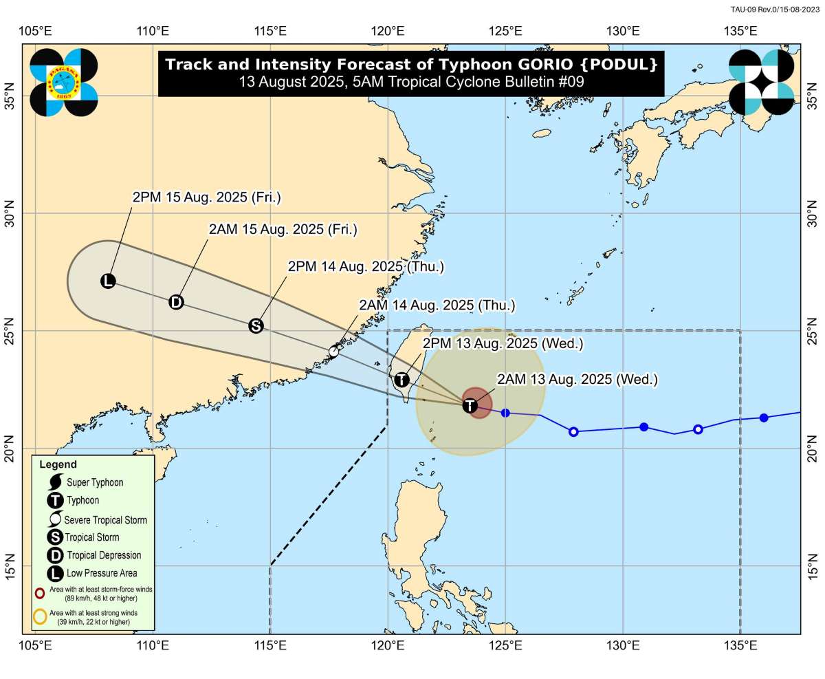
The storm forecast bulletin of the Philippine Atmospheric, Geophysical and Astronomical Services Administration (PAGASA) said that at 4:00 a.m. on August 13, the center of typhoon Podul (local name is Gorio) was about 165km northeast of Itbayat Island, Batanes Province (Philippines), at 21.9 degrees North latitude; 122.9 degrees East longitude.
The strongest wind near the center of the storm reached 140 km/h, gusting up to 170 km/h, central pressure 965 hPa. The storm is moving west-northwest at a speed of 25 km/h.
The range of strong winds of level 6 and above extends up to 400km from the center of the storm. Satellite images show that the storm has a tight structure, with clear eye in the low layer. The warm sea conditions of 29-31 degrees Celsius, low-level wind shear and favorable air flow above are supporting the process of rapid strengthening.
Typhoon Podul is forecast to reach a peak intensity of 185 km/h just before making landfall in Taiwan (China), with some models predicting that the storm will maintain winds of 175-185 km/h. The China Meteorological Administration (CWA) has issued a land warning for Hualien, Taitung,̂i Dong districts and Kaohsiung city.
The southern mountainous region of Taiwan (China) is forecast to have up to 600 mm of rain. The mountainous areas of the East and Central regions may exceed the extremely heavy rain level of 200mm in 24 hours or 100mm in just 3 hours. Authorities have warned of a high risk of landslides, flash floods and flash floods.
More than 700 residents in Hoa Lien district have been evacuated from areas at risk of natural dam failure. 4m high waves will appear on most of the coast, especially in the East, which can reach 6-8m, accompanied by high tides causing flooding in the suburbs.
The impact of the storm is expected to spread to Japan and the Philippines. From the evening of August 13 to the early morning of August 14, Okinawa (Japan) and the northernmost islands of the Philippines will have heavy rain, strong gusts of wind and rough seas.
After sweeping across Taiwan (China), Typhoon Podul will weaken rapidly due to the impact of mountainous terrain, but when entering the Taiwan Strait, it will still maintain strong tropical storm intensity. It is forecast that on August 14, the storm will make landfall in the southern coastal area of China, then weaken and gradually dissipate as it moves deeper inland. Heavy rain and strong winds may affect the inland area along the storm's path.
The weather forecast bulletin of the Vietnam National Center for Hydro-Meteorological Forecasting said that on the day and night of August 13, the northeastern sea area of the North East Sea will have strong winds of level 7-9, gusts of level 11-12; very rough seas; waves 3-5m high.
On August 14, the northeastern sea area of the North East Sea will have strong winds of level 7-8, gusts of level 9 Legal waves 2-4m high; rough seas. Natural disaster risk level due to strong winds at sea: level 3.


