The Philippine Atmospheric, Geophysical and Astronomical Services Administration (PAGASA) said that the La Nina phenomenon is intensifying over the Pacific Ocean, which could cause rainfall to exceed the average from October 2025 to February 2026. The scenario of heavy rain, storms following storms and the risk of flash floods and landslides is being put in a high- national alert situation.
Given the development of La Nina, the likelihood of above-average rainfall in the next 5 months is very high, especially in the eastern regions of the country, PAGASA stressed in its official announcement.
According to PAGASA, the La Nina phenomenon originated from the sea surface temperature in the equatorial Pacific Ocean dropping below average from August 2025 and reaching La Nina (down 0.5 degrees Celsius) in September.
Current climate models suggest that this trend will continue until at least the winter of 2025-2026, the weather forecasting agency said.
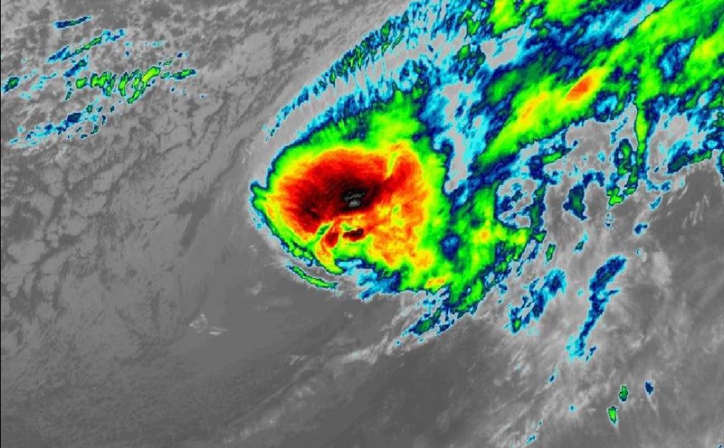
La Nina often increases the frequency of heavy rains and tropical storms, as cold air from the Pacific Ocean facilitates the formation of tropical cyclones.
PAGASA forecasts that exceeding the standard rainfall may be the result of stronger storms, combined with other rainfall systems such as the tropical convergence zone, low pressure, northeast monsoon, etc.
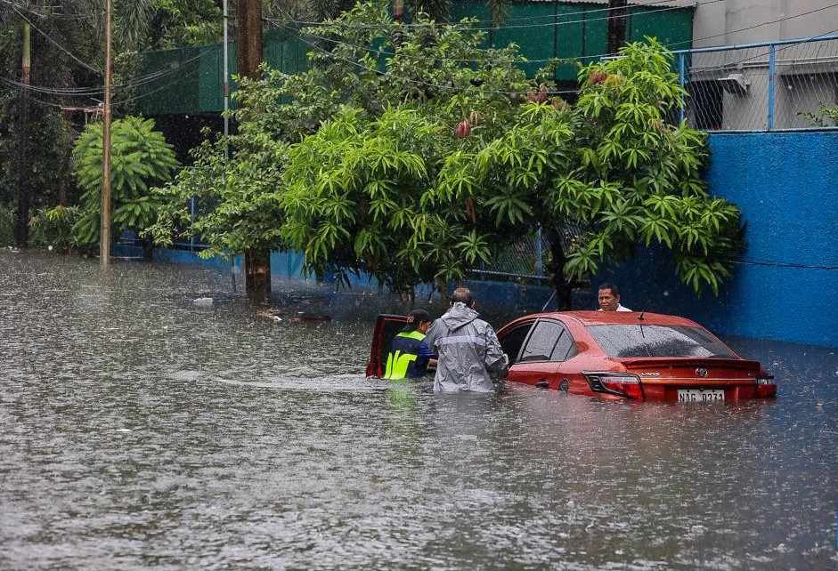
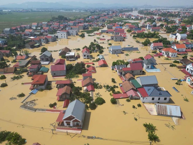
The combination of these factors can cause flooding, flash floods and landslides in many vulnerable areas, especially in the Central and South of Luzon, Visayas and Mindanao, PAGASA warned.
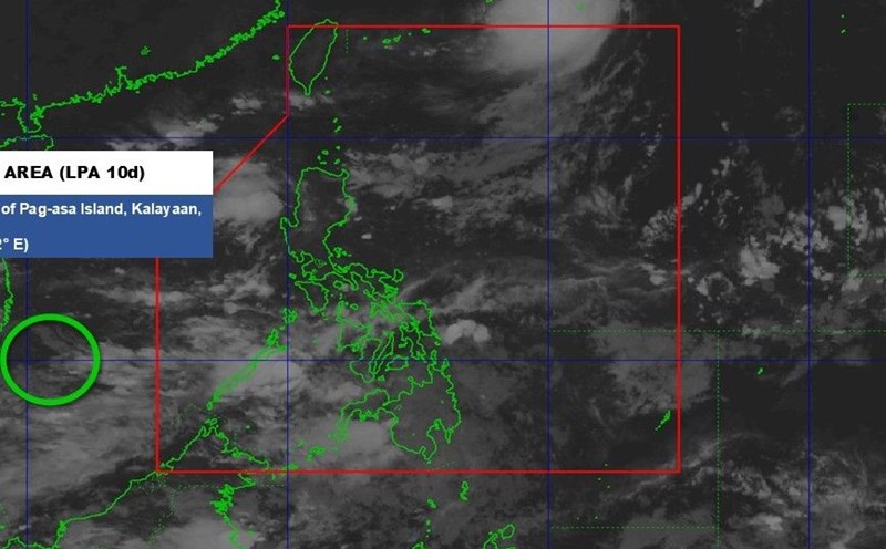
As of early October 2025, the Philippines has had 17 typhoons, of which 2 appeared in just the first 10 days of October. The average annual rate is 20, but PAGASA predicts that the actual figure this year could exceed the standard.
The storm forecast may form or enter the Philippine Forecast Area (PAR) in the next 6 months as follows: October 2025: 2-4 storms. November 2025: 2-3 attacks. December 2025: 1-2 attacks. January 2026: 0-1 attack. February 2026: 0-1 attack. March 2026: 0-1 attack.
The Philippines is entering the northeast monsoon season, after completely stopping the southwest monsoon on October 7. This transitional season is expected to coincide with the peak period of La Nina, causing the eastern coastal areas to be at risk of prolonged rain for many days, with strong winds and large waves.
The impact of La Nina on Vietnam is also predicted to be complicated. The forecast for rain at the end of this year may be 15-30% higher than the average of many years, concentrated in the Central, Central Highlands and Southern regions.
La Nina typically prolongs the typhoon season, with the possibility of 1-2 more storms appearing late in November and December, which could make landfall in the Central region or cause widespread heavy rains in the North. At the same time, the stronger northeast monsoon will cause the North to welcome cold air, early cold and severe cold that may appear from the end of November.
Experts say that the combination of La Nina and the northeast monsoon will make natural disasters more complicated at the end of the year. The mountainous areas of the North and North Central regions are at risk of flash floods and landslides, while the plains and large urban areas may be flooded for a long time.