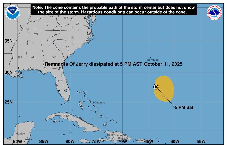
Hurricane Jerry officially dissipated on October 11, but the Atlantic Ocean is still not at peace. The US National Hurricane Center is currently monitoring four new tropical disturbances, including two that are intensifying in the Caribbean Sea, threatening to open up a series of consecutive cyclones by the end of the 2025 hurricane season.
According to the latest storm news at 5:00 p.m. (US time) on October 11 from the NHC, storm Jerry has been officially "erased", leaving only a weak link in the Atlantic.
Meteorologists say January 2 is not the cause of heavy rains along the east coast of Florida. However, many areas from Edgewater, Brevard County to Treasure Coast and Jupiter have experienced localized flooding, with heavy rain over the past two days combining high tides and large waves.
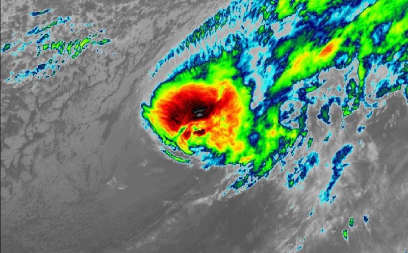
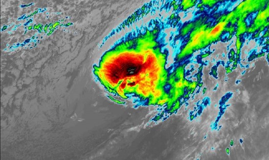
Four tropical disturbances are currently being monitored, including a large area of large-scale chaotic thunderstorms south of the Cabo Verde Islands, which could potentially become a tropical depression next week. According to the NHC, the chance of formation within 48 hours is 20%; the chance of formation within 7 days is 40%.
Three other disturbances were recorded: A central Atlantic tropical wave moving west at a speed of 17-27 km/h;
A tropical wave in the western Caribbean, near the 76W line, is heading towards Central America;
Another tropical wave in the far western Caribbean, near the 86W line, is also moving in the same direction and could continue to strengthen.
Meteorologists warn that the 2025 Atlantic hurricane season is not over yet, and another cyclone could form at the end of October as sea surface temperatures remain above the average for many years.
According to the National Oceanic and Atmospheric Administration (NOAA), 97% of Atlantic hurricane activity occurs between June 1 and November 30 every year, peaking on September 10.
Although it is past the peak period, experts warn that this year's storm season is still unusual, especially as the La Nina phenomenon continues to persist, helping sea surface temperatures to warmer and wind shear to weaken - ideal conditions for storm formation.
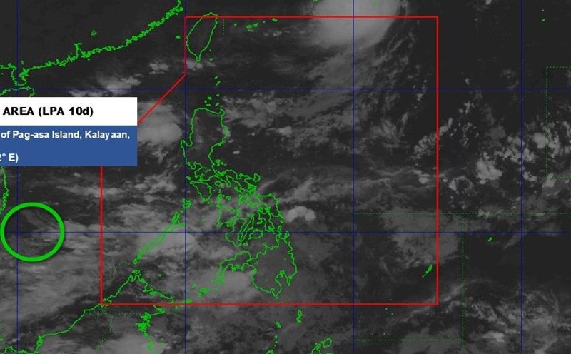
Regarding storms in the East Sea, since the beginning of the year, there have been 15 storms and tropical depressions, much higher than the average of many years. Of which, 7 were directly affecting the mainland of Vietnam.
It is forecasted that from now until the end of 2025, there will be about 3 - 4 storms and tropical depressions in the East Sea, of which 1 - 2 are likely to directly affect Vietnam. The main affected area is likely the Central region, especially in October and the first half of November, when storm activity typically peaks at the end of the season.
On October 12, a low pressure trough with an axis at about 13-16 degrees North latitude was present in the East Sea. The Vietnam National Center for Hydro-Meteorological Forecasting said that on October 12, the sea areas with scattered showers and thunderstorms include the sea area from Quang Tri to Ca Mau; from Ca Mau to An Giang; Gulf of Thailand; the Central and South East Sea area (including Truong Sa special zone).
Meanwhile, flooding in Thai Nguyen, Bac Ninh, Lang Son provinces and Hanoi city is still continuing in communes and wards along the river, low-lying areas may last for the next 1-2 days; there is a risk of riverbank erosion, river dykes and landslides on steep slopes in the above areas.