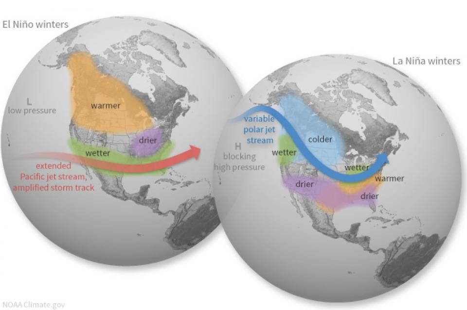
With less than two weeks left in the year, data shows that 2024 is likely to be the hottest year on record, surpassing the record-breaking 2016. One of the main factors contributing to this phenomenon is the absence of La Nina, despite previous weather forecast models predicting its occurrence.
What is La Nina?
La Nina is a phase of the El Nino Southern Oscillation (ENSO) phenomenon - a climate phenomenon characterized by changes in sea surface temperatures in the central and eastern Pacific Ocean, along with fluctuations in the upper atmosphere. ENSO has a major influence on global atmospheric circulation, which in turn affects weather around the world.
ENSO has three main phases: warm (El Nino), cool (La Nina), and neutral - occurring in cycles of 2 to 7 years. The most recent La Nina occurred in 2020-2023, while the next El Nino occurred in 2023-2024.
During the neutral phase, the ocean water in the eastern Pacific (near the northwest coast of South America) is cooler than the western Pacific (near Indonesia and the Philippines) because winds blow from east to west, pulling warm water westward.

Current state of the ocean and this year's ENSO forecast
According to NOAA (National Oceanic and Atmospheric Administration), as of December 9, sea surface temperatures along the equatorial central and eastern Pacific remained near or below average. This indicates that the neutral phase of ENSO is continuing and La Nina is only in the “watch” phase.
Initially, weather models predicted La Nina would appear in August-September, then moved to October-December. Now, the latest forecasts suggest a weak and short-lived La Nina from December to February.
Experts say that even if La Nina forms, the phenomenon will end quickly and return to a neutral phase around March-May 2025.
Why is this year's La Nina forecast inaccurate?
There are several factors that have caused forecast models to fail to identify La Nina this year.
One is that this year, the interaction between the ocean and the atmosphere has not been as expected, causing the Pacific Ocean surface temperature to remain warm or near average. This is partly due to the impact of El Nino continuing into 2024.
Second, the unusual westerly winds. During the September-October period, when there is a possibility of a transition to La Nina, the anomalous westerly winds prevail. In terms of climate, the unusual westerly winds are unfavorable conditions for the development of La Nina.
Third is the influence of the monsoon season and ENSO. This year, when El Nino ended and the neutral phase of ENSO appeared, it coincided with the monsoon season (June-September). This rainy season brought abundant and above-average rainfall, changing atmospheric conditions, including westerly winds, thereby affecting the La Nina transition.
The absence of La Nina, combined with unusual climate factors, has thrown forecast models off course this year. While a weak La Nina may emerge later this year, its impact will be limited and short-lived over the winter. This also contributes to the likelihood that 2024 will be the warmest year on record.


