According to information on the Indian Defense Review on November 23, after decades of being missed by disjointed clues, scientists finally confirmed: Zealandia is the 8th continent on Earth, and 94% of them are under thousands of meters of sea water.
This discovery did not come in a moment of brilliance, but was the result of decades of collecting data on rock models, sediments, golf maps, and seabed terrain.
But it was not until 2017, when the team of geological experts from GNS Science, Royal Research Institute of New Zealand published a shocking study in the journal GSA Today, that the world seriously admitted: Zealandia is not a piece of rubble, not a subdued plateau, but a complete continent with a continental crust structure, a clear geological history and an area of nearly 5.5 million km2, larger than India and equal to 2/3 of Australia's area.
So why is humanity missing an entire continent? The simple answer is depth. More than 2km of sea water covers the surface of Zealandia, making it "popular" for traditional survey methods. Only when satellite technology, weight measurement and deep-sea drilling developed, did the true shape of this continent gradually emerge.
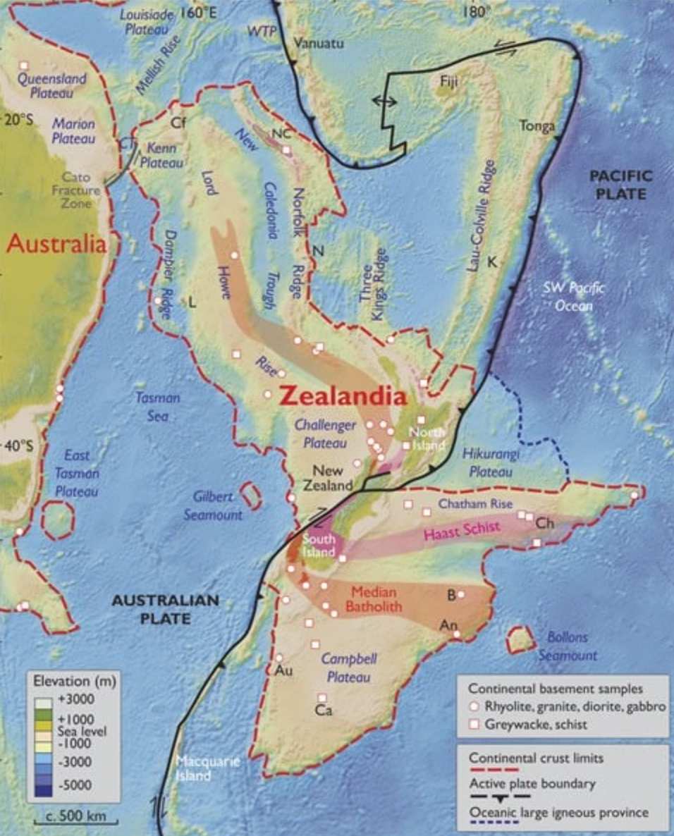
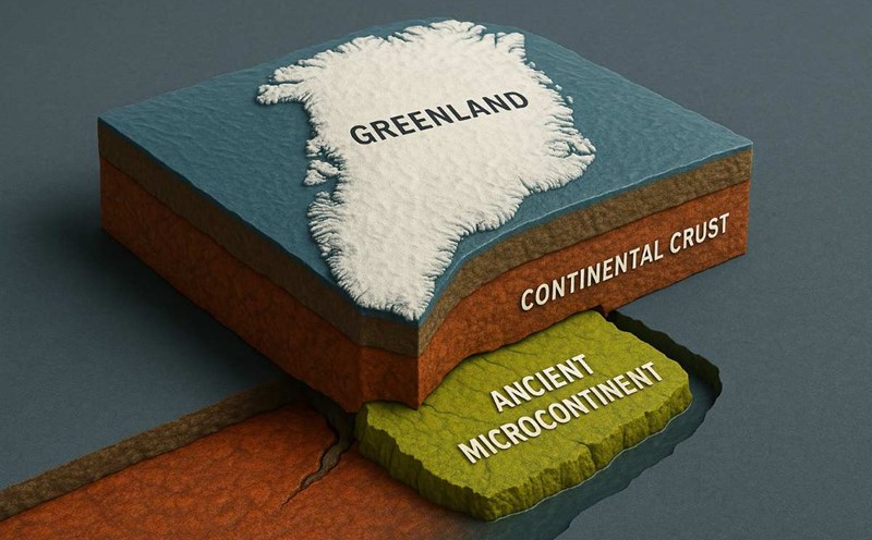
Even the continental shell of Zealandia is unusually thin, only about 20km, compared to 30-45km of other continents. This could explain why it sank after separating from the supercontinent Gondwana 85 million years ago.
The existence of a large area of land in the south is not a new idea. Since 1642, explorer Abel Tasman has been searching for Terra Australis - the Southern locality - and although he did not discover Zealandia, he accidentally passed through the area on the peripheral continental shelf.
By the end of the 19th century, Scotch naturalist James Hector also commented that New Zealand was just the remnant of a sunken continent. But this discovery has been forgotten for nearly 100 years.
It was not until 1995 that the term "Zealandia" was proposed by American geophysicist Bruce Luyendyk, paving the way for more large-scale research.
The momentum is further increased as the United Nations Convention on the Law of the Sea allows New Zealand to expand its economic zone if it proves to be adjacent to the continent.
In 2017, six drilling drills from research vessels of the International Ocean exploration Program (IODP) were taken up from sedimentary corees deeper than 1,250m. Inside are fossils, pollen, and traces of shallow marine environment, proving that Zealandia once floated on water surface and was eligible for development.
Dinosaur fossils - including sauropod and ankylosaur - found in New Zealand and the Chatham Islands also show that at least part of the continent is still above sea level after receding from Gondwana.
However, the timing of the entire of Zealandia sinking is still a mystery. Some scientists believe that the entire continent sank 25 million years ago, after which parts of the country such as New Zealand emerged thanks to tectonic activity. Others believe that part of Zealandia has never completely disappeared underwater.