
The latest storm and low pressure news on the evening of July 23rd from the Philippine Atmospheric, Geophysical and Astronomical Services Administration (PAGASA) said that tropical depression Kiyapo, a system forecast to strengthen into a storm, with the international name Noul, is accelerating in the waters east of Cagayan, Philippines.
The center of the tropical depression Kiyapo is 555km east of Tuguegarao city, Cagayan. The tropical depression near the East Sea is moving northwest at a speed of 30 km/h. The maximum sustained wind is 55 km/h near the center of the tropical depression and gusts up to 70 km/h.
Previously, at 5 pm on the same day, the center of the tropical depression Kiyapo was 640km east of Tuguegarao city, Cagayan, moving northwest at a speed of 30 km/h. The maximum sustained wind was 45 km/h near the center of the tropical depression and gusts reached 55 km/h.
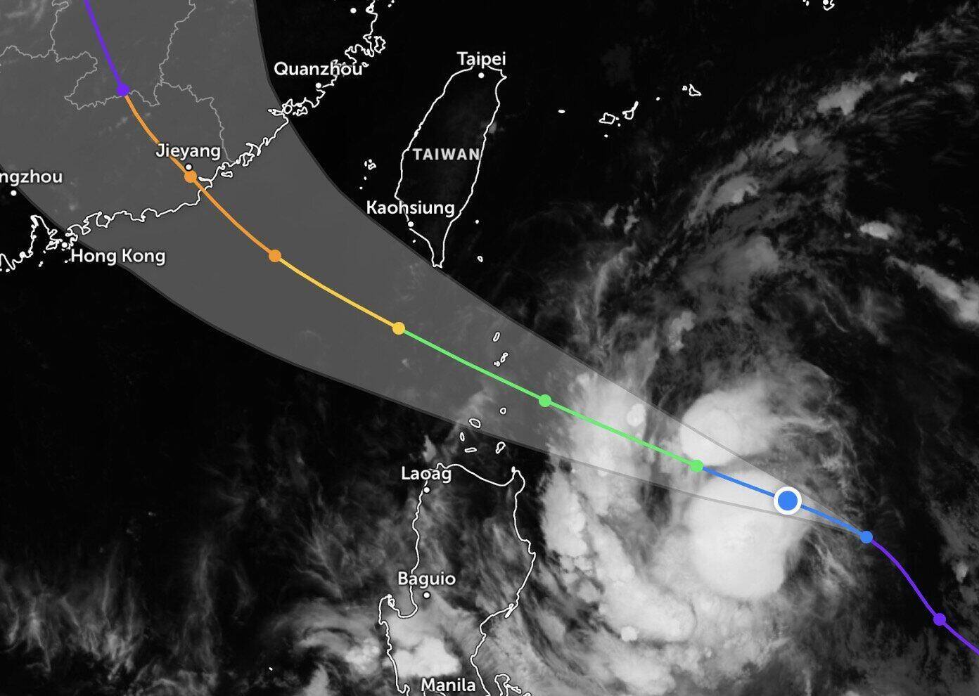
Philippine typhoon forecasters predict that the predecessor system of Typhoon Noul will continue to move west-northwest until July 25, heading towards the Luzon Strait before turning northwest in the remaining forecast time.
The bulletin stated clearly that the center of Typhoon Noul may approach the northeast of Cagayan Island in the morning and afternoon of July 24, then approach or make landfall in the Babuyan archipelago area in the afternoon and evening of July 24. The storm then enters the East Sea and will leave the Philippine forecast area on July 25.
Notably, this system is gradually strengthening as it moves over the Philippine Sea and may reach tropical storm level on July 24. The storm will continue to strengthen as it moves north of the East Sea.
It is expected that the latest storm in the East Sea will gradually weaken when it makes landfall in southern mainland China and move deeper into the mainland.


